MyTopo
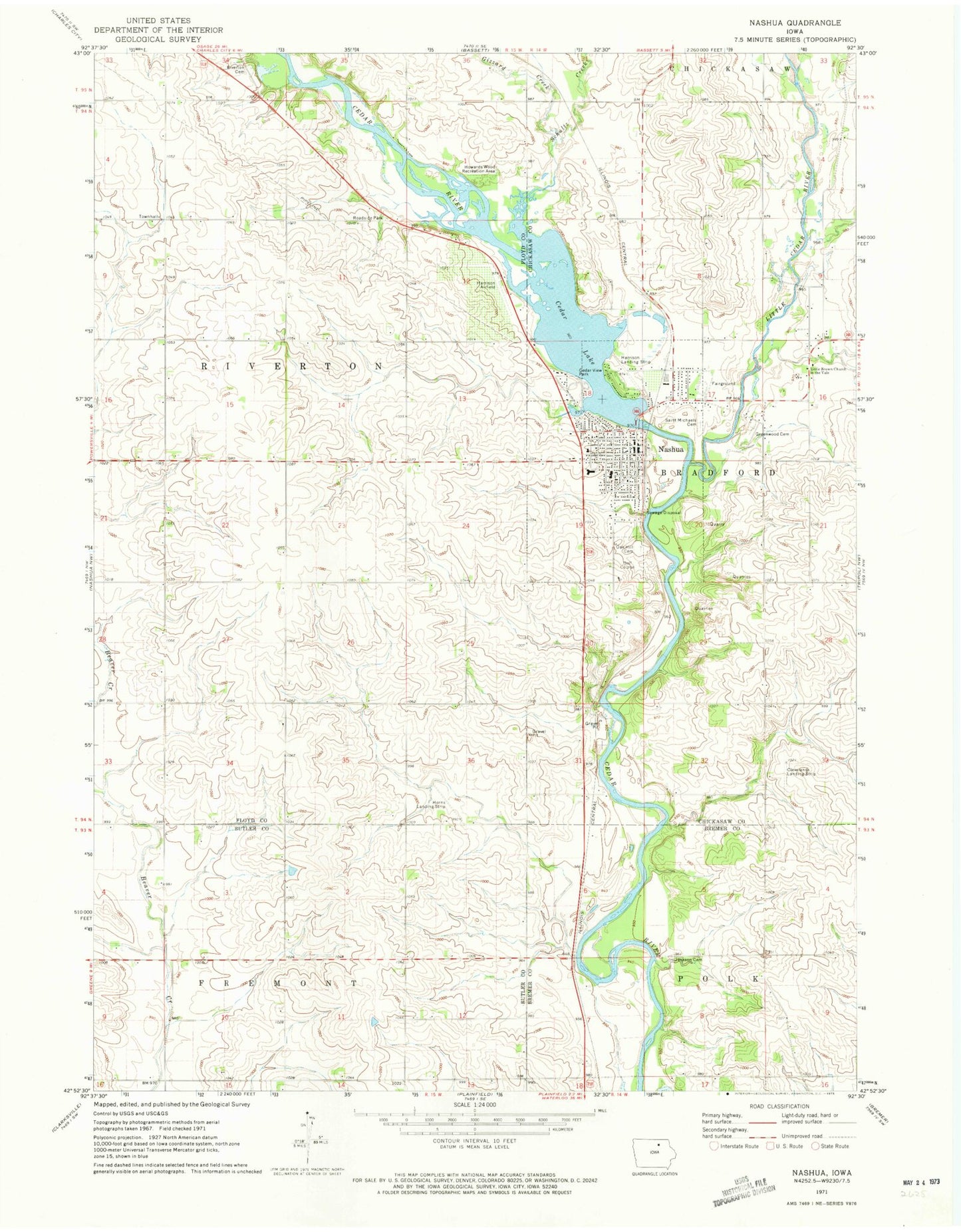
Classic USGS Nashua Iowa 7.5'x7.5' Topo Map
Couldn't load pickup availability
Historical USGS topographic quad map of Nashua in the state of Iowa. Map scale may vary for some years, but is generally around 1:24,000. Print size is approximately 24" x 27"
This quadrangle is in the following counties: Bremer, Butler, Chickasaw, Floyd.
The map contains contour lines, roads, rivers, towns, and lakes. Printed on high-quality waterproof paper with UV fade-resistant inks, and shipped rolled.
Contains the following named places: Bradford, Bradford Pioneer Village, Bradford Post Office, Cedar Lake, Cedar Lake Park, Cedar River Wildlife Area, Cedar View Park, Chick-A-Dee Garden, Chickasaw Ambulance Service Nashua, Chickasaw County Museum, City of Nashua, Clevelands Landing Strip, Gizzard Creek, Greenwood, Greenwood Cemetery, Harrison Landing Strip, Hauser Wildlife Area, Howards Wood Recreation Area, Jackson Cemetery, Jackson Point Post Office, Little Brown Church Historical Marker, Little Brown Church in, Little Cedar River, Nashua, Nashua - Plainfield Elementary School, Nashua - Plainfield Middle School / High School, Nashua Area Medical Center, Nashua Cedar River Access, Nashua Dental Office, Nashua Fire and Rescue Department, Nashua Police Department, Nashua Post Office, Nashua Public Library, Nashua Town and Country Club, Oak Hill Cemetery, Pearl Rock, Pearl Rock Canoe Launch Site, Pearl Rock Catholic Cemetery, Pearl Rock Post Office, Prosper Post Office, River Ranch Camping, Riverton Cemetery, Riverton Post Office, Riverton Townhall, Saint John Lutheran Church, Saint Michaels Catholic Church, Saint Michaels Cemetery, Schultz Creek, Shields Chiropractic Health, Township of Riverton, United Methodist Church, ZIP Code: 50658