MyTopo
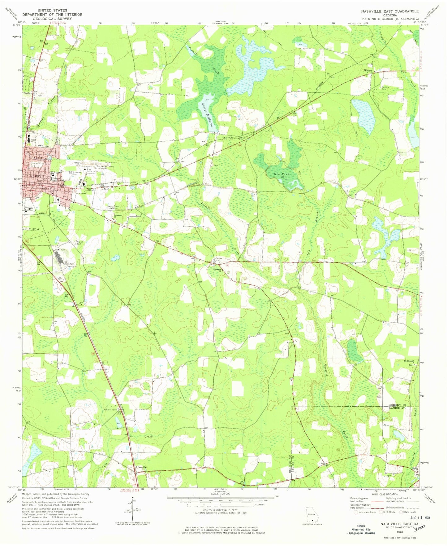
Classic USGS Nashville East Georgia 7.5'x7.5' Topo Map
Couldn't load pickup availability
Historical USGS topographic quad map of Nashville East in the state of Georgia. Map scale may vary for some years, but is generally around 1:24,000. Print size is approximately 24" x 27"
This quadrangle is in the following counties: Berrien, Lanier.
The map contains contour lines, roads, rivers, towns, and lakes. Printed on high-quality waterproof paper with UV fade-resistant inks, and shipped rolled.
Contains the following named places: Allenville, Avera Cemetery, Avera Mill, Averys Millpond, Baker Chapel, Beetree Recreation Area, Berrien County Airport, Berrien County Courthouse, Berrien County High School, Bristol Temple, Call to Faith Tabernacle, Carter Park, Christian Church of God, Church of God, City of Nashville, Eastview Cemetery, Empire Church, Forrester Church, Full Gospel Chapel, Gaskins Lake, Gin Branch, Gin Pond, Grahams Chapel, Harmon Gaskins Cemetery, Heritage Park, Holiness Church, Immanuel Baptist Church, Immanuel Church, Irene Church, Jesus Name Church, Mathis Chapel Holiness Baptist Church, Mount Pleasant Church, Nashville Church of the Nazarene, Nashville Division, Nashville Holiness Deliverance Church, Nashville Middle School, Nashville Mission, New Bethel Baptist Church, Northside Park, Old Griner Cemetery, Saint James Cemetery, Saint James Methodist Church, Saint Marys Catholic Church, South Georgia Medical Center Berrien Campus, South One Ten Airport, United Pentecostal Church, Weber, WNGA-AM (Nashville), Wolfpen Branch, Zion Wall Freewall Baptist Church, ZIP Code: 31639