MyTopo
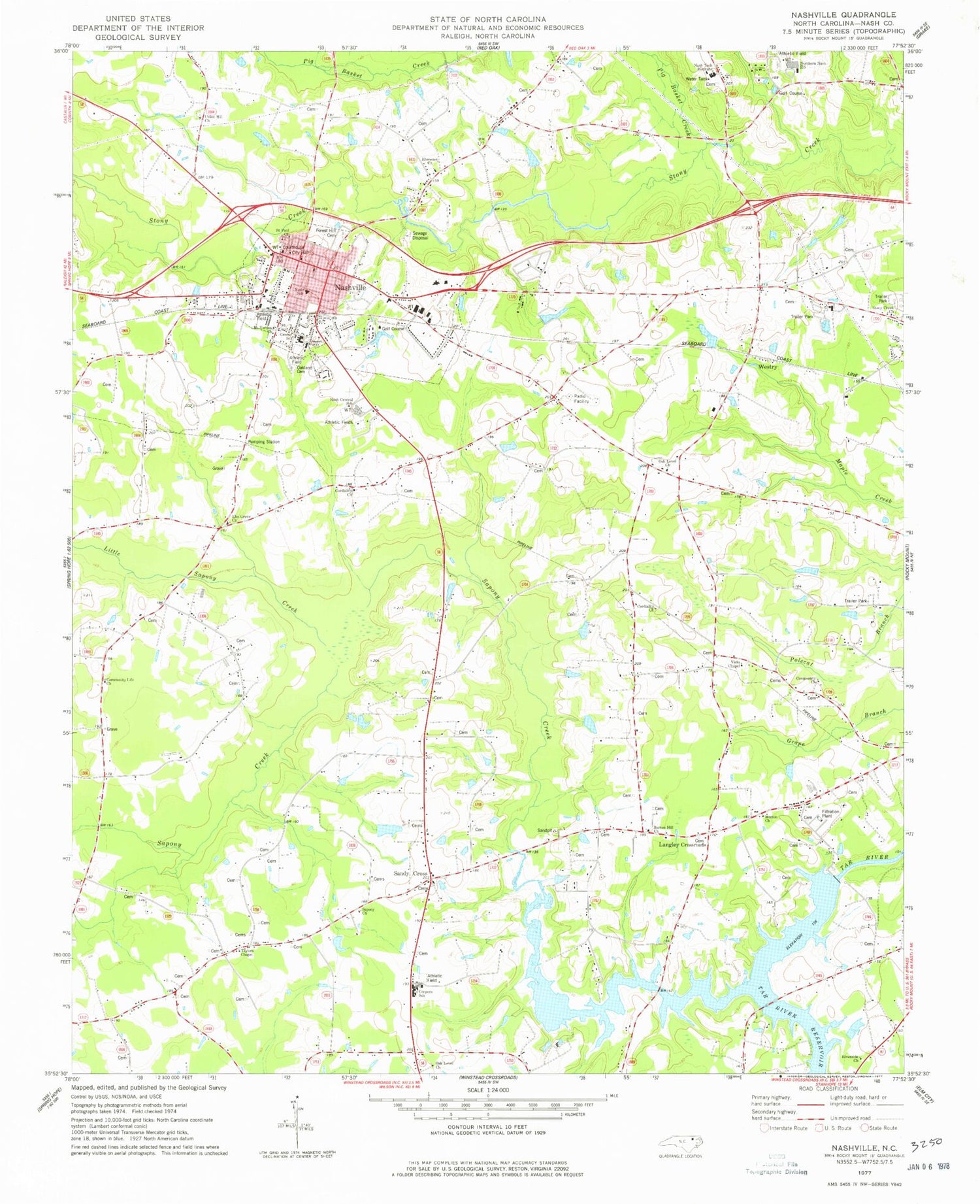
Classic USGS Nashville North Carolina 7.5'x7.5' Topo Map
Couldn't load pickup availability
Historical USGS topographic quad map of Nashville in the state of North Carolina. Map scale may vary for some years, but is generally around 1:24,000. Print size is approximately 24" x 27"
This quadrangle is in the following counties: Nash.
The map contains contour lines, roads, rivers, towns, and lakes. Printed on high-quality waterproof paper with UV fade-resistant inks, and shipped rolled.
Contains the following named places: Barnes Hill Church, Birchwood Homes, Bones Pond, Bones Pond Dam, Bones Store, Brooklyn, Cockrells Chapel, Cockrells Crossroads, Coley Pond, Coley Pond Dam, Community Church, Community Life Church, Coopers School, Coopers Store, Coopers Volunteer Fire Department and Rescue, Coopertown, Cordiality Church, Deans School, Deans Store, Ebenezer Church, Elm Grove Church, Elm Grove School, Evans Bridge, Forest Hill Cemetery, Galatia Church, Greene School, Langley Crossroads, Little Sapony Creek, Maple Creek Church, Morton Church, Mount Vernon Church, Nash Central School, Nash County, Nash County Emergency Medical Services, Nash County Sheriff's Office, Nash School, Nash Tech Institute, Nashville, Nashville City Hall, Nashville Fire Department, Nashville Police Department, Nashville Post Office, Northern Nash High School, Oak Level Church, Oak Level School, Oakland Cemetery, Pig Basket Creek, Piney Grove Church, Proctors Store, Regency Estates, Riverside Church, Rocky Mount Reservoir, Saint Paul Church, Sandy Cross, Sandy Cross Methodist Church, Sapony Church, Sapony Creek, Snells Crossroads, Snells Siding Site, Southside Park, Stony Creek Church, Sun Valley, Tar River Dam, Taylors Chapel, Town of Nashville, Township of Coopers, Township of Nashville, Township of Oak Level, Union Hill Church, Vicks Chapel, Wards Bridge, Wells Mineral Spring, Westgate Terrace, Westry, Williams Bridge, Winwood, WRSV-FM (Rocky Mount)


