MyTopo
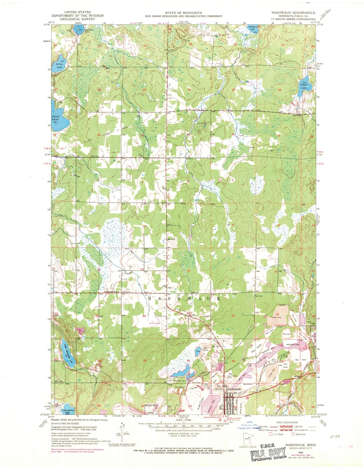
Classic USGS Nashwauk Minnesota 7.5'x7.5' Topo Map
Couldn't load pickup availability
Historical USGS topographic quad map of Nashwauk in the state of Minnesota. Map scale may vary for some years, but is generally around 1:24,000. Print size is approximately 24" x 27"
This quadrangle is in the following counties: Itasca.
The map contains contour lines, roads, rivers, towns, and lakes. Printed on high-quality waterproof paper with UV fade-resistant inks, and shipped rolled.
Contains the following named places: Argonne Mine, Calbraith Mine, Carrol Mine, City of Nashwauk, Cloverdale Mennonite Church, Cloverdale School, Dollar Lake, Grand Rapids Clinic- Nashwauk, Hadley Mine, Halobe Mine, Harrison Lake, Hawkins Mine, Johnson Lake, Larue Mine, Little McCarthy Lake, Mace Mine, Mesaba Clinic- Nashwauk, Nashwauk, Nashwauk Alliance Church, Nashwauk Ambulance Service, Nashwauk Cemetery, Nashwauk City Park Camp, Nashwauk Fire Department, Nashwauk Lutheran Church, Nashwauk Police Department, Nashwauk Post Office, Nashwauk-Keewatin High School, O'Brien North Dam, Parkview Mobile Home Court, Perry-Wyman Tailings Basin, Perry-Wyman Tailings Dike, Reservoir Number Four, Saint Cecilia's Church, Shafer Lake, Township of Nashwauk, United Methodist Church, York Mine, ZIP Code: 55769