MyTopo
Classic USGS Nassau New York 7.5'x7.5' Topo Map
Couldn't load pickup availability
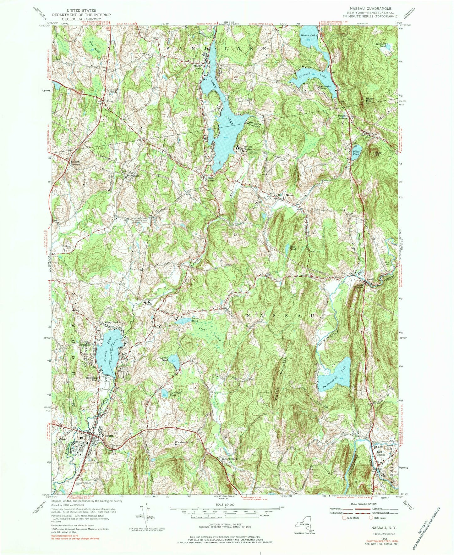
Historical USGS topographic quad map of Nassau in the state of New York. Typical map scale is 1:24,000, but may vary for certain years, if available. Print size: 24" x 27"
This quadrangle is in the following counties: Rensselaer.
The map contains contour lines, roads, rivers, towns, and lakes. Printed on high-quality waterproof paper with UV fade-resistant inks, and shipped rolled.
Contains the following named places: Alder Brook, Bailey Mountain, Black Brook, Braeside, Burden Lake, Clarks Chapel Cemetery, Cleveland Pond, Crooked Lake, Curtis Mountain, Denault Corners, East Nassau, Glass Lake, Hoag Corners, Jacks Corners, Larkin Cemetery, Lyons Pond, Maple Grove, Mashodack Hill, Methodist Farm, Millers Corners, Morey Park, Mud Lake, Mud Pond, Nassau, Nassau Lake, Nassau and Schodack Cemetery, North Schodack, Pikes Hill, Pikes Pond, Pine Swamp, Rendert Pond, Rosecrans Park, Shivers Corners, Sliters, Smith Pond, Tackawasick Creek, Totem Lodge, Woodlawn Cemetery, North Nassau, Alexander Farm Airport, Town of Nassau, Tackawasick Lake, Village of Nassau, Village of East Nassau, Cedar Acres Mobile Home Park, Rainbow Mobile Home Park, Grace United Methodist Church, Nassau Reformed Church, Saint Mary's Church, Saint Stephen's Lutheran Church, East Nassau Baptist Church, New Hope for Life Ministries, Nassau Free Library, Nassau Town Hall, Nassau Post Office, Donald P Sutherland School, Nassau Ambulance, Hoags Corner Volunteer Ambulance, Hoags Corners Volunteer Fire Company Station 1, Hoags Corners Volunteer Fire Company Station 2, Nassau Hose Company 1, East Nassau Post Office, Nassau Lake Census Designated Place