MyTopo
Classic USGS Natanes Mountains NE Arizona 7.5'x7.5' Topo Map
Couldn't load pickup availability
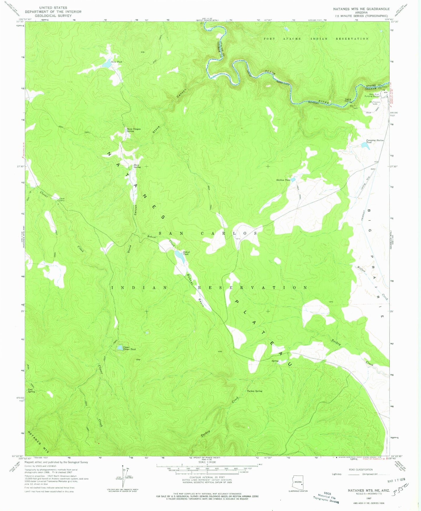
Historical USGS topographic quad map of Natanes Mountains NE in the state of Arizona. Map scale may vary for some years, but is generally around 1:24,000. Print size is approximately 24" x 27"
This quadrangle is in the following counties: Apache, Graham.
The map contains contour lines, roads, rivers, towns, and lakes. Printed on high-quality waterproof paper with UV fade-resistant inks, and shipped rolled.
Contains the following named places: Black River Number Two Tank, Black River Pumping Station, Black River Tank, Bobcat Basin, Bobcat Creek, Bobcat Tank, Clover Camp, Lost Spring, Pumping Station Tank, Stallion Tank, Stove Canyon, Stove Canyon Spring, Stove Spring, Stove Tank, Turkey Spring, Upper Clover Tank