MyTopo
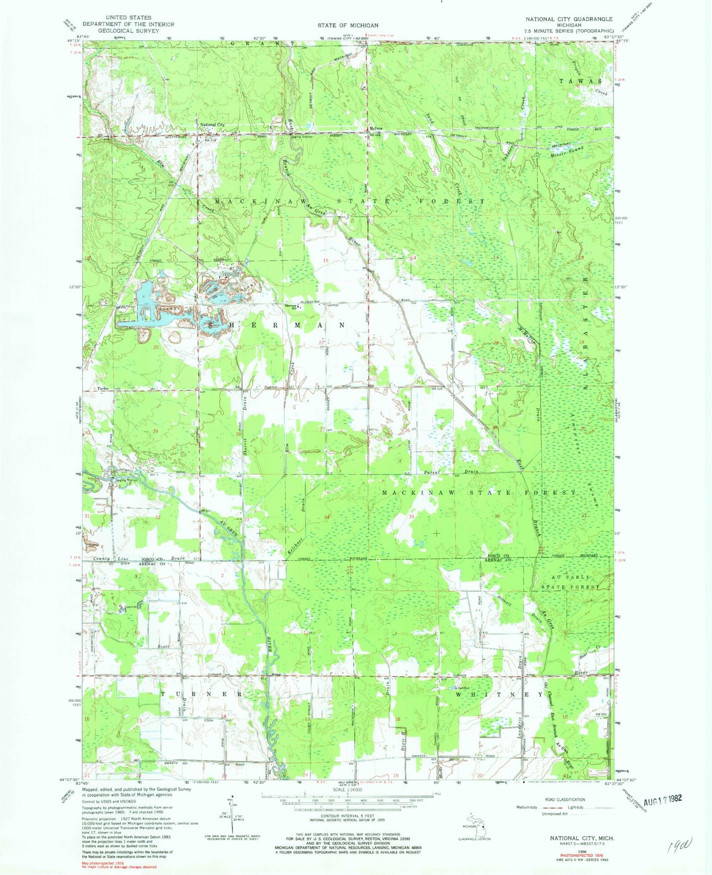
Classic USGS National City Michigan 7.5'x7.5' Topo Map
Couldn't load pickup availability
Historical USGS topographic quad map of National City in the state of Michigan. Map scale may vary for some years, but is generally around 1:24,000. Print size is approximately 24" x 27"
This quadrangle is in the following counties: Arenac, Iosco.
The map contains contour lines, roads, rivers, towns, and lakes. Printed on high-quality waterproof paper with UV fade-resistant inks, and shipped rolled.
Contains the following named places: Bear Creek, County Line Drain, Elm Creek, Kelchner Drain, McIvor, McIvor Post Office, McIvor Station, McMullen Drain, Messer Swamp, National City, National City Post Office, National City Station, Parent Drain, Saddler Creek, Sand Creek, Scott Drain, Sherman School, Sherman Townhall, Sherrit Drain, Stowell Drain, Township of Sherman, Turtle, Turtle Post Office, ZIP Code: 48765