MyTopo
Classic USGS Natural Bridge New York 7.5'x7.5' Topo Map
Couldn't load pickup availability
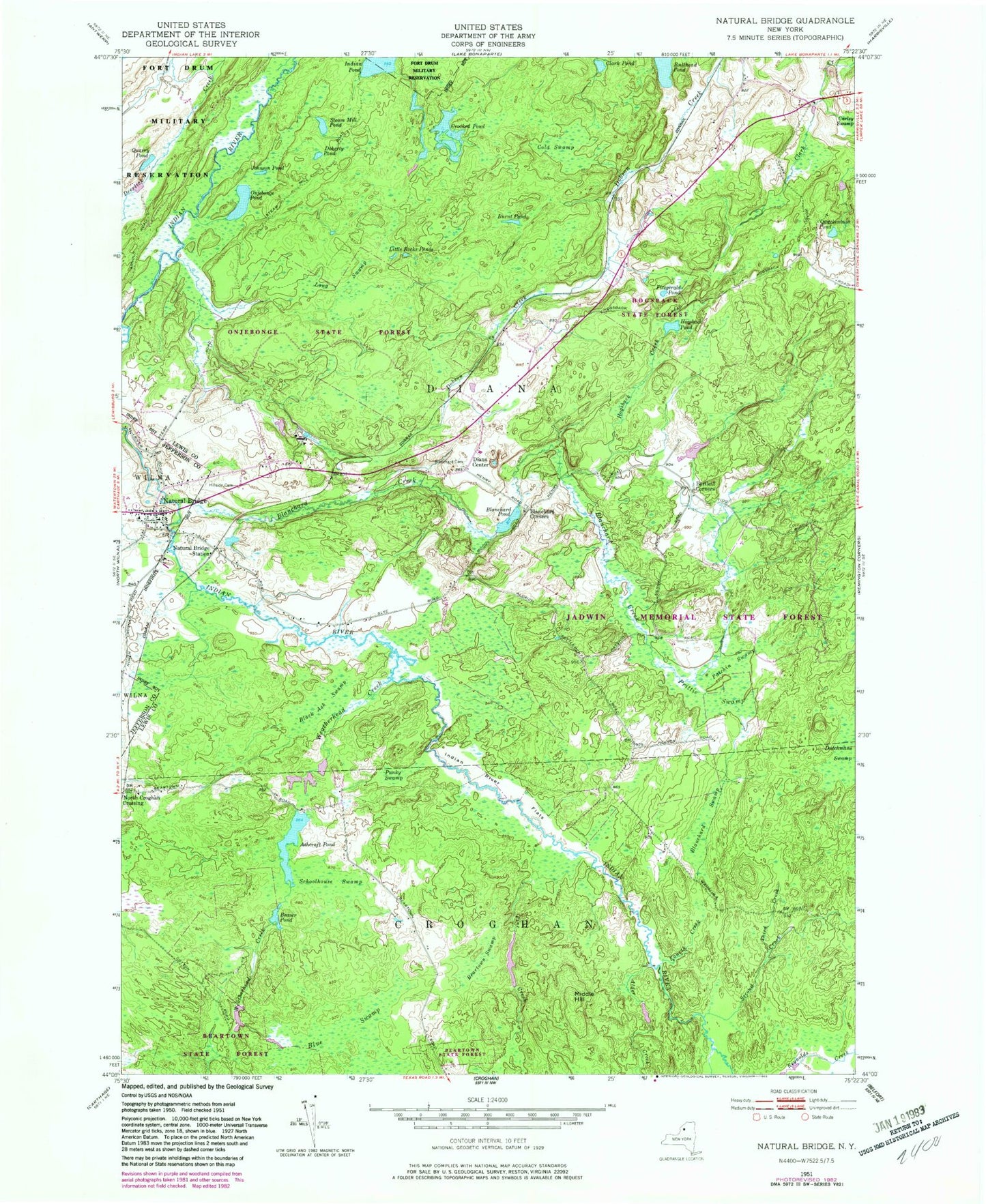
Historical USGS topographic quad map of Natural Bridge in the state of New York. Map scale may vary for some years, but is generally around 1:24,000. Print size is approximately 24" x 27"
This quadrangle is in the following counties: Jefferson, Lewis.
The map contains contour lines, roads, rivers, towns, and lakes. Printed on high-quality waterproof paper with UV fade-resistant inks, and shipped rolled.
Contains the following named places: Alder Creek, Ashcraft Pond, Bartlett Corners, Beartown Swamp, Beaver Pond, Black Ash Swamp, Blanchard Cemetery, Blanchard Corners, Blanchard Creek, Blanchard Pond, Blanchard Swamp, Blue Swamp, Burnt Pond, Clark Pond, Cold Swamp, Crooked Pond, Diana Center, Doherty Pond, Fitzgerald Pond, Fourth Creek, Hillside Cemetery, Hogsback Creek, Hogsback Pond, Indian River Flats, Johnson Pond, Little Rocks Ponds, Long Swamp, Middle Hill, Natural Bridge, Natural Bridge Census Designated Place, Natural Bridge Post Office, Natural Bridge Station, Natural Bridge Volunteer Fire Company, North Croghan Crossing, Onjebonge Pond, Patchin Swamp, Pine Creek, Prittie Swamp, Punky Swamp, Quackenbush Pond, Quarry Pond, Schoolhouse Swamp, Second Creek, Steam Mill Pond, Third Creek, Weatherhead Creek, ZIP Code: 13665