
MyTopo
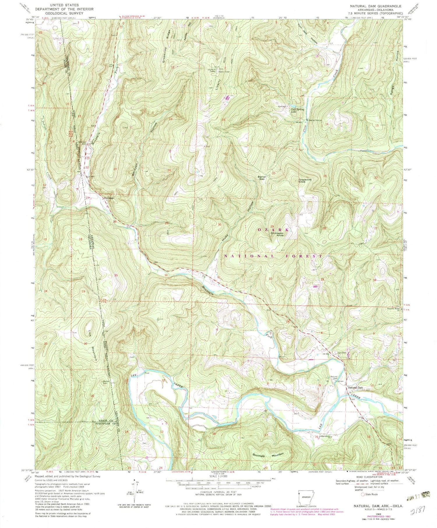
Classic USGS Natural Dam Arkansas 7.5'x7.5' Topo Map
Couldn't load pickup availability
Historical USGS topographic quad map of Natural Dam in the states of Arkansas, Oklahoma. Map scale may vary for some years, but is generally around 1:24,000. Print size is approximately 24" x 27"
This quadrangle is in the following counties: Adair, Crawford, Sequoyah.
The map contains contour lines, roads, rivers, towns, and lakes. Printed on high-quality waterproof paper with UV fade-resistant inks, and shipped rolled.
Contains the following named places: Barker Gap, Bateman Cemetery, Birchfield Mountain, Chinkapin Knob, Cold Spring, Cold Spring Lake, Davidson, Grapevine Knob, Grapevine Ridge, Hall Cemetery, Huey Creek, Huey Hollow, Independence Church, Independence School, Indian Creek, Lee Creek Bridge, Liberty Hill, Lick Hollow, Lick Mountain, Morton Cemetery, Mountain Fork, Natural Dam, Natural Dam Fire Department, Natural Dam Post Office, Peaceful Home Church, Range Hollow, Rosedale, Tom Jack Hollow, Township of Barker, Township of Lees Creek, Whitzen Hollow, Whizzen Hollow Creek, ZIP Code: 72948


