MyTopo
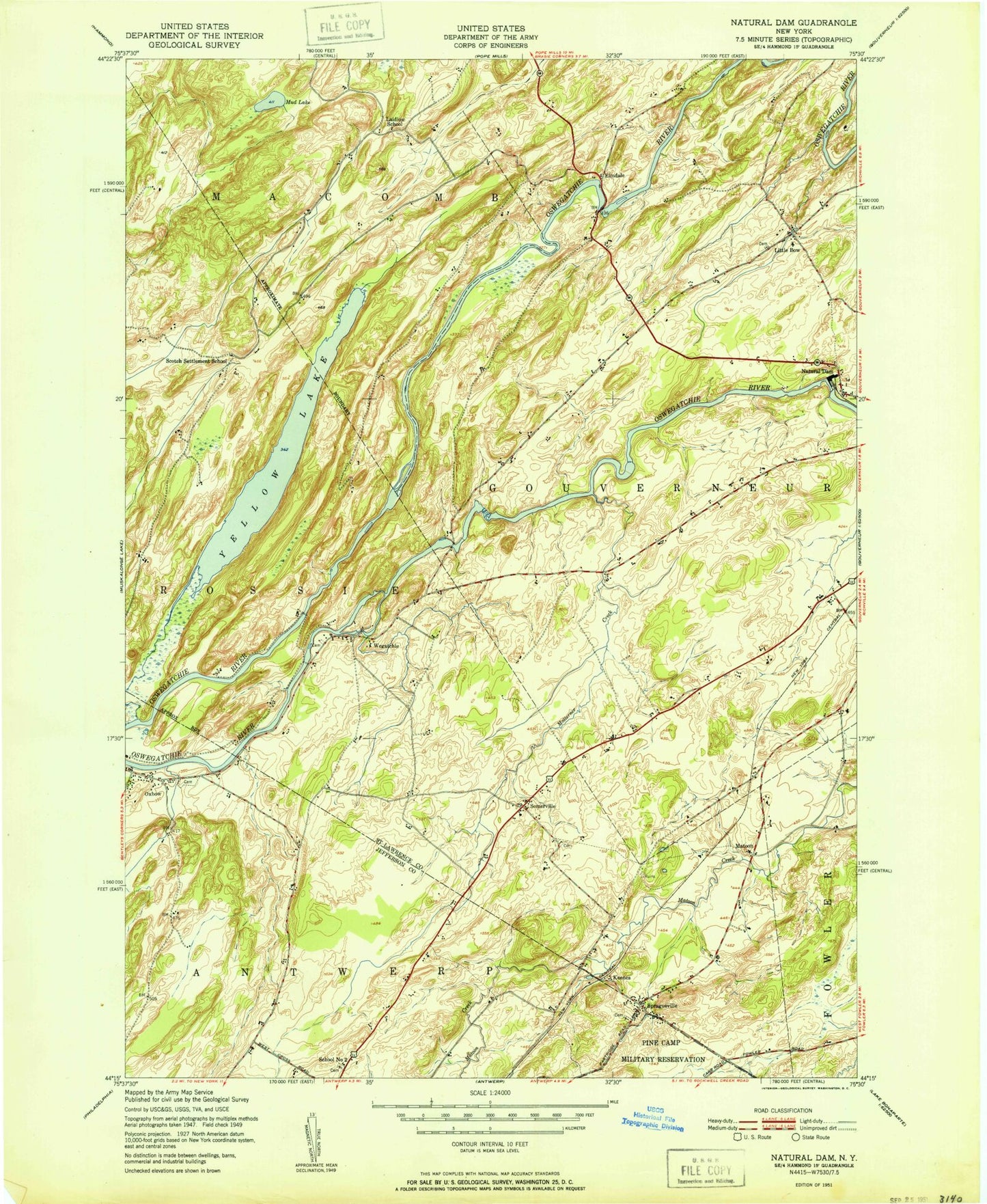
Classic USGS Natural Dam New York 7.5'x7.5' Topo Map
Couldn't load pickup availability
Historical USGS topographic quad map of Natural Dam in the state of New York. Map scale may vary for some years, but is generally around 1:24,000. Print size is approximately 24" x 27"
This quadrangle is in the following counties: Jefferson, St. Lawrence.
The map contains contour lines, roads, rivers, towns, and lakes. Printed on high-quality waterproof paper with UV fade-resistant inks, and shipped rolled.
Contains the following named places: Elmdale, Keenes, Laidlow School, Little Bow, Malterna Creek, Mud Lake, Natural Dam, Oswegatchie River Bridge, Oxbow, Oxbow Volunteer Fire Department, Pikes Corner, School Number 12, School Number 2, Scotch Settlement School, Somerville, Spragueville, Spragueville Cemetery, Vrooman Creek, Wegatchie, Wilhome Dairy Farms, Yellow Lake, ZIP Code: 13608