MyTopo
Classic USGS Natural Trap Cave Wyoming 7.5'x7.5' Topo Map
Couldn't load pickup availability
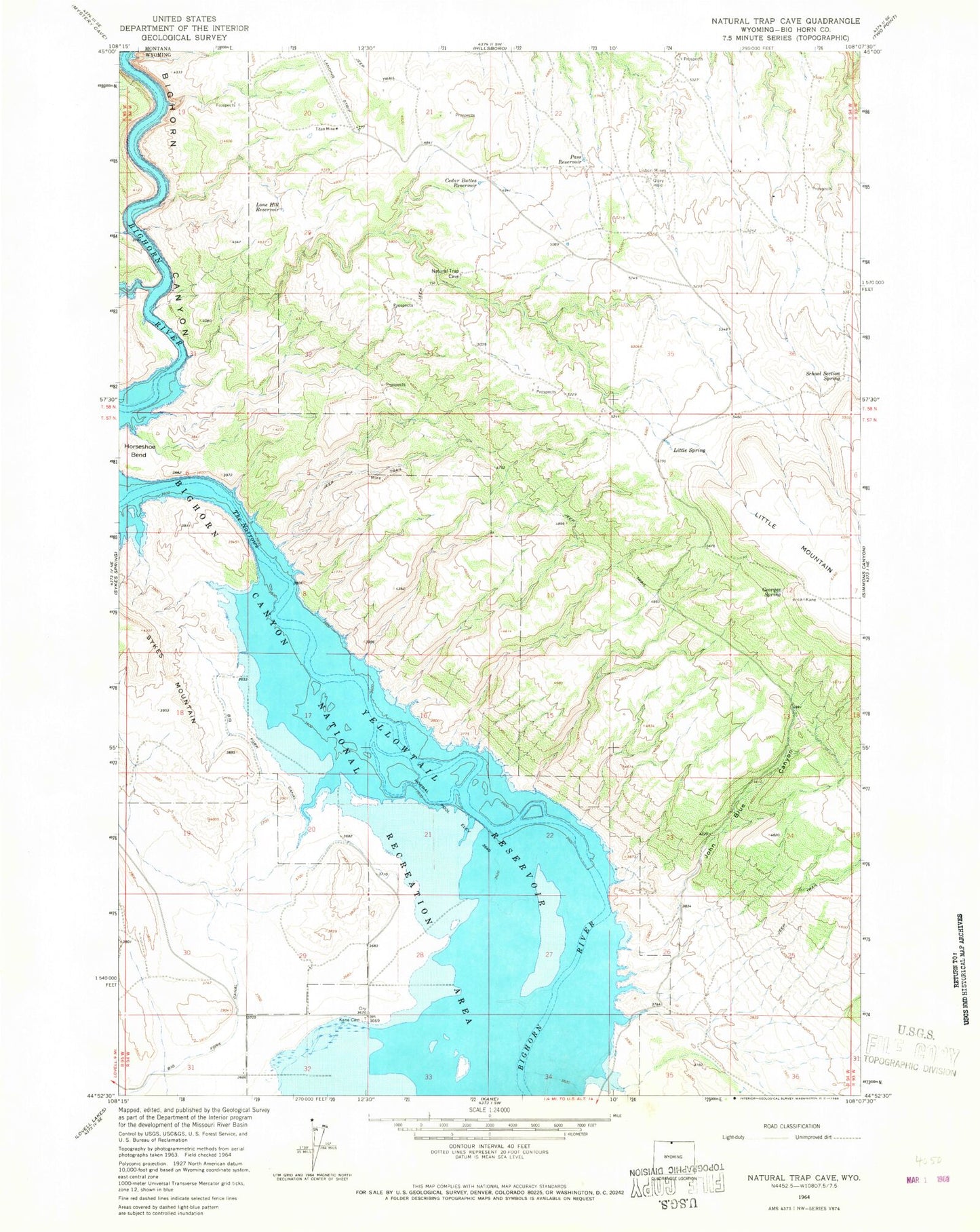
Historical USGS topographic quad map of Natural Trap Cave in the state of Wyoming. Map scale may vary for some years, but is generally around 1:24,000. Print size is approximately 24" x 27"
This quadrangle is in the following counties: Big Horn, Carbon.
The map contains contour lines, roads, rivers, towns, and lakes. Printed on high-quality waterproof paper with UV fade-resistant inks, and shipped rolled.
Contains the following named places: Avery Claims Mine, Big Fork Canal, Cave Group Mine, Cedar Buttes Reservoir, Dirty Beast Mine, Fuesner and Sons Mine, Georges Spring, Glory Hole, High Noon Claims Mine, High Noon Mine, Horseshoe Claim Number Nine Mine, Horseshoe Claims Number Ten Mine, Horseshoe Group Mine, Iona - Kane Cemetery, John Blue Canyon, John Claim Mine, Lisbon Mines, Little Mountain Mine, Little Spring, Lone Hill Reservoir, Mickey 2-10 Mine, Midnight Mine, Mike 1-10 Mine, Mike Number Ten Mine, Modern Mines Mine, Pass Reservoir, Saunders Mine, School Section Spring, Smith-Powleson Claim Mine, Super Cub Mine, The Narrows River, Titan Mine, Tri Pacer Number Five Mine, Tri Pacer Number Four Mine, Tri-pacer Number Four Mine, Western Bighorn Group Mine, Whitehead Claims Mine