MyTopo
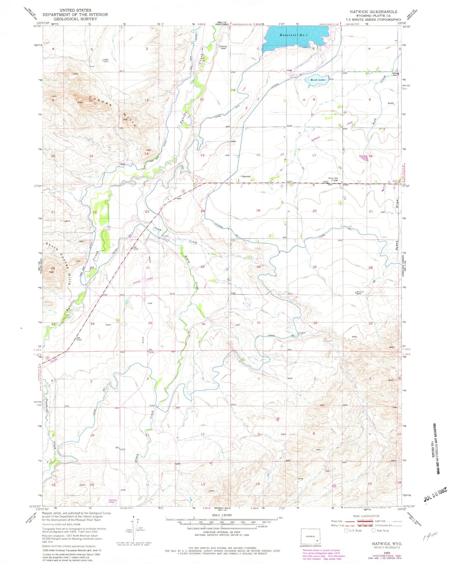
Classic USGS Natwick Wyoming 7.5'x7.5' Topo Map
Regular price
$16.95
Regular price
Sale price
$16.95
Unit price
per
Couldn't load pickup availability
Historical USGS topographic quad map of Natwick in the state of Wyoming. Map scale may vary for some years, but is generally around 1:24,000. Print size is approximately 24" x 27"
This quadrangle is in the following counties: Platte.
The map contains contour lines, roads, rivers, towns, and lakes. Printed on high-quality waterproof paper with UV fade-resistant inks, and shipped rolled.
Contains the following named places: Ayers, Brush Creek, Canal Number 1, Canal Number 3, Cooney Hills, Linton School, Natwick, Number 1 Lateral, Reservoir Number One, Rock Lake, Rock Lake Dam, Rock Lake Grange, Sand Creek, Texan Lode, Two Bar Ditch, Two Bar Ranch Airport, Wheatland Number 1 Dam