MyTopo
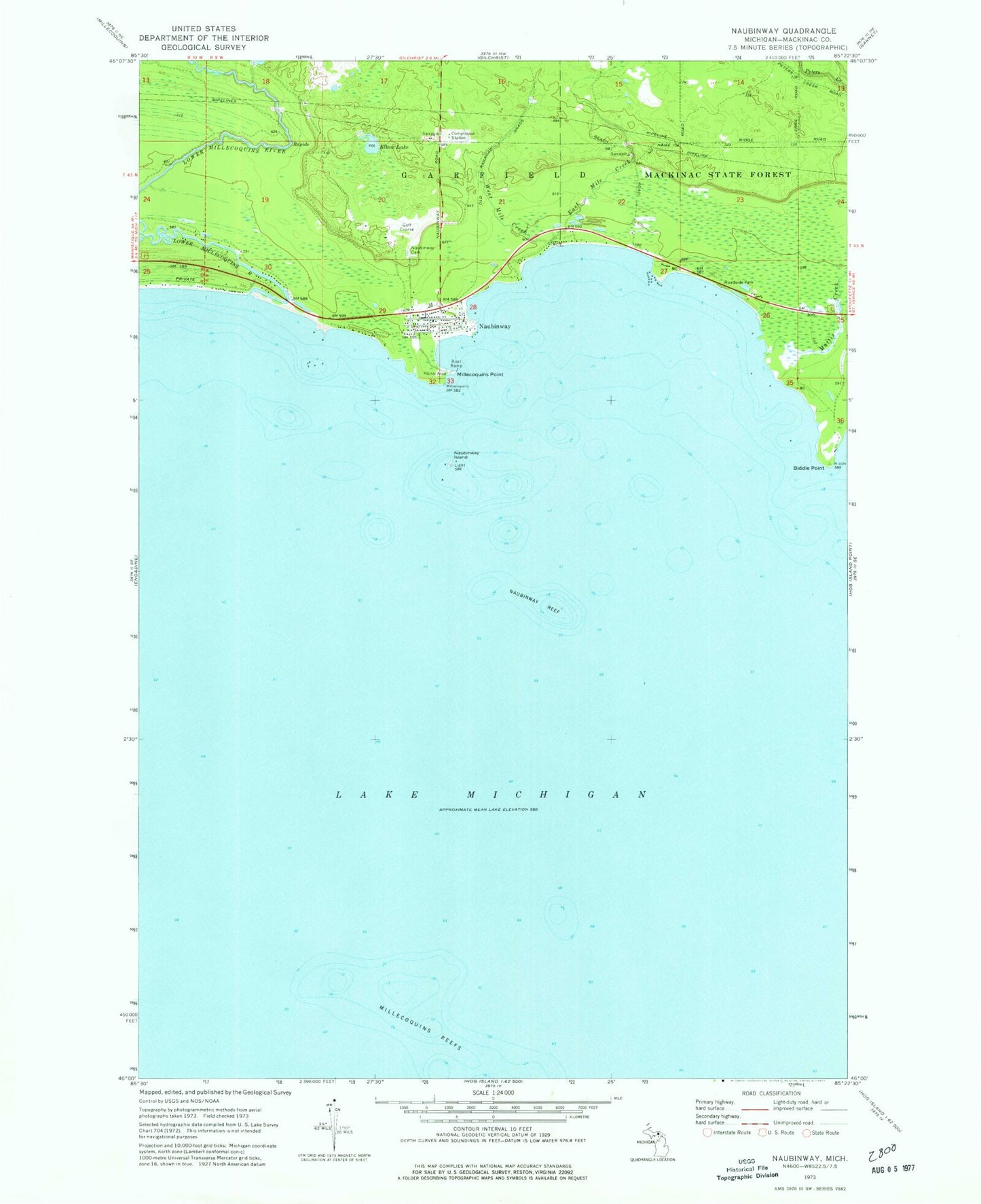
Classic USGS Naubinway Michigan 7.5'x7.5' Topo Map
Couldn't load pickup availability
Historical USGS topographic quad map of Naubinway in the state of Michigan. Map scale may vary for some years, but is generally around 1:24,000. Print size is approximately 24" x 27"
This quadrangle is in the following counties: Mackinac.
The map contains contour lines, roads, rivers, towns, and lakes. Printed on high-quality waterproof paper with UV fade-resistant inks, and shipped rolled.
Contains the following named places: Biddle Point, East Mile Creek, Elbow Lake, Garfield Township Fire Department Station 2, Hiawatha Golf Club, Lower Millecoquins River, Mackinac Straits Medical Clinic, Mattix Creek, Michigan Department of Natural Resources Naubinway Field Office, Millecoquins Point, Millecoquins Reefs, Naubinway, Naubinway Cemetery, Naubinway Census Designated Place, Naubinway Christian Fellowship, Naubinway Island, Naubinway Island Light, Naubinway Post Office, Naubinway Reef, Naubinway Rest Area, Northernmost Point of Lake Michigan Historical Marker, Threemile Creek, West Mile Creek