MyTopo
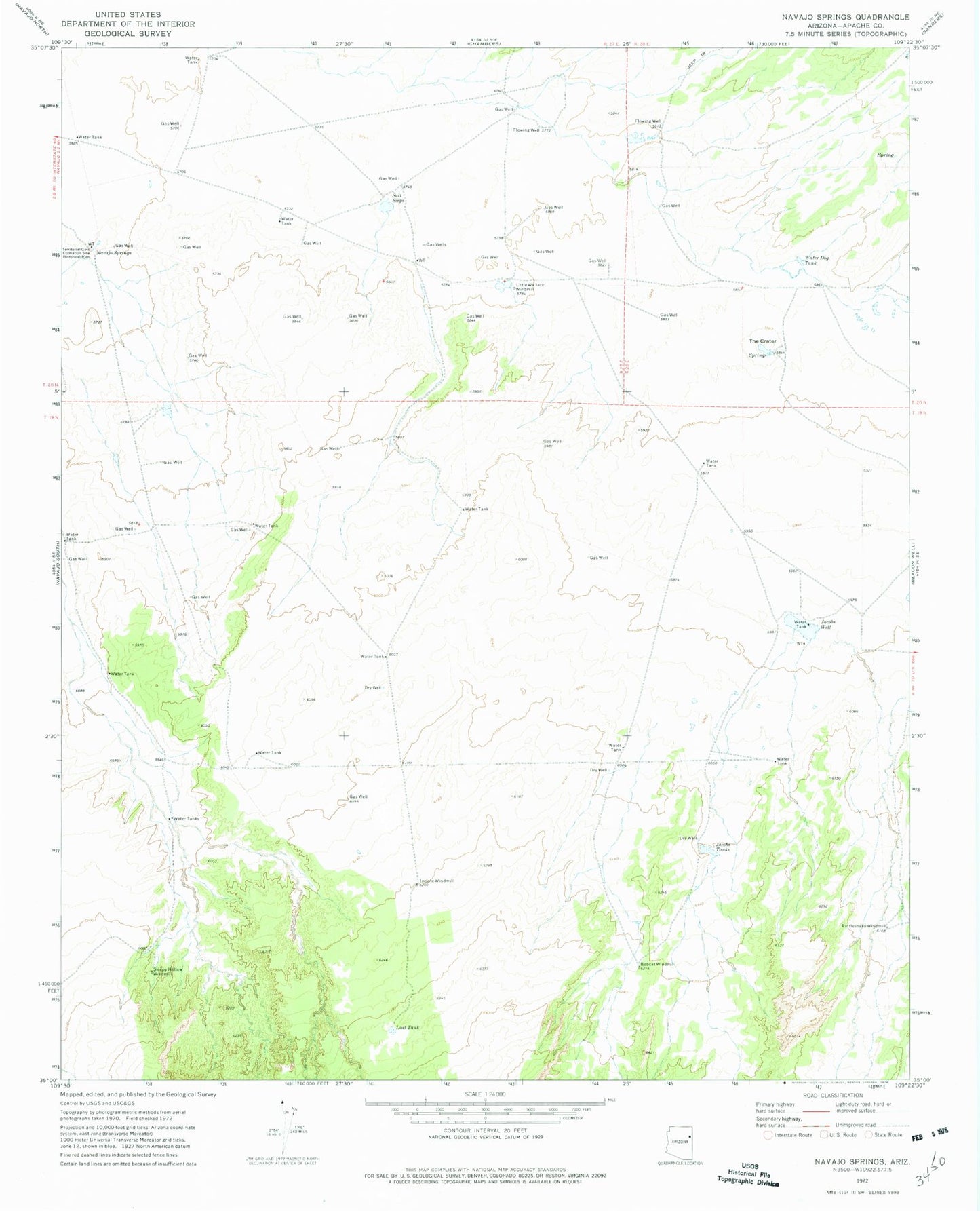
Classic USGS Navajo Springs Arizona 7.5'x7.5' Topo Map
Regular price
$16.95
Regular price
Sale price
$16.95
Unit price
per
Couldn't load pickup availability
Historical USGS topographic quad map of Navajo Springs in the state of Arizona. Map scale may vary for some years, but is generally around 1:24,000. Print size is approximately 24" x 27"
This quadrangle is in the following counties: Apache.
The map contains contour lines, roads, rivers, towns, and lakes. Printed on high-quality waterproof paper with UV fade-resistant inks, and shipped rolled.
Contains the following named places: Bobcat Windmill, Jacobs Tank, Jacobs Well, Little Wallace Windmill, Lost Tank, Navajo Springs, Rattlesnake Windmill, Salt Seeps, Sleepy Hollow Windmill, Teclote Windmill, Territorial Government Formation Site Historical Monument, The Crater, Water Dog Tank