MyTopo
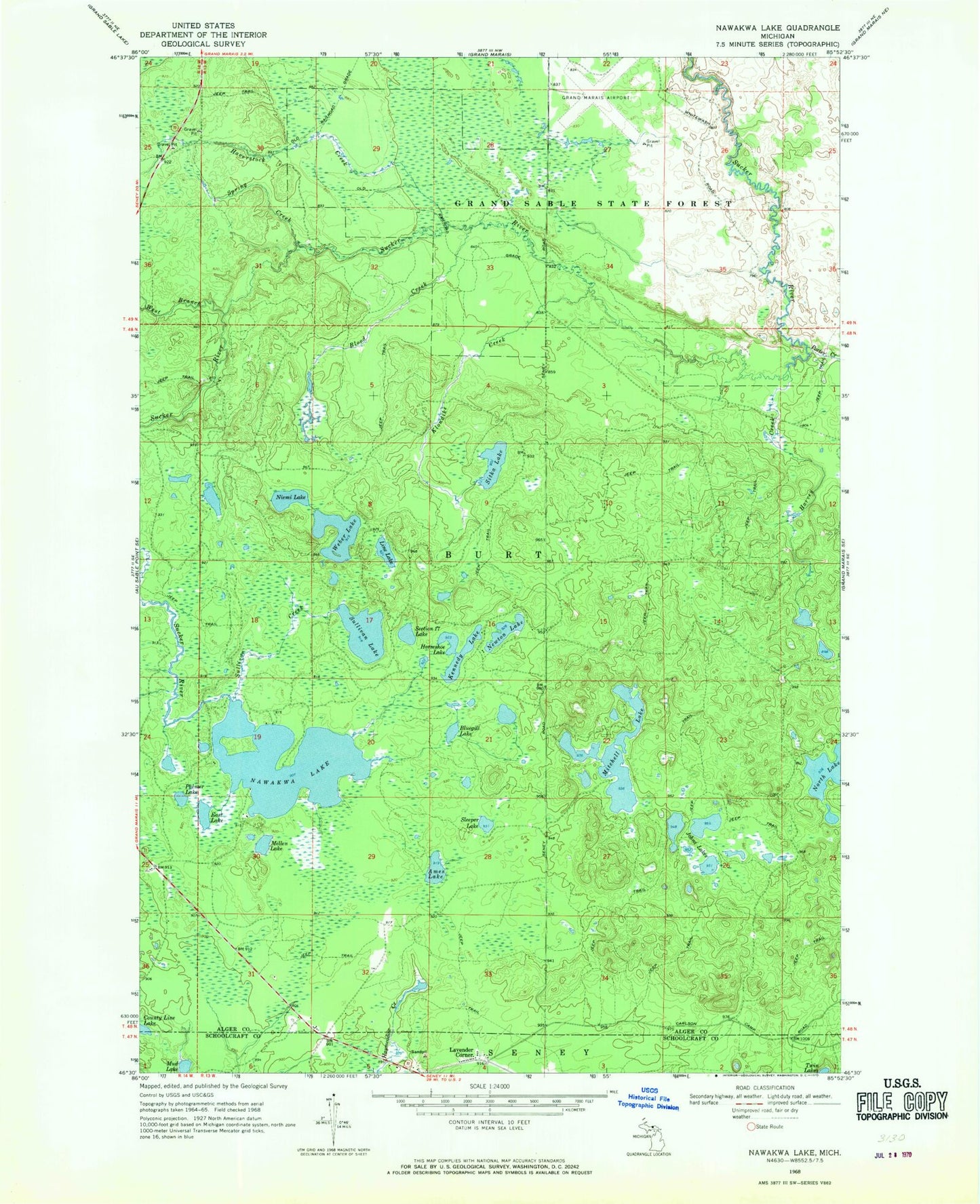
Classic USGS Nawakwa Lake Michigan 7.5'x7.5' Topo Map
Couldn't load pickup availability
Historical USGS topographic quad map of Nawakwa Lake in the state of Michigan. Typical map scale is 1:24,000, but may vary for certain years, if available. Print size: 24" x 27"
This quadrangle is in the following counties: Alger, Schoolcraft.
The map contains contour lines, roads, rivers, towns, and lakes. Printed on high-quality waterproof paper with UV fade-resistant inks, and shipped rolled.
Contains the following named places: Ames Lake, Blood Creek, Bluegill Lake, County Line Lake, East Lake, Harvey Creek, Haverstock Creek, Horseshoe Lake, Johns Lakes, Kennedy Lake, Klondike Creek, Lavender Corner, Line Lake, Mellen Lake, Mitchell Lake, Mud Lake, Nawakwa Lake, Newton Lake, Niemi Lake, North Lake, Palmer Lake, Porter Creek, Section Seventeen Lake, Sitka Lake, Sleeper Lake, Spring Creek, Sullivan Creek, Sullivan Lake, Weber Lake, West Branch Sucker River, Grand Marais Airport, Youngs Post Office (historical), Youngs Station (historical)