MyTopo
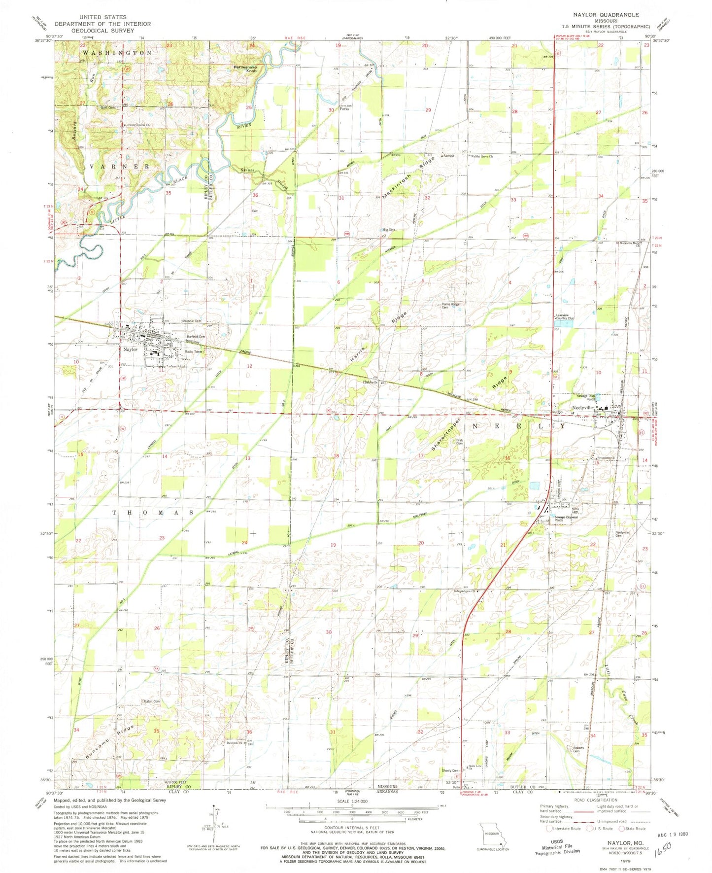
Classic USGS Naylor Missouri 7.5'x7.5' Topo Map
Couldn't load pickup availability
Historical USGS topographic quad map of Naylor in the state of Missouri. Map scale may vary for some years, but is generally around 1:24,000. Print size is approximately 24" x 27"
This quadrangle is in the following counties: Butler, Ripley.
The map contains contour lines, roads, rivers, towns, and lakes. Printed on high-quality waterproof paper with UV fade-resistant inks, and shipped rolled.
Contains the following named places: Barfield Cemetery, Beech Ridge School, Big Sink, Booser, Brown Ditch, Buncomb Church, Buncomb Ridge, Buncomb School, Butler County Fire Protection District Neelyville Station, Buzzard Run, Byrnes Ditch, City of Naylor, City of Neelyville, Corinth General Church, Crab Cemetery, Ditch Number 1, Ditch Number 3, Eaton Cemetery, Ferguson Switch, Friendship Church, Gaines Slough, Gaines Switch, Gheen, Gum Cemetery, Gum School, Harris Ridge, Harris Ridge Cemetery, Harris Ridge School, Hart Ditch, Hart School, Harviell Ditch, Hazel Dell School, Hubbells, Independence Church, Jennings Ditch, Jennings School, Lakeview Country Club, Lateral Number 1, Lutz Cemetery, Mackintosh Ridge, Mackintosh School, Mendosa, Moark Ditch, Naylor, Naylor Memorial Cemetery, Naylor Volunteer Fire Department, Neeleyville Cemetery, Neeleyville Ditch, Neelyville, Neelyville Post Office, Oakdale School, Parks, Rattlesnake Knob, Roberts Cemetery, Saint Margarite Mary Church, Sharecropper Ridge, Sheely Cemetery, Sims, Sims Cemetery, Sixteen to One School, State Line Church, Taft Ditch, Township of Neely, Walnut Grove Church