MyTopo
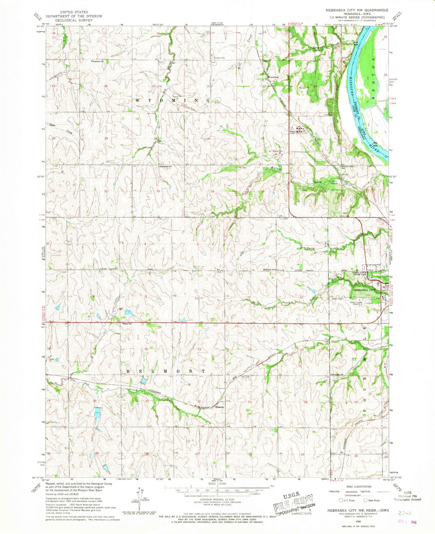
Classic USGS Nebraska City NW Nebraska 7.5'x7.5' Topo Map
Couldn't load pickup availability
Historical USGS topographic quad map of Nebraska City NW in the states of Nebraska, Iowa. Map scale may vary for some years, but is generally around 1:24,000. Print size is approximately 24" x 27"
This quadrangle is in the following counties: Fremont, Otoe.
The map contains contour lines, roads, rivers, towns, and lakes. Printed on high-quality waterproof paper with UV fade-resistant inks, and shipped rolled.
Contains the following named places: Arbor Day Trail - Nebraska City Trail, Arbor Lodge Historical Marker, Arbor Lodge State Historical Park, Arbor Lodge Trail, Baker School, Belmont Election Precinct, Bethel United Church of Christ, Buchanan School, Camp Catron, Copeland Bend Wildlife Management Area, Cowles Cemetery, Elberon, Ferguson School, Indian Treaty Monument Historical Marker, Jay Dam, Jay Reservoir, Jehovahs Witnesses Kingdom Hall, KNCY-AM (Nebraska City), KNCY-FM (Nebraska City), Maple Grove School, McCartney Public School, Nebraska City Historical Marker, Nebraska City Senior High School, Old Wyoming Post Office, Peru State Regional Technology Center, Steinhart Park, Sunnyside School, Table Creek Golf Course, The Church of Jesus Christ of Latter Day Saints, Township of Belmont, Township of Four Mile, Township of Wyoming, Walnut Creek School, Wildwood Golf Course, Wildwood House, Wilson Creek Dam 5-15, Wilson Creek Dam 5-5, Wilson Creek Dam 5-C, Wilson Creek Dam 5-F, Wilson Creek Dam 5-H, Wilson Creek Dam 5-J, Wilson Creek Dam 6-4, Wilson Creek Dam 6-5, Wilson Creek Dam 6-7, Wilson Creek Dam 6-8, Wilson Creek Dam 7-19-E, Wilson Creek Reservoir 5-15, Wilson Creek Reservoir 5-5, Wilson Creek Reservoir 5-C, Wilson Creek Reservoir 5-F, Wilson Creek Reservoir 5-H, Wilson Creek Reservoir 5-J, Wilson Creek Reservoir 6-4, Wilson Creek Reservoir 6-5, Wilson Creek Reservoir 6-7, Wilson Creek Reservoir 6-8, Wilson Creek Reservoir 7-19-E, Wilson Creek Reservoir 7-9, Wyoming, Wyoming Creek, Wyoming Election Precinct, Wyoming Post Office, ZIP Code: 68410


