MyTopo
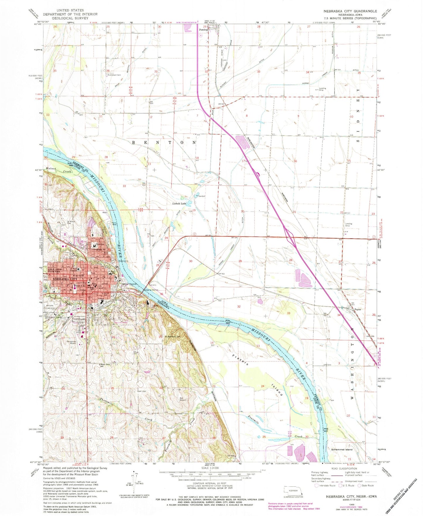
Classic USGS Nebraska City Nebraska 7.5'x7.5' Topo Map
Couldn't load pickup availability
Historical USGS topographic quad map of Nebraska City in the states of Nebraska, Iowa. Map scale may vary for some years, but is generally around 1:24,000. Print size is approximately 24" x 27"
This quadrangle is in the following counties: Fremont, Otoe.
The map contains contour lines, roads, rivers, towns, and lakes. Printed on high-quality waterproof paper with UV fade-resistant inks, and shipped rolled.
Contains the following named places: Ambassador Nebraska City, Applewood Mobile Home Park, Arbor Christian Fellowship, Baha'i Faith, Bartlett and Company Elevator, Blanchard Cemetery, Calvary Community Church, CHI Heath Saint Mary's Hospital, Christ Lutheran Church, Church of Christ, City of Nebraska City, Cresaps Lateral Number 7, Crocker Spur, Crosby, Duffs Friendship Villa, East Port, Eastport, Eastport Post Office, Faith Baptist Church, Family Physicians of Nebraska City, First Baptist Church, First Christian Church, First Evangelical Lutheran Church, First United Methodist Church, Fort Kearny, Fort Kearny Post Office, Four Mile Election Precinct, Fourmile Creek, Frazers Island, Grain Service Company Elevator, Grand Army of the Republic Hall, Greggsport School, Grundman Airport, Hayward Elementary School, Horse Creek, Horse Creek Ditch, John Brown Park, Kearney City Post Office, Lambert Cemetery, Lewis and Clark National Historic Trail, Liebold Lake, Lourdes Central Catholic School, Lourdes Primary School, Maple Grove Public School, Mayhew Cabin Historical Marker, Mid-Plains Eyecare Center, Midwest Dermatology Clinic, Montana, Morton-James Public Library, Nebraska City, Nebraska City Dental Clinic, Nebraska City Fire Department, Nebraska City Foot Clinic, Nebraska City Manor, Nebraska City Middle School, Nebraska City Northside School, Nebraska City Police Department, Nebraska City Post Office, Nebraska City Volunteer Fire Department, Nebraska Schools for Visually Handicapped, North Table Creek, Old Fort Kearny Historical Marker, Old Freighters Museum, Otoe County Courthouse, Otoe County Sheriffs Office, Park EZ Mobile Home Court, Payne, Payne Junction, Payne Post Office, Pentecostal Kings Church, Percival, Percival Fire and Rescue Benton Township, Percival Post Office, Presbyterian Church, Reorganized Church of Jesus Christ of Latter Day Saints, Riverview Marina State Recreation Area, Roll Brothers Airport, Saint Benedicts Catholic Church, Saint Benedicts Cemetery, Saint Marys Catholic Church, Saint Marys Cemetery, Saint Marys Episcopal Church, Saint Marys Hospital Heliport, Second Ave School, Seventh Day Adventist Church, Sixth Street School, South Table Creek, Tabitha Health Care Services, Threemile Creek, Township of Benton, Victorian Acres RV Park and Campground, Walnut Creek, Waubonsie Access, West Benton Ditch, Wyuka Cemetery, ZIP Code: 51648