MyTopo
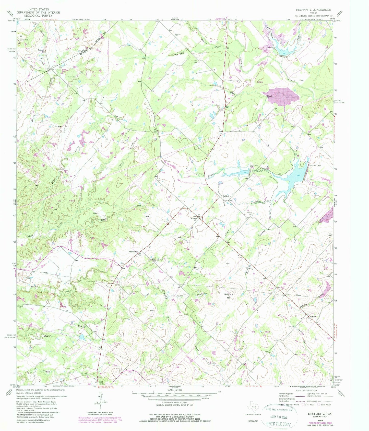
Classic USGS Nechanitz Texas 7.5'x7.5' Topo Map
Couldn't load pickup availability
Historical USGS topographic quad map of Nechanitz in the state of Texas. Map scale may vary for some years, but is generally around 1:24,000. Print size is approximately 24" x 27"
This quadrangle is in the following counties: Fayette, Lee.
The map contains contour lines, roads, rivers, towns, and lakes. Printed on high-quality waterproof paper with UV fade-resistant inks, and shipped rolled.
Contains the following named places: Albers Branch, Alexander Branch, Anchorage Farm Field, Bell Cemetery, Bethany Church, Blair Creek, Center for American History Winedale Historical Center, Dam Number 10, Dam Number 9, Greenbriar Lake, Greenbriar Lake Dam, Hellers Branch, Hellers Hill, Hickory Ridge Cemetery, Jones Creek, Mile Branch, Nechanitz, Pin Oak Creek, Polk - Wisdom Branch Library, Preston Royal Branch Library, Rocky Branch, Round Top Area History Museum, Round Top Division, Schumann Cemetery, Skillman Southwestern Branch Library, Soil Conservation Service Site 10 Dam, Soil Conservation Service Site 10 Reservoir, Soil Conservation Service Site 4 Dam, Soil Conservation Service Site 4 Reservoir, Soil Conservation Service Site 5 Dam, Soil Conservation Service Site 5 Reservoir, Soil Conservation Service Site 9 Dam, Soil Conservation Service Site 9 Reservoir, Speckels Branch, Turkey Creek, Ullrich Airport, Violets Creek, Waldeck, Waldeck Cemetery, Waldeck Church, Walhalla, Walnut Hill Branch Library