MyTopo
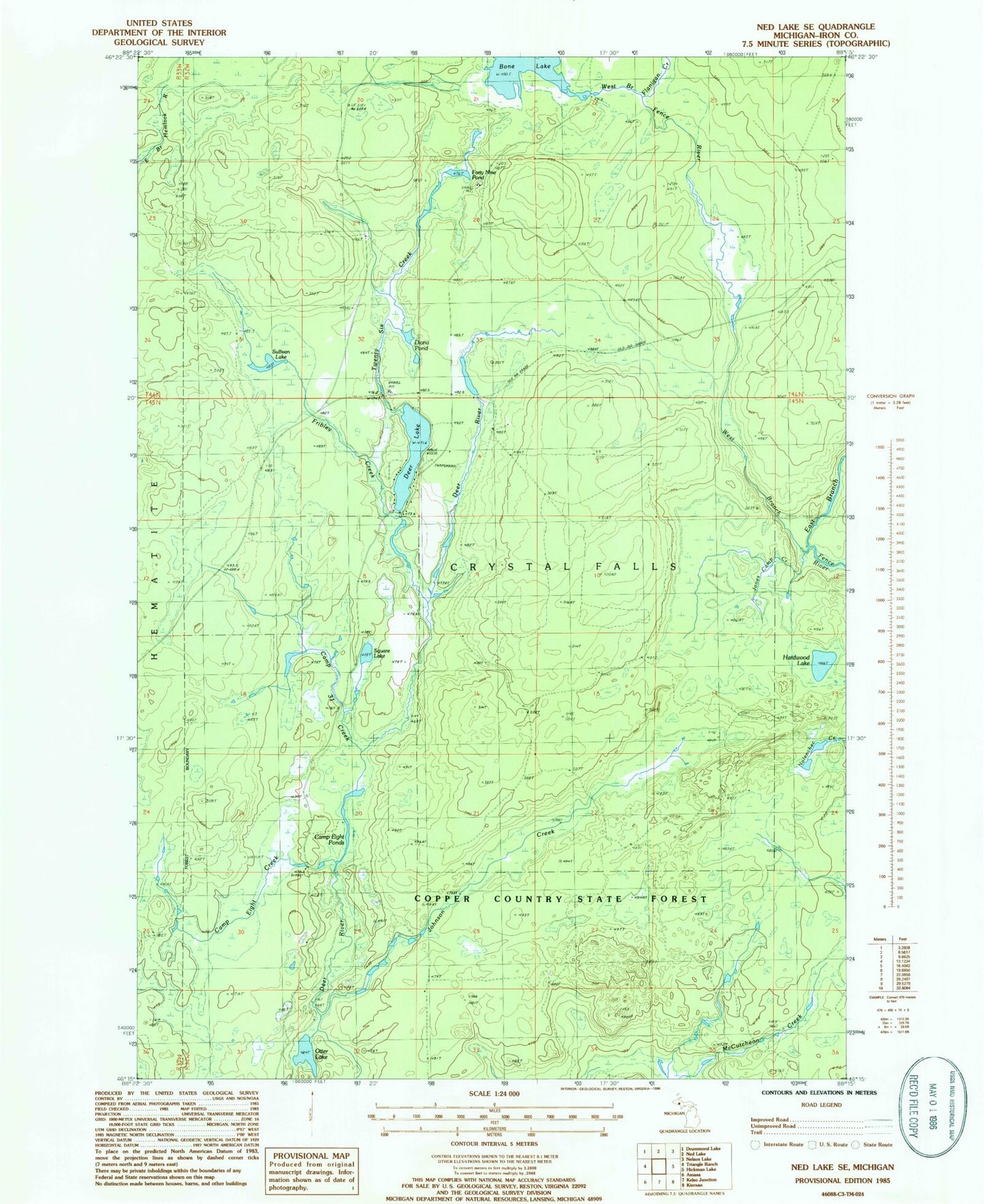
Classic USGS Ned Lake SE Michigan 7.5'x7.5' Topo Map
Couldn't load pickup availability
Historical USGS topographic quad map of Ned Lake SE in the state of Michigan. Map scale may vary for some years, but is generally around 1:24,000. Print size is approximately 24" x 27"
This quadrangle is in the following counties: Iron.
The map contains contour lines, roads, rivers, towns, and lakes. Printed on high-quality waterproof paper with UV fade-resistant inks, and shipped rolled.
Contains the following named places: Bone Lake, Camp Creek, Camp Eight Creek, Camp Eight Ponds, Deer Lake, Deer Lake State Forest Campground, Diana Pond, East Branch Fence River, Flanigan Creek, Forty Nine Pond, Fribley Creek, Hardwood Lake, Johnson Creek, Jones Camp Creek, Otter Lake, Square Lake, Sullivan Lake, Twenty Six Creek, West Branch Fence River