MyTopo
Classic USGS Needham Arkansas 7.5'x7.5' Topo Map
Couldn't load pickup availability
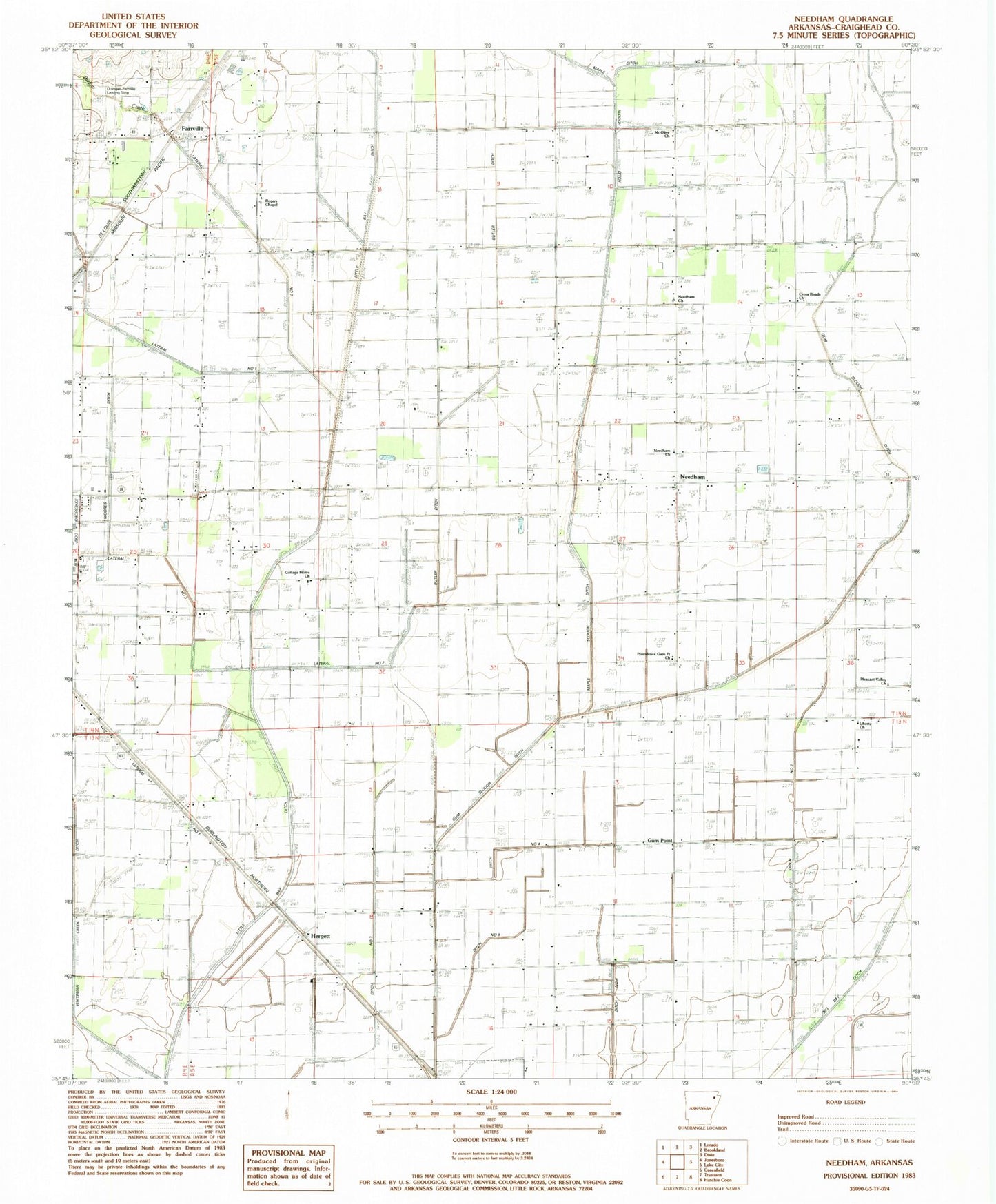
Historical USGS topographic quad map of Needham in the state of Arkansas. Map scale may vary for some years, but is generally around 1:24,000. Print size is approximately 24" x 27"
This quadrangle is in the following counties: Craighead.
The map contains contour lines, roads, rivers, towns, and lakes. Printed on high-quality waterproof paper with UV fade-resistant inks, and shipped rolled.
Contains the following named places: Air - Evacuation Lifeteam 2, Bridger Creek, Brown Church, Brown School, Butler Ditch, Classic Airstrip, Cottage Home Church, Cross Roads Church, Disinger-Farrville Landing Strip, Ditch Number 2, Ditch Number 3, Ditch Number 7, Farrville, Gum Point, Gum Point School, Gum Slough Ditch, Herget Chapel, Hergett, John Parker Strip, Jonesboro Industrial Development Corporation Industrial Park, Lateral Number 1, Lateral Number 2, Lateral Number 2 Moores Ditch, Lateral Number 3, Liberty Church, Little Bay Ditch, Main Ditch, Maple Slough Ditch, Mount Olive Church, Murray Creek, Needham, Needham Church, Northeast Arkansas Post Office, Pekin, Phillips, Phillips School, Pleasant Valley School, Pleasant Valley United Methodist Church, Providence Gum Point Church, Rogers CHapel, Rogers School, Township of Nettleton, Webbs Mill, Whitburg