MyTopo
Classic USGS Needle Butte Montana 7.5'x7.5' Topo Map
Couldn't load pickup availability
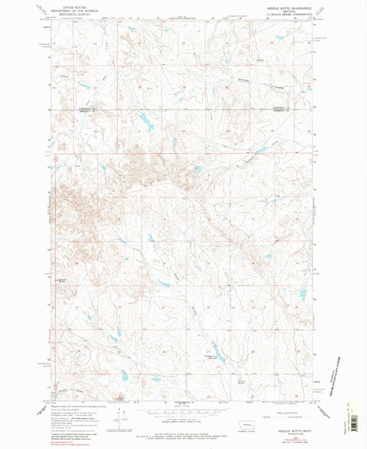
Historical USGS topographic quad map of Needle Butte in the state of Montana. Map scale may vary for some years, but is generally around 1:24,000. Print size is approximately 24" x 27"
This quadrangle is in the following counties: Garfield, Rosebud.
The map contains contour lines, roads, rivers, towns, and lakes. Printed on high-quality waterproof paper with UV fade-resistant inks, and shipped rolled.
Contains the following named places: Caladine Coulee, G Newman Number 1 Dam, G Newman Number 6 Dam, Killen Number 7 Dam, Killen Number 8 Dam, Killen Number 9 Dam, Lee Number 11 Dam, Lee Number 12 Dam, Lee Number 13 Dam, Maudlin Post Office, Maudlin School, Needle Butte, Nordang Coulee, Sunday Butte, Sunday Creek Reservoir, Sunday Creek Reservoir Dam, Sweetser Spring, Westcott School