MyTopo
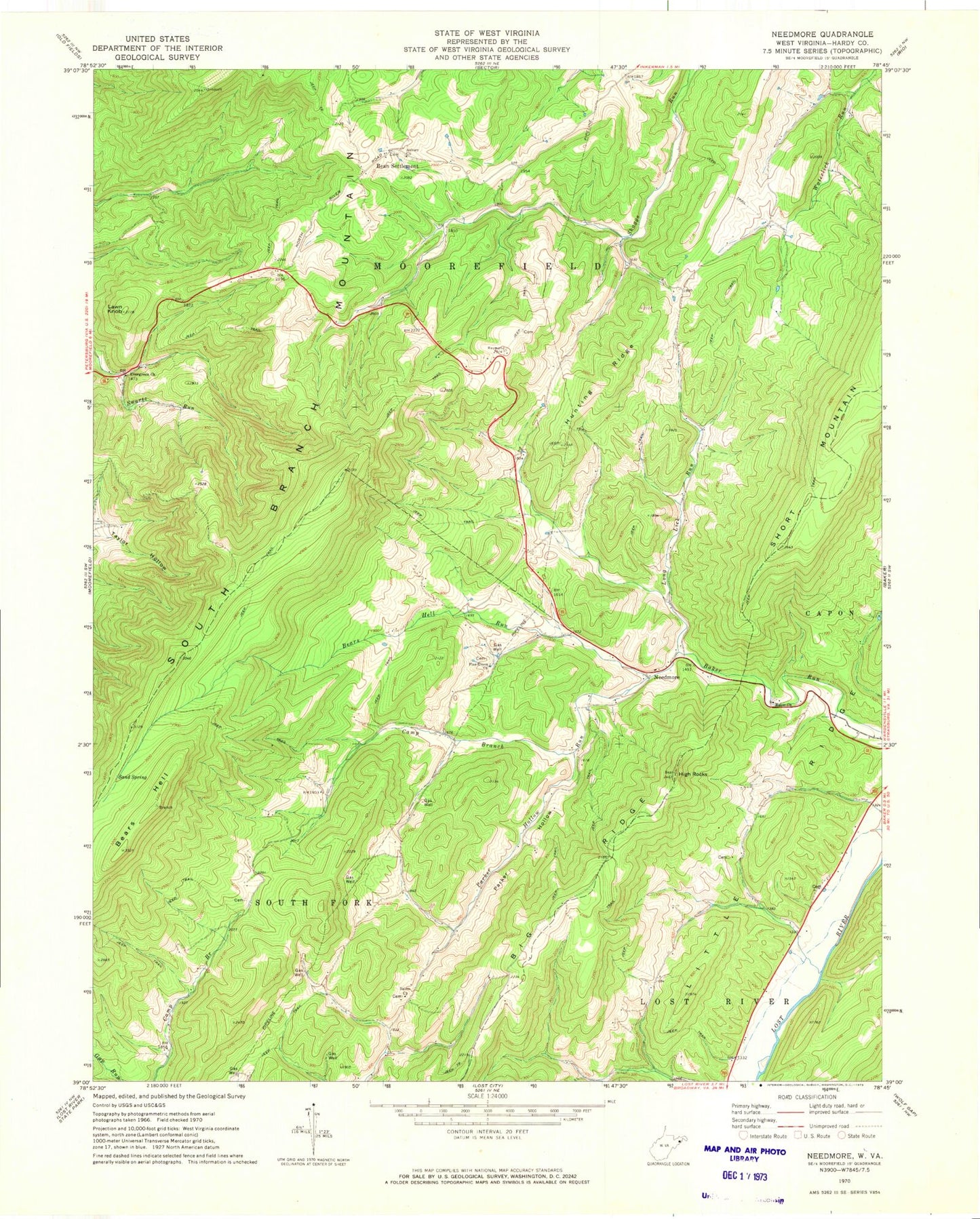
Classic USGS Needmore West Virginia 7.5'x7.5' Topo Map
Couldn't load pickup availability
Historical USGS topographic quad map of Needmore in the state of West Virginia. Map scale may vary for some years, but is generally around 1:24,000. Print size is approximately 24" x 27"
This quadrangle is in the following counties: Hardy.
The map contains contour lines, roads, rivers, towns, and lakes. Printed on high-quality waterproof paper with UV fade-resistant inks, and shipped rolled.
Contains the following named places: Asbury Church, Baker Church, Baker Run School, Bean Settlement, Bears Hell, Bears Hell Run, Camp Branch, Camp Branch School, Chestnut Cove School, Doman, East Hardy Early Middle School, East Hardy High School, East Hardy Public Library, Evergreen Church, Fabius, Hardy County, High Rocks, Hines School, Hunting Ridge, Lawn Knob, Long Lick Run, Long Lick Run Bridge, Long Lick School, Luxemburg School, Miller School, Mine Spring School, Needmore, Parker Hollow, Phils Lick School, Pine Grove Cemetery, Pine Grove Church, Reynolds School, Salem Church, Sand Spring, Swartz Run, Taylor Hollow, Webster Spring, ZIP Code: 26801