MyTopo
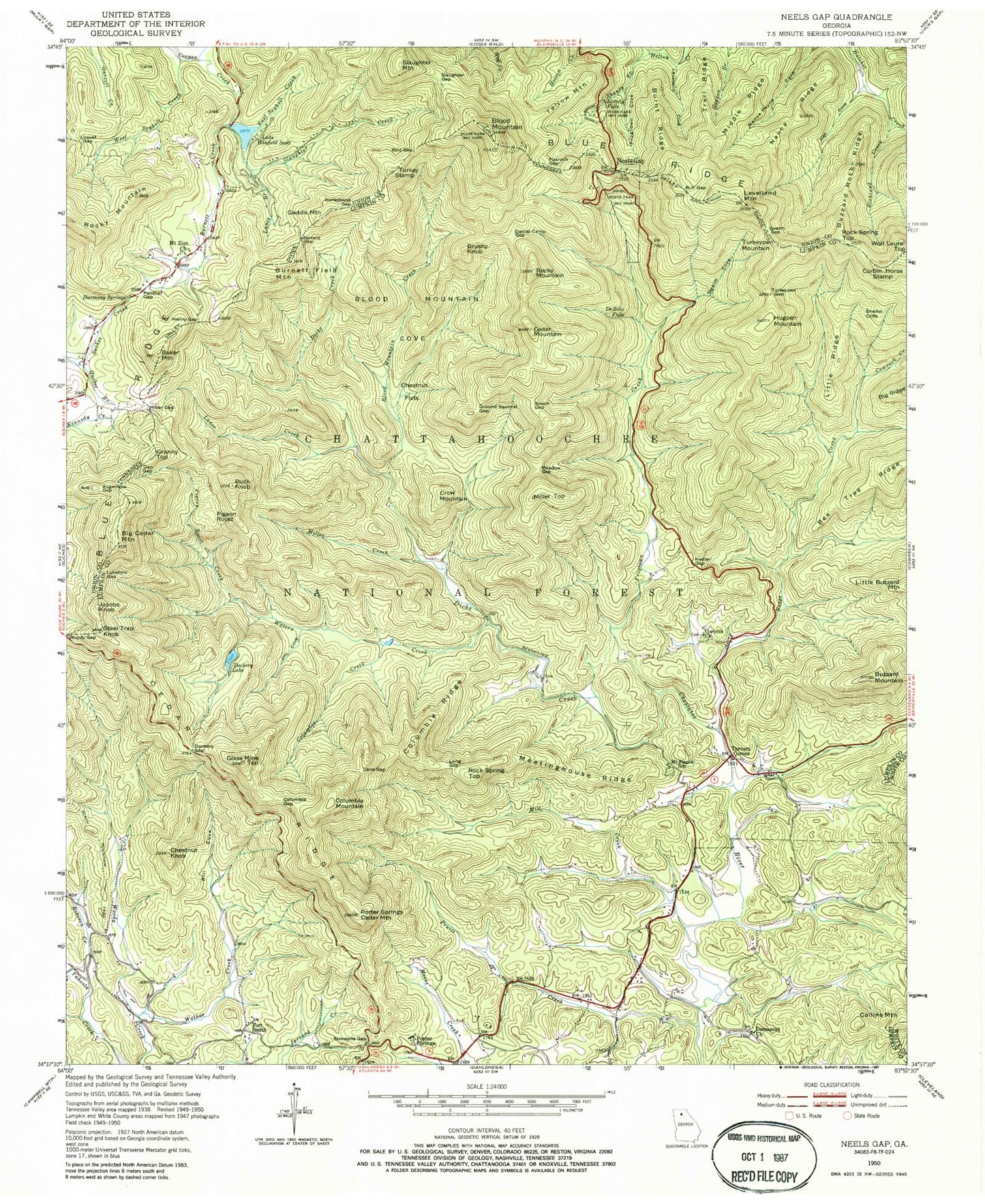
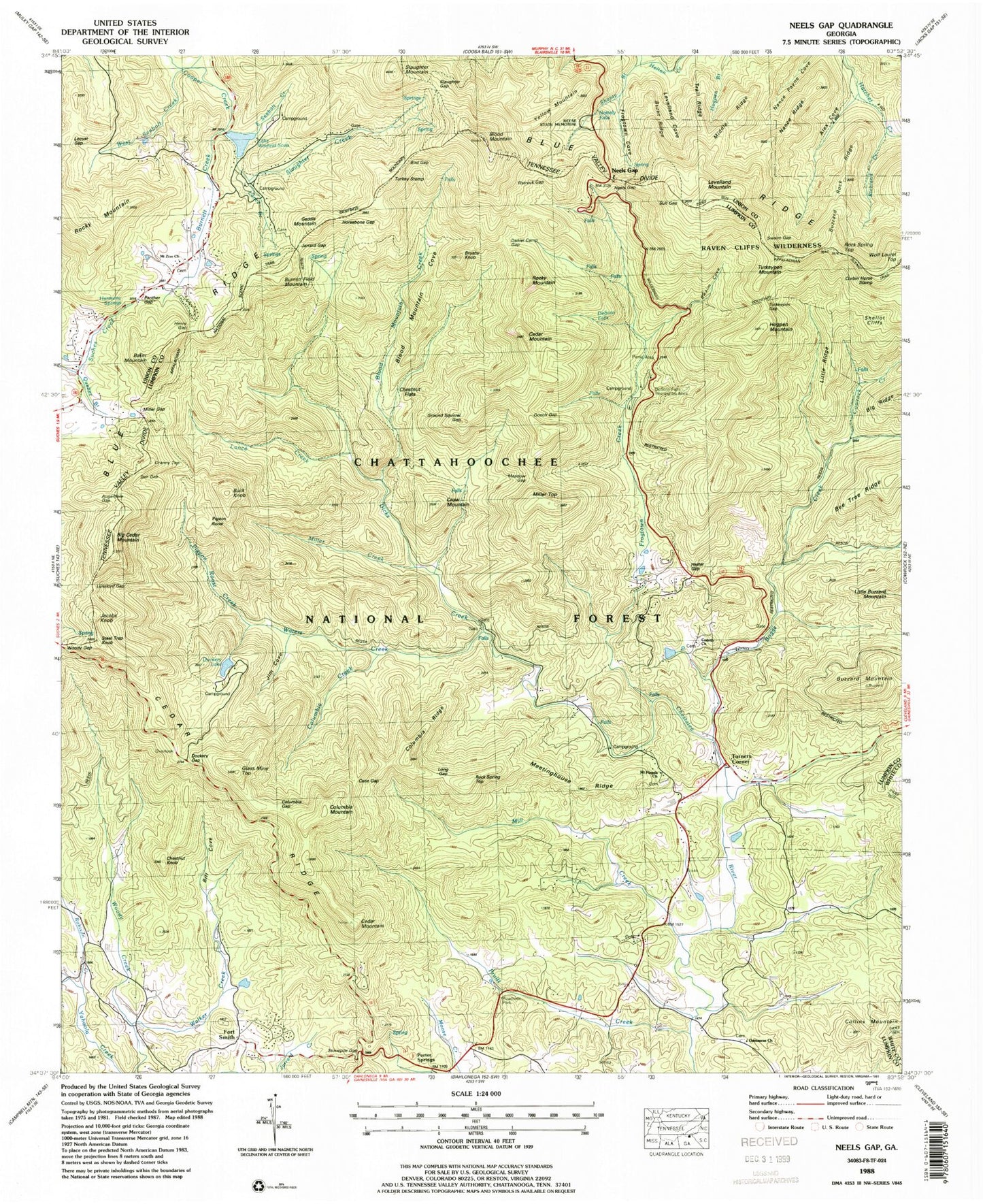
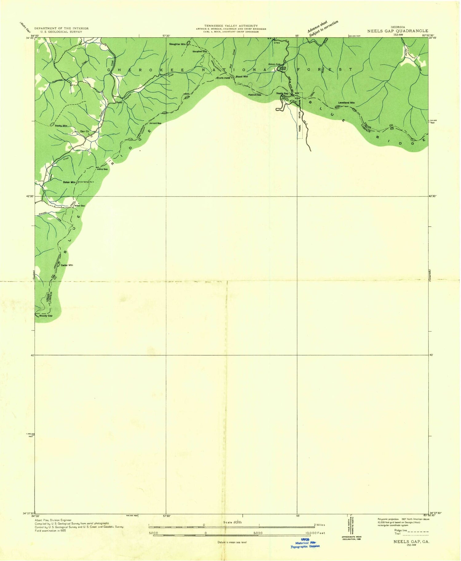
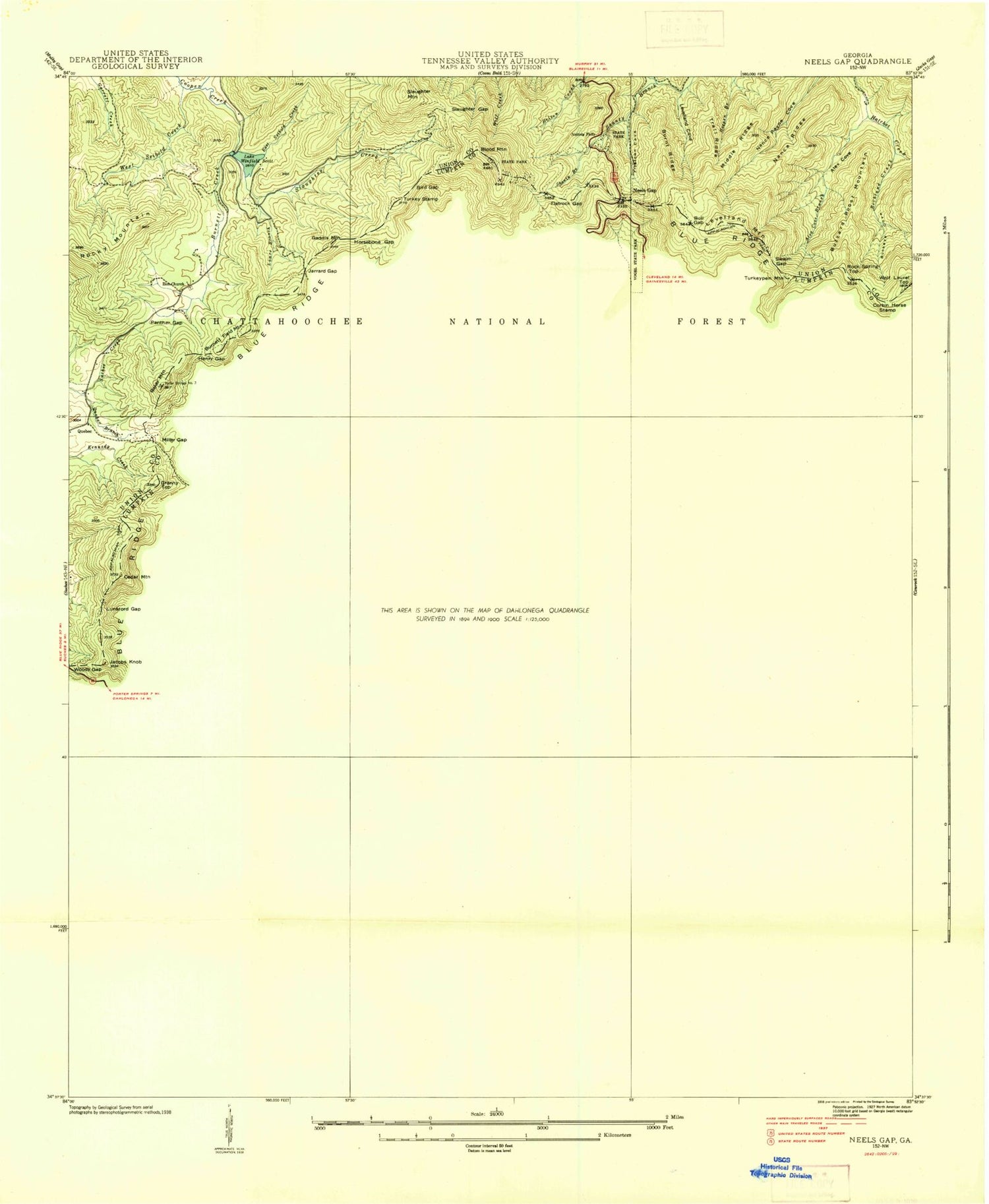
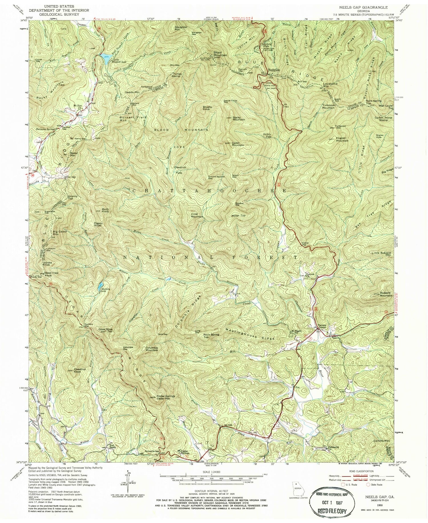
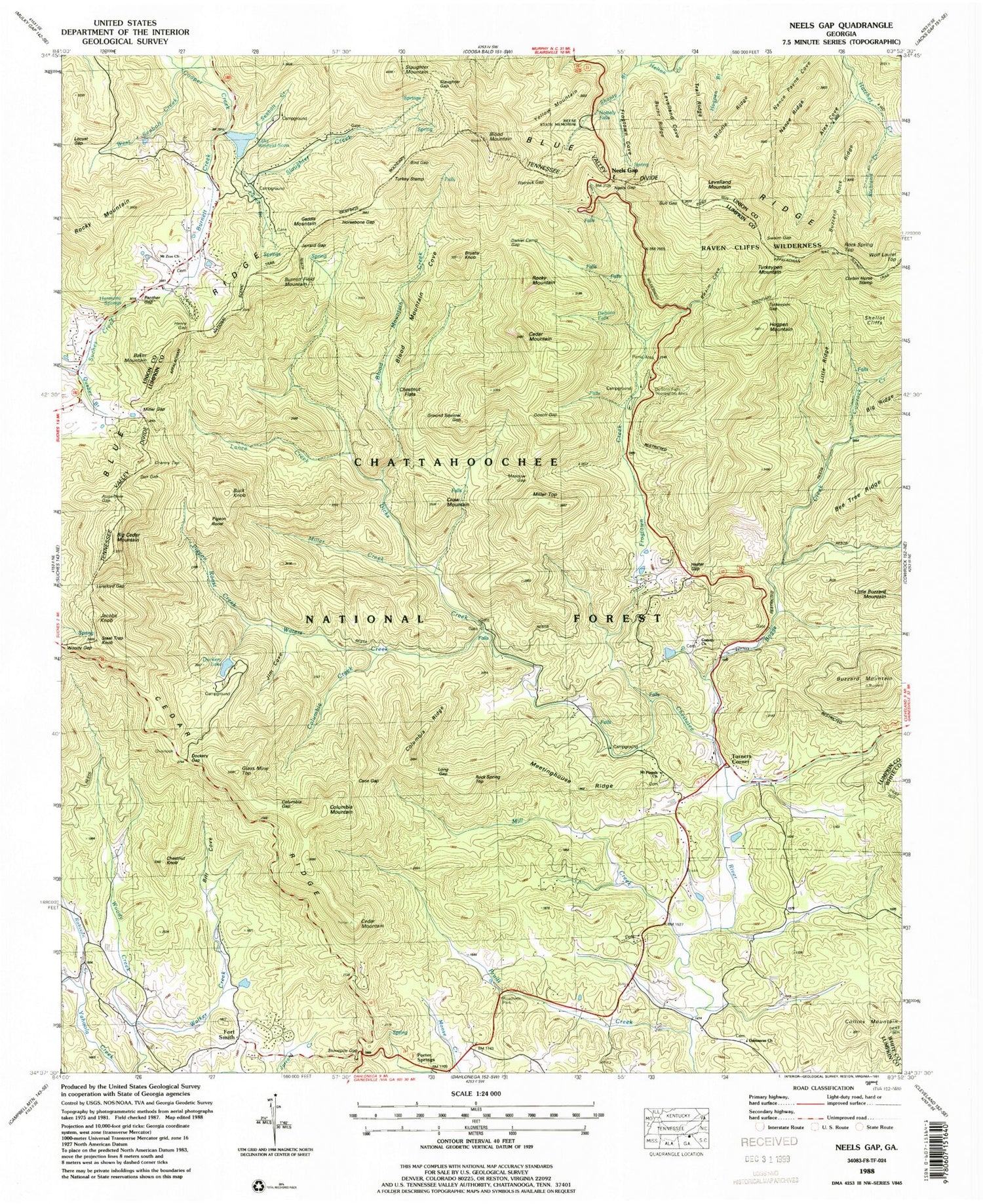
USGS Classic Neels Gap Georgia 7.5'x7.5' Topo Map
Couldn't load pickup availability
Historical USGS topographic quad map of Neels Gap in the state of Georgia. Scale: 1:24000. Print size: 24" x 27"
This quadrangle is in the following counties: Lumpkin, Union, White.
The map contains contour lines, roads, rivers, towns, lakes, and grids including latitude / longitude and UTM / MGRS. Printed on high-quality waterproof paper with UV fade-resistant inks.
Contains the following named places: Dockery Lake, Levelland Mountain, Alex Cove, Augerhole Gap, Boggs Creek, Baker Mountain, Bill Cove, Bird Gap, Blood Mountain, Blood Mountain Cove, Blood Mountain Creek, Buck Knob, Bull Gap, Burnett Creek, Burnett Field Mountain, Burnt Ridge, Buzzard Mountain, Buzzard Rock Ridge, Cane Gap, Cedar Mountain, Cedar Ridge, Chestnut Flats, Chestnut Knob, Columbia Creek, Columbia Gap, Columbia Ridge, Cowrock Creek, Dan Gap, Daniel Camp Gap, Dicks Creek, Dockery Gap, Flatrock Gap, Frogtown Cove, Frogtown Creek, Glass Mine Top, Gooch Gap, Ground Squirrel Gap, Harmony Springs, Henry Gap, Hester Gap, Hogpen Mountain, Horsebone Gap, Jarrard Creek, Jarrard Gap, Jim Cove, Lance Branch, Lance Creek, Lee Creek, Levelland Cove, Little Ridge, Locust Gap, Long Gap, Lunsford Gap, Meadow Gap, Meetinghouse Ridge, Middle Ridge, Mill Creek, Miller Creek, Miller Gap, Mount Pisgah School (historical), Mount Zion Church, Nance Ridge, Nottely Falls, Panther Gap, Pigeon Roost Creek, Porter Springs Cedar Mountain, Pruitt Creek, Quebec Branch, Richland Creek, Robison Creek, Rocky Mountain, Shanty Branch, Shellot Cliffs, Slaughter Creek, Slaughter Gap, Steel Trap Knob, Stonepile Gap, Swaim Cove, Swaim Gap, Trail Ridge, Turkeypen Gap, Vogel State Park, Walker Creek, Waters Creek, West Seabolt Creek, Lake Winfield Scott, Woody Gap, Reece State Memorial, Chestatee Wildlife Management Area, Lake Winfield Scott Campground, DeSoto Falls Trail, DeSoto Falls Recreation Area, Chestatee Knoll Campground, Water Creek Campground, Mount Pisgah Church, Chestatee Overlook, Dockery Lake Campground, DeSoto Falls Scenic Area, Brushy Knob, Collins Mountain, Columbia Mountain, Corbin Horse Stamp, Crow Mountain, Fort Smith, Gaddis Mountain, Granny Top, Jacobs Knob, Miller Top, Pigeon Roost, Porter Springs, Rock Spring Top, Rock Spring Top, Rocky Mountain, Slaughter Mountain, Turkey Stamp, Turkeypen Mountain, Turners Corner, Yellow Mountain, Lake Winfield Scott Dam, Dockery Lake Dam, Dollar Lake Dam, Dollar Lake, Quebec (historical), Zion School (historical), Big Cedar Mountain, Corinth Church, Damascus Primitive Baptist Church, DeSoto Falls, East Seabolt Creek, Neels Gap, Gates (historical), Turners Campsites, Walnut (historical), Willow (historical), Porter Spring Post Office (historical), Porter Springs Post Office (historical), Blood Mountain Wilderness, High Water Falls