MyTopo
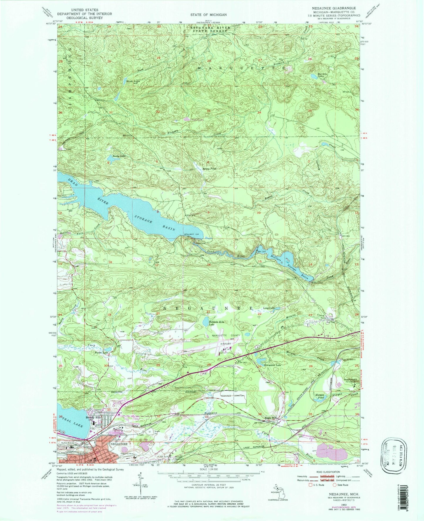
Classic USGS Negaunee Michigan 7.5'x7.5' Topo Map
Couldn't load pickup availability
Historical USGS topographic quad map of Negaunee in the state of Michigan. Typical map scale is 1:24,000, but may vary for certain years, if available. Print size: 24" x 27"
This quadrangle is in the following counties: Marquette.
The map contains contour lines, roads, rivers, towns, and lakes. Printed on high-quality waterproof paper with UV fade-resistant inks, and shipped rolled.
Contains the following named places: Baldwin Kiln Lake, Beaver Farm Creek, Beverly Hills, Club Lake, Eagle Mills, Harkin Lake, Holyoke Trail, Horseshoe Lake, Long Lake, Maas Mine, Mather Mine B, McClure Dam, McClure Storage Basin, Morgan Heights Sanatorium, Morgan Pond, Nash Lake, Nealy Creek, Negaunee Cemetery, Negaunee Mine, Picket Lake, Pine Hill Quarry, Reany Lake, Reany Pond, Marquette County Airport (historical), WMVN-AM (Ishpeming), Charter Township of Marquette, Township of Negaunee, Immanuel Lutheran Church, Church of Our Saviour, Seventh Day Adventist Church, Saint Paul Parish, Mitchell United Methodist Church, Calvary Church of Negaunee, Bethany Lutheran Church, Eastwood Apostolic Lutheran Church, Calvary Baptist Church, Eastwood Nursing Center, Negaunee Historical Society Museum, Negaunee Middle School, Negaunee High School, Lakeview Elementary School, Negaunee Post Office, Negaunee Station, Cherry Street Field, Teal Lake Beach, Eastwood Playlot, Miners Park, Peter Waara Park, Michigan Iron Industry Museum, Trestle Falls, Upper Carp River Falls, Morgan Post Office (historical), Morgan Station (historical), Eagle Mills Post Office (historical), Eagle Mills Station, Marquette Iron Range Historical Marker, Jackson Mine Historical Marker, Northland Chapel Gardens Cemetery, Negaunee Township Fire Department, Michigan State Police District 8 Negaunee Post 81