
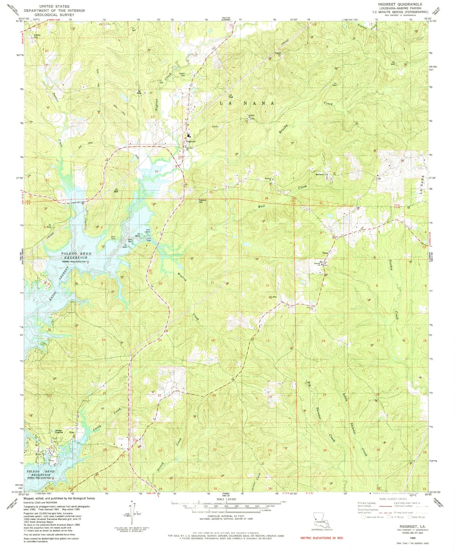
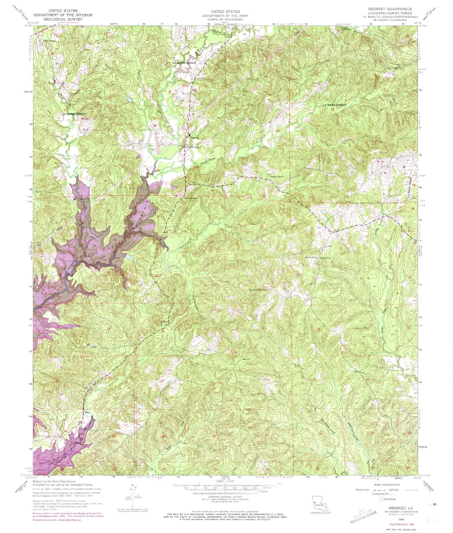
MyTopo
Classic USGS Negreet Louisiana 7.5'x7.5' Topo Map
Couldn't load pickup availability
Historical USGS topographic quad map of Negreet in the state of Louisiana. Map scale may vary for some years, but is generally around 1:24,000. Print size is approximately 24" x 27"
This quadrangle is in the following counties: Sabine.
The map contains contour lines, roads, rivers, towns, and lakes. Printed on high-quality waterproof paper with UV fade-resistant inks, and shipped rolled.
Contains the following named places: Antioch Cemetery, Antioch Church, Antioch School, Brushy Creek, Caney Creek, Carroll Cemetery, Cedar Grove School, Dess, Dess Fire Lookout Tower, Esto, Macedonia Church, Negreet, Negreet Creek, Negreet High School, Negreet Post Office, Negreet School, Parish Governing Authority District 2, Peg Leg Fire Department, Recknor, Redland Cemetery, Redland Church, Roberts Cemetery, Turner Creek, Wall Creek, Ward Three, Winfrey Creek, Zion Hill Baptist Church


