MyTopo
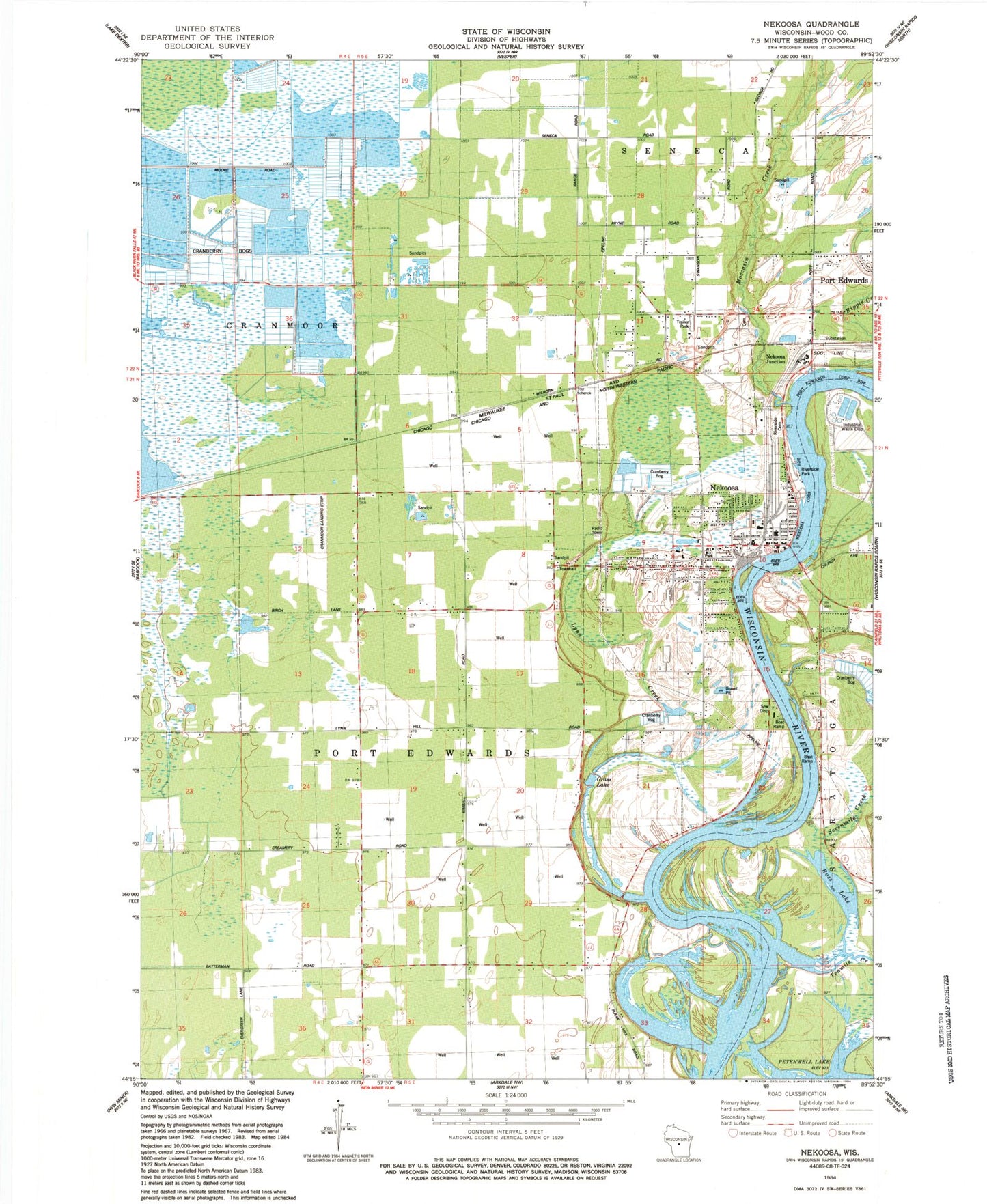
Classic USGS Nekoosa Wisconsin 7.5'x7.5' Topo Map
Couldn't load pickup availability
Historical USGS topographic quad map of Nekoosa in the state of Wisconsin. Map scale may vary for some years, but is generally around 1:24,000. Print size is approximately 24" x 27"
This quadrangle is in the following counties: Wood.
The map contains contour lines, roads, rivers, towns, and lakes. Printed on high-quality waterproof paper with UV fade-resistant inks, and shipped rolled.
Contains the following named places: 11 Reservoir, 14 Reservoir, Alexander Middle School, Arbutus School, Bethlehem Lutheran Church, Ceex Haci, Ceex Haci Census Designated Place, City of Nekoosa, Cranmoor Airstrip, Grass Lake, Green Grove School, Humke Elementary School, Lynn Creek, Moccasin Creek, Nekoosa, Nekoosa Academy, Nekoosa Alternate Charter Middle School, Nekoosa Fire Department, Nekoosa Flowage 5564, Nekoosa High School, Nekoosa Junction, Nekoosa Police Department, Nekoosa Post Office, Nekoosa WP348 Dam, Pine Grove School, Plank Hill School, Ripple Creek, Riverside Cemetery, Riverside Park, Ross Lake, Sacred Heart of Jesus Church, Sacred Heart School, Sevenmile Creek, Tenmile Creek, Town of Port Edwards, Village of Port Edwards Cemetery, WCAE-AM (Nekoosa), Wittenberg School, Wood County 2 C 6118 Dam, Wood County 3 C 6118 Dam