MyTopo
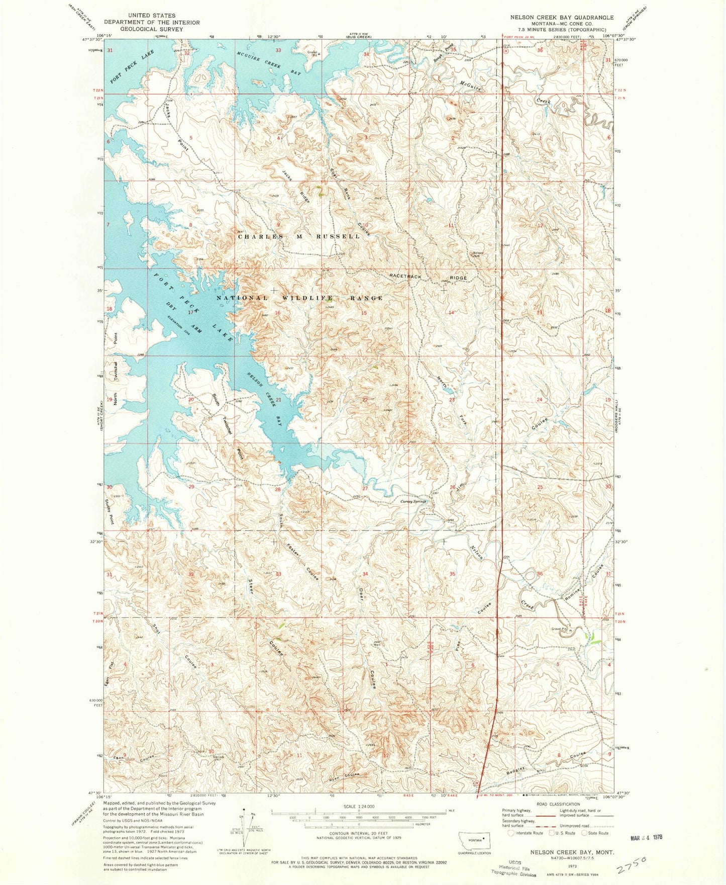
Classic USGS Nelson Creek Bay Montana 7.5'x7.5' Topo Map
Couldn't load pickup availability
Historical USGS topographic quad map of Nelson Creek Bay in the state of Montana. Map scale may vary for some years, but is generally around 1:24,000. Print size is approximately 24" x 27"
This quadrangle is in the following counties: McCone.
The map contains contour lines, roads, rivers, towns, and lakes. Printed on high-quality waterproof paper with UV fade-resistant inks, and shipped rolled.
Contains the following named places: 01N45E29BBCC01 Well, 01N45E31BCBA01 Well, 20N43E01AABD01 Well, 21N43E36BCCD01 Well, 21N43E36DAAC01 Well, 21N43E36DAAD01 Well, Carney Springs, Coal Bank Coulee, Deer Coulee, Jacks Point, Jacks Ridge, Jim Coulee, McGuire Creek, McGuire Creek Bay, McGuire Creek Recreation Area, Nelson Creek, Nelson Creek Bay, Nelson Creek Recreation Area, North Fork Jim Coulee, North Twitchell Point, Pine Coulee, R C Mothershead Number 1 Dam, Racetrack Ridge, Romine Coulee, Rough Prong McGuire Creek, South Foster Coulee, South Twitchell Point, Steer Coulee