MyTopo
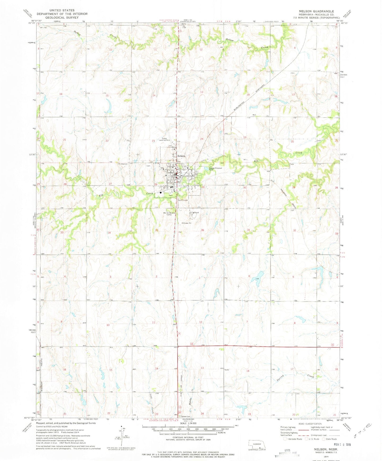
Classic USGS Nelson Nebraska 7.5'x7.5' Topo Map
Couldn't load pickup availability
Historical USGS topographic quad map of Nelson in the state of Nebraska. Map scale may vary for some years, but is generally around 1:24,000. Print size is approximately 24" x 27"
This quadrangle is in the following counties: Nuckolls.
The map contains contour lines, roads, rivers, towns, and lakes. Printed on high-quality waterproof paper with UV fade-resistant inks, and shipped rolled.
Contains the following named places: Adams Dam, Adams Reservoir, Church of Christ, City of Nelson, Corman Dam, Corman Reservoir, Doher Landing Strip, Elk Creek Country Club, Farmers Union Cooperative Association Elevator, Frahm Dam, Frahm Reservoir, Gebhards Dam, Gebhards Reservoir, Good Samaritan Center, Harbine Park, Harbine Park Campground, Highland Election Precinct, Jones Dam, Jones Reservoir, Lawrence-Nelson Junior-Senior High School, Nelson, Nelson Community United Church of Christ, Nelson Dental Clinic, Nelson Election Precinct, Nelson Elementary School, Nelson Post Office, Nelson Public Library, Nelson Volunteer Fire Department and Rescue Squad, Norgaard Dam, Norgaard Reservoir, North Park, Nuckolls County, Nuckolls County Courthouse, Nuckolls County Fairgrounds, Nuckolls County Sheriff's Office, Sacred Heart Catholic Church, Salem Cemetery, Salem Church, Schiermeyer Dam, Schiermeyer Reservoir, Schleufer Dam, Schleufer Reservoir, Seventh Day Adventist Church, Wehrman Dam, Wehrman Reservoir, We-So-Braska Camp, Westside Medical Services, ZIP Code: 68961