MyTopo
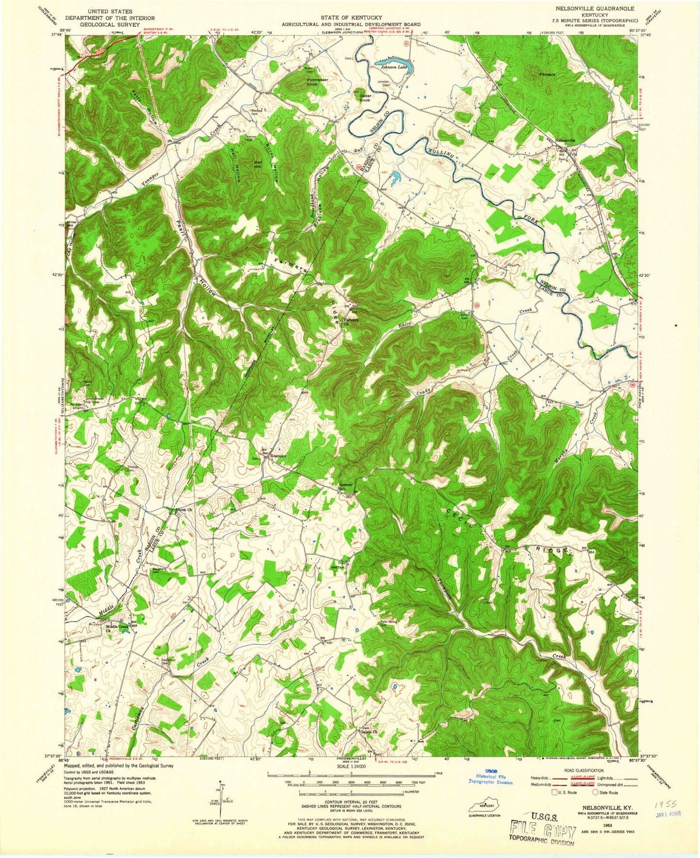
Classic USGS Nelsonville Kentucky 7.5'x7.5' Topo Map
Couldn't load pickup availability
Historical USGS topographic quad map of Nelsonville in the state of Kentucky. Map scale may vary for some years, but is generally around 1:24,000. Print size is approximately 24" x 27"
This quadrangle is in the following counties: Hardin, Larue, Nelson.
The map contains contour lines, roads, rivers, towns, and lakes. Printed on high-quality waterproof paper with UV fade-resistant inks, and shipped rolled.
Contains the following named places: Bledsoe Cemetery, Broadhead Run, Brown Cemetery, Burns Hollow, Cap Hollow, Castleman Cemetery, Cecil Ridge, Cedar Knob, Crady Creek, Daugherty Cemetery, Edlin Cemetery, Edlin Creek, Farmers Ridge, Hall Hill, Hall Hollow, Harris Cemetery, Johnson Cemetery, Johnson Lake, Middle Creek Baptist Church, Murphy Creek, Neff Cemetery, Nelsonville, Patty Hollow, Pearl Hollow, Pinnacle, Potmesser Knob, Potts Spring Cemetery, Province Hollow, Roanoke, Salem Church, Thomas Family Cemetery, Union Christian Church, Vernon Cemetery, WKMO-FM (Hodgenville)