

MyTopo
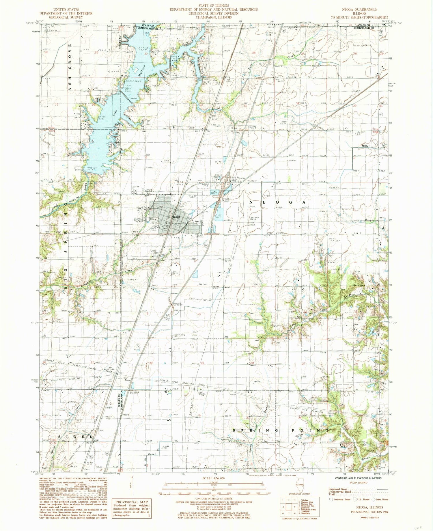
Classic USGS Neoga Illinois 7.5'x7.5' Topo Map
Couldn't load pickup availability
Historical USGS topographic quad map of Neoga in the state of Illinois. Map scale may vary for some years, but is generally around 1:24,000. Print size is approximately 24" x 27"
This quadrangle is in the following counties: Coles, Cumberland, Shelby.
The map contains contour lines, roads, rivers, towns, and lakes. Printed on high-quality waterproof paper with UV fade-resistant inks, and shipped rolled.
Contains the following named places: Apperson School, Beehive School, Brush Creek, Brush Creek Cemetery, Brush Creek Church, Bush Creek, Carrey School, City of Neoga, Clear Creek, Concord Cemetery, Concord Church, Copperas Creek Cemetery, Copperas School, Crossing Cemetery, Crossing School, Downey Cemetery, First Christian Church of Neoga, Grace United Methodist Church, Illinois Central Pioneer Cemetery, Illinois Central Railroad Cemetery, Lake Mattoon, Lake Mattoon Dam, Lambert School, Lockhart Cemetery, Lone Elm School, Long Point Cemetery, Long Point School, Maple Grove School, Neoga, Neoga Cemetery, Neoga Elementary School, Neoga Fire Department, Neoga Police Department, Neoga Post Office, Neoga Senior High School, Prairie School, Raney Cemetery, Township of Neoga, Walk School, Wateroak School, West Union School, Whitehall Church, Whitehall School, Williamson Airport, Zion Chapel Cemetery, Zion Chapel United Brethren Church, Zion School, ZIP Code: 62447


