
MyTopo
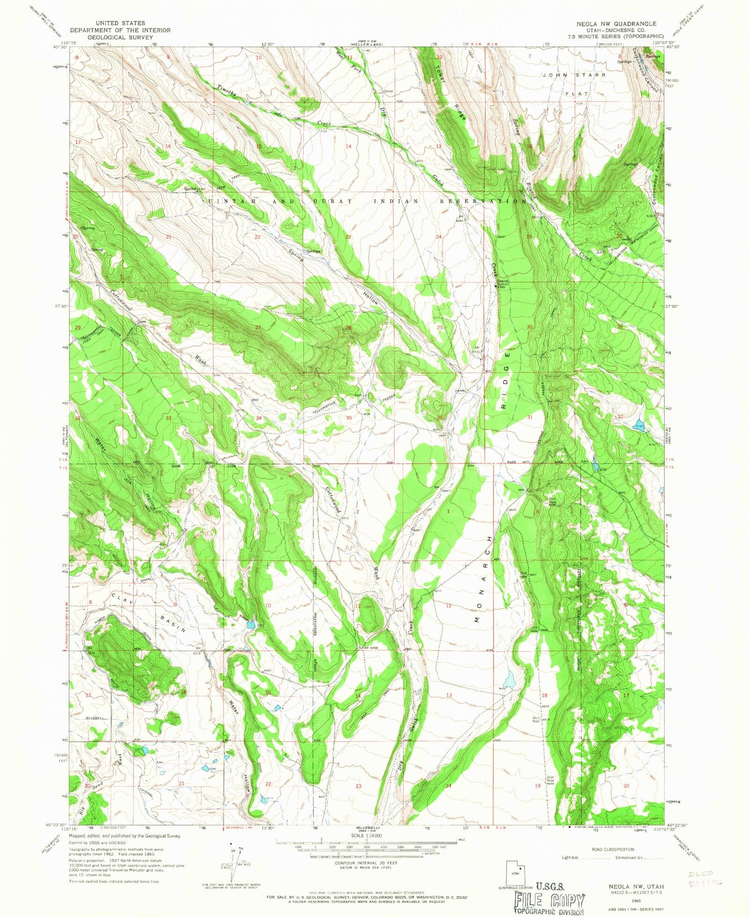
Classic USGS Neola NW Utah 7.5'x7.5' Topo Map
Couldn't load pickup availability
Historical USGS topographic quad map of Neola NW in the state of Utah. Map scale may vary for some years, but is generally around 1:24,000. Print size is approximately 24" x 27"
This quadrangle is in the following counties: Duchesne.
The map contains contour lines, roads, rivers, towns, and lakes. Printed on high-quality waterproof paper with UV fade-resistant inks, and shipped rolled.
Contains the following named places: Browns Draw Reservoir, Cedarview Dam, Clay Basin, Cottonwood Canyon, Cottonwood Wash, F Canal, KUUU-FM (Neola), Monarch Ridge, North Ditch, South Ditch, Spring Hollow, Timothy Creek, Uintah and Ouray Reservation, West Fork Dry Gulch Creek, Yellowstone Extension Canal, Yellowstone Feeder Canal


