MyTopo
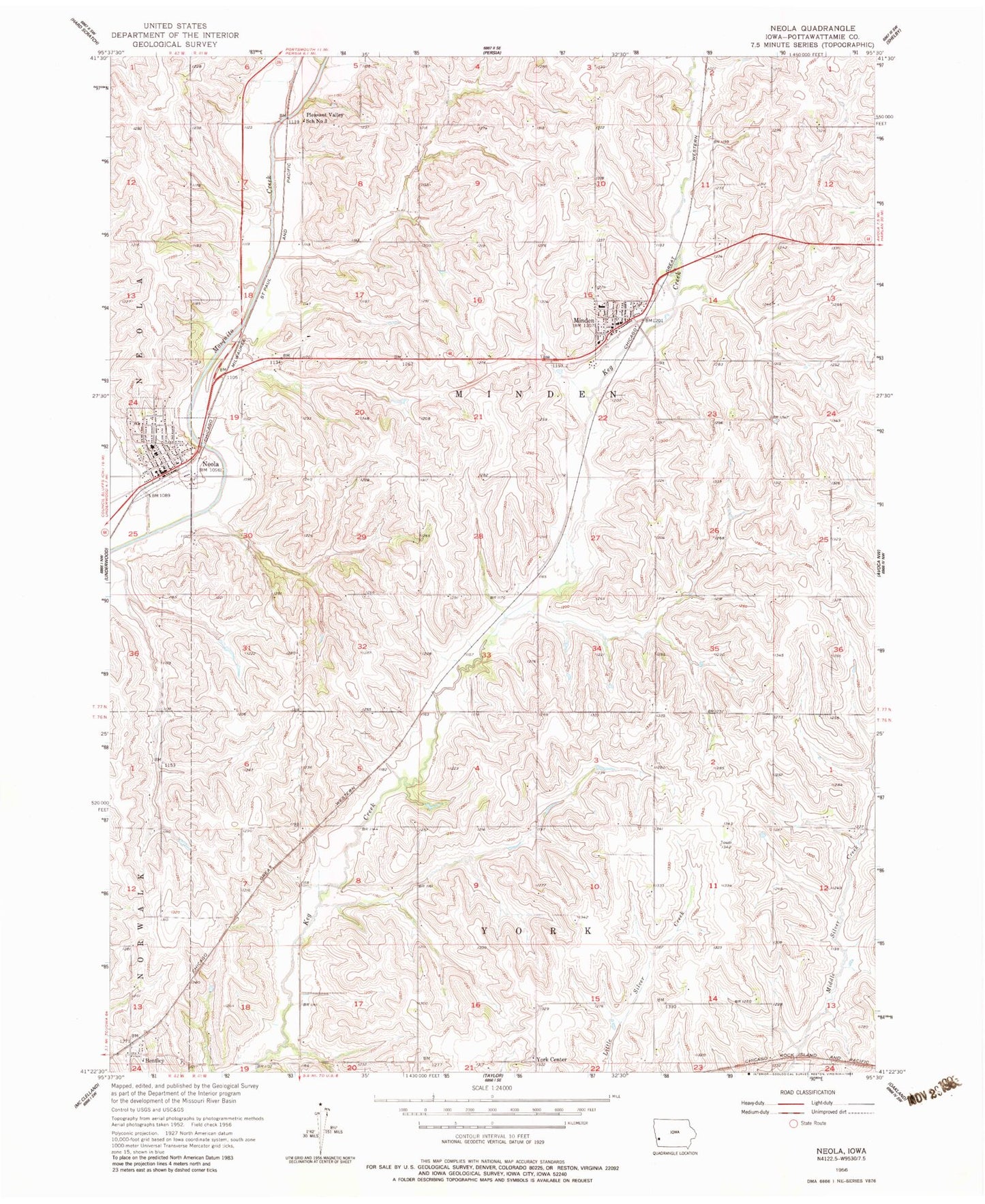
Classic USGS Neola Iowa 7.5'x7.5' Topo Map
Couldn't load pickup availability
Historical USGS topographic quad map of Neola in the state of Iowa. Map scale may vary for some years, but is generally around 1:24,000. Print size is approximately 24" x 27"
This quadrangle is in the following counties: Pottawattamie.
The map contains contour lines, roads, rivers, towns, and lakes. Printed on high-quality waterproof paper with UV fade-resistant inks, and shipped rolled.
Contains the following named places: Arrowhead County Park, Bentley, Bentley Census Designated Place, Bentley Post Office, City of Minden, City of Neola, Cogley Physicians Clinic, First Presbyterian Church, Harvest Alliance Church, Minden, Minden City Hall, Minden Clinic, Minden Community Hall, Minden Dental Center, Minden Post Office, Minden Township Cemetery, Minden Volunteer Fire and Rescue, Neola, Neola City Hall, Neola Creek, Neola Elevator, Neola Family Dentistry Center, Neola Post Office, Neola Township Cemetery, Neola Volunteer Fire Department, Pleasant Valley School Number 3, Saint Patricks Catholic Church, Saint Patricks Cemetery, Township of Minden, Township of York, United Church of Christ, York Center, ZIP Code: 51553