MyTopo
Classic USGS Neola Utah 7.5'x7.5' Topo Map
Couldn't load pickup availability
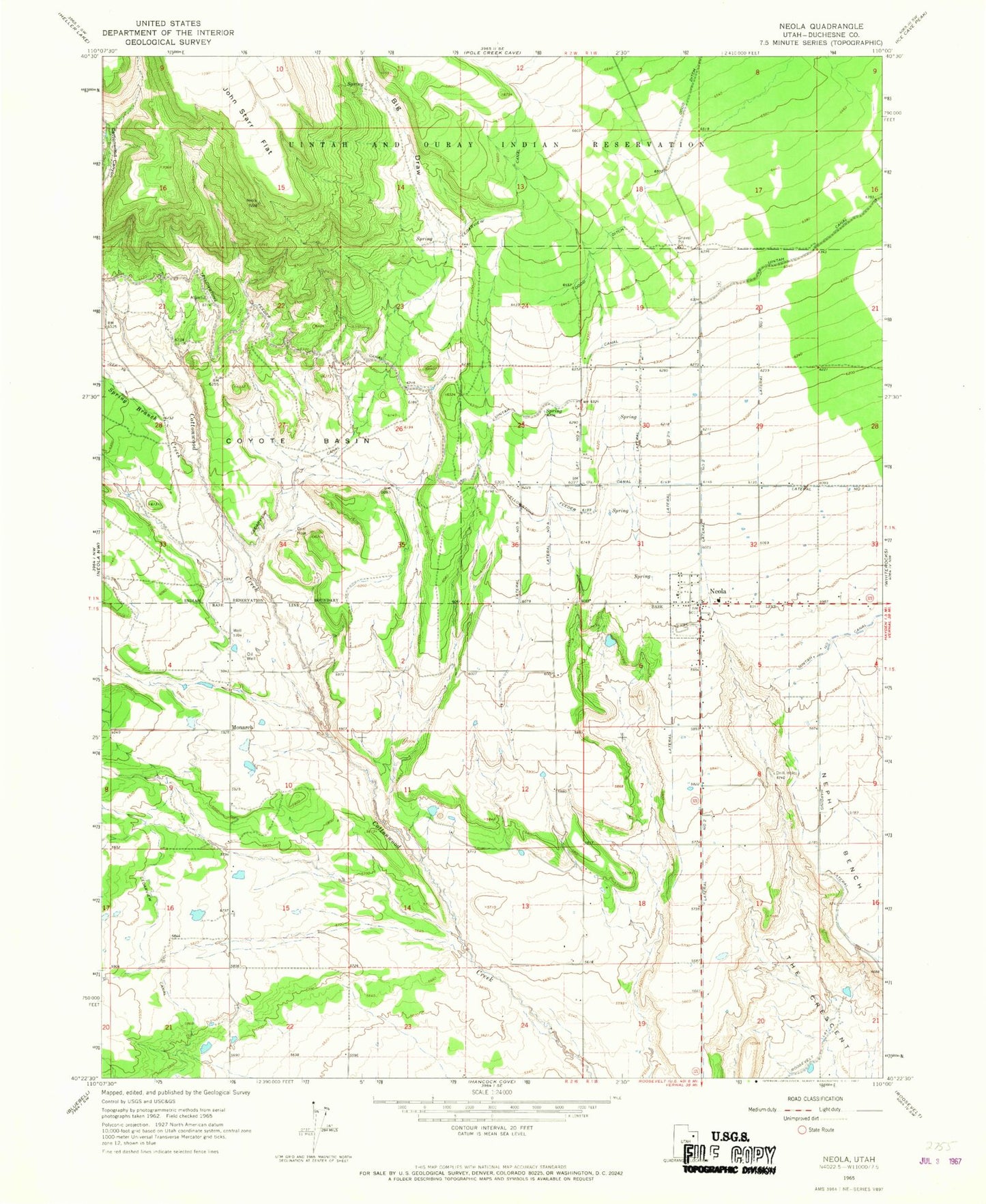
Historical USGS topographic quad map of Neola in the state of Utah. Map scale may vary for some years, but is generally around 1:24,000. Print size is approximately 24" x 27"
This quadrangle is in the following counties: Duchesne.
The map contains contour lines, roads, rivers, towns, and lakes. Printed on high-quality waterproof paper with UV fade-resistant inks, and shipped rolled.
Contains the following named places: Big Draw, Browns Draw Dam, Cedarview Canal, Coyote Basin, Dodd Ditch, Greenhalgh Cemetery, Lateral Number 1, Lateral Number 2, Lateral Number 2 1/2, Lateral Number 3, Lateral Number 4, Lateral Number 5, Monach Cemetery, Monarch, Neola, Neola Cemetery, Neola Census Designated Place, Neola Elementary School, Neola Fire Department, Neola Post Office, Spring Branch Creek, The Church of Jesus Christ of Latter Day Saints, Uintah Canal, ZIP Code: 84053