MyTopo
Classic USGS Neponset Reservoir NW Utah 7.5'x7.5' Topo Map
Regular price
$16.95
Regular price
Sale price
$16.95
Unit price
per
Couldn't load pickup availability
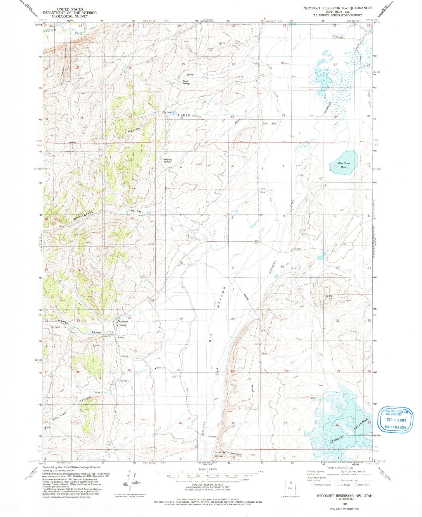
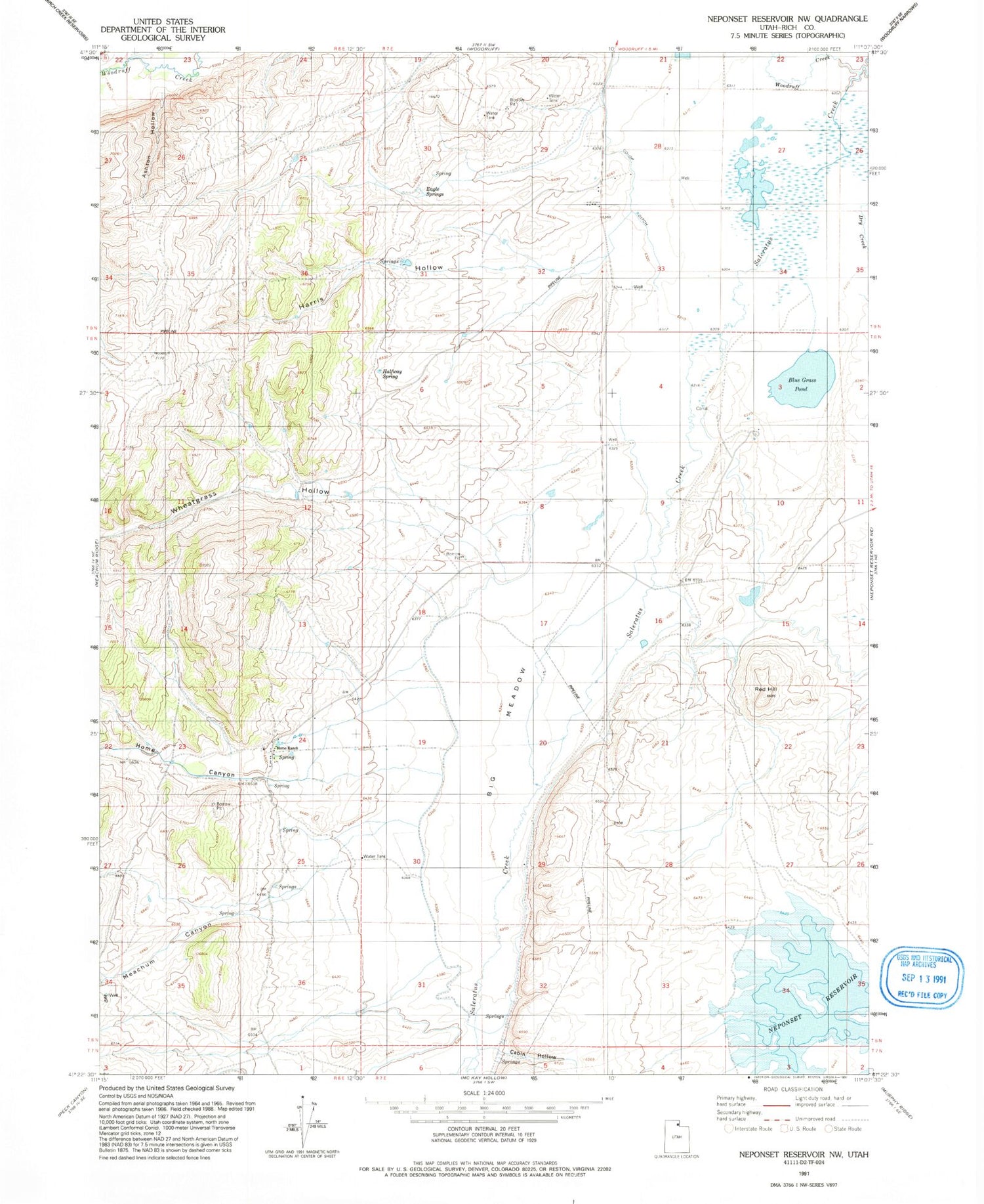
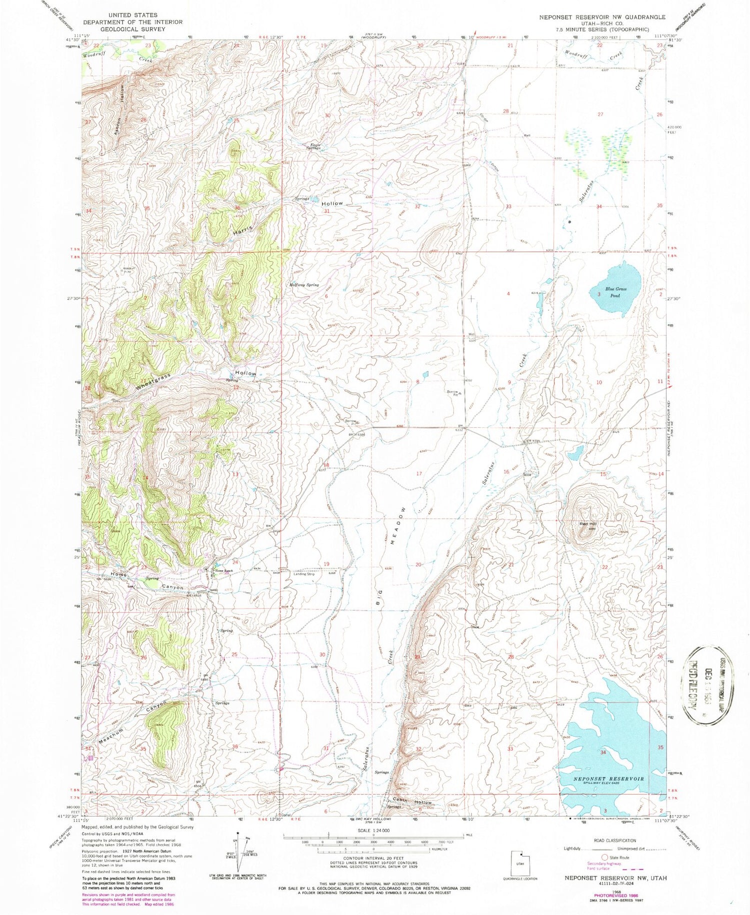
Historical USGS topographic quad map of Neponset Reservoir NW in the state of Utah. Map scale may vary for some years, but is generally around 1:24,000. Print size is approximately 24" x 27"
This quadrangle is in the following counties: Rich.
The map contains contour lines, roads, rivers, towns, and lakes. Printed on high-quality waterproof paper with UV fade-resistant inks, and shipped rolled.
Contains the following named places: Ashton Hollow, Big Meadow, Blue Grass Pond, Cabin Hollow, Co-Op Ditch, Dry Creek, Eagle Springs, Halfway Spring, Harris Hollow, Home Canyon, Home Ranch, Meachum Canyon, Neponset Reservoir, Randolph-Woodruff Division, Red Hill, Wheatgrass Hollow, Woodruff Creek, ZIP Code: 84086