MyTopo
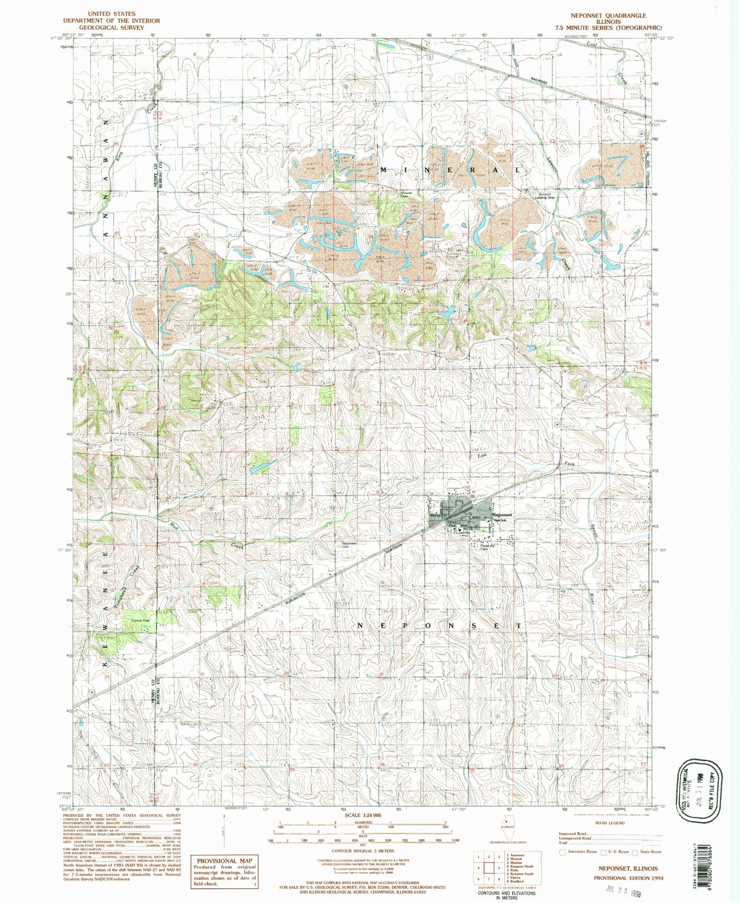
Classic USGS Neponset Illinois 7.5'x7.5' Topo Map
Couldn't load pickup availability
Historical USGS topographic quad map of Neponset in the state of Illinois. Map scale may vary for some years, but is generally around 1:24,000. Print size is approximately 24" x 27"
This quadrangle is in the following counties: Bureau, Henry.
The map contains contour lines, roads, rivers, towns, and lakes. Printed on high-quality waterproof paper with UV fade-resistant inks, and shipped rolled.
Contains the following named places: Bowen School, Douglas School, Edwin G Bennett Airport, Floral Hill Cemetery, Francis Park, Indian Hill, Kentville School, Kuster School, Miller School, Mineral Cemetery, Neponset, Neponset Cemetery, Neponset Elementary Schools, Neponset Fire Protection District, Neponset High School, Neponset Post Office, Neponset Public Library, Neponset Village Police Department, Scott Park, Scott School, Tomahawk Creek, Township of Mineral, Township of Neponset, Village of Neponset, ZIP Code: 61345