MyTopo
Classic USGS Nesowadnehunk Lake Maine 7.5'x7.5' Topo Map
Couldn't load pickup availability
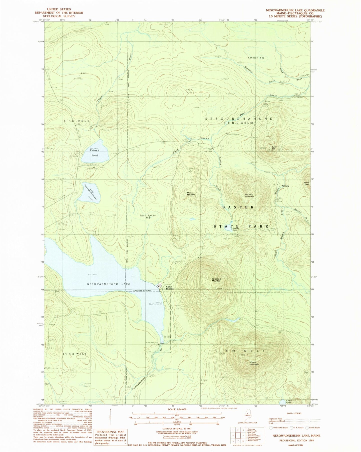
Historical USGS topographic quad map of Nesowadnehunk Lake in the state of Maine. Map scale may vary for some years, but is generally around 1:24,000. Print size is approximately 24" x 27"
This quadrangle is in the following counties: Piscataquis.
The map contains contour lines, roads, rivers, towns, and lakes. Printed on high-quality waterproof paper with UV fade-resistant inks, and shipped rolled.
Contains the following named places: Black Brook, Black Spruce Bog, Burnt Mountain, Burnt Mountain Lookout Tower, Camp Phoenix, Center Mountain, Center Pond, Dwelley Brook, Dwelley Pond, Hathorn Brook, Kennedy Bog, Little Nesowadnehunk Lake, McCarty, McCarty Mountain, Morse Mountain, Nesourdnahunk Township, Nesowadnehunk Dam, Nesowadnehunk Lake, Strickland Mountain, Thissell Pond