MyTopo
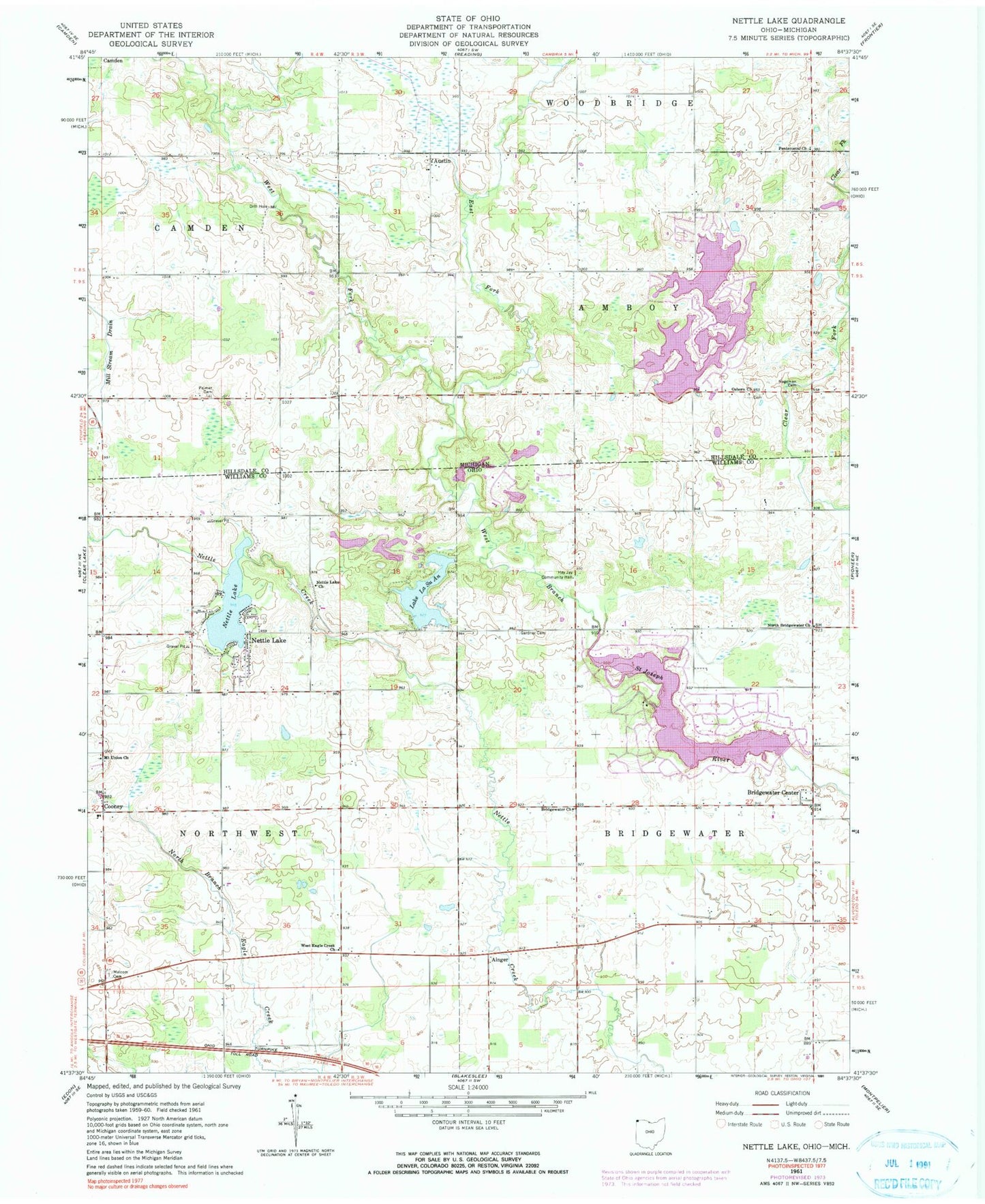
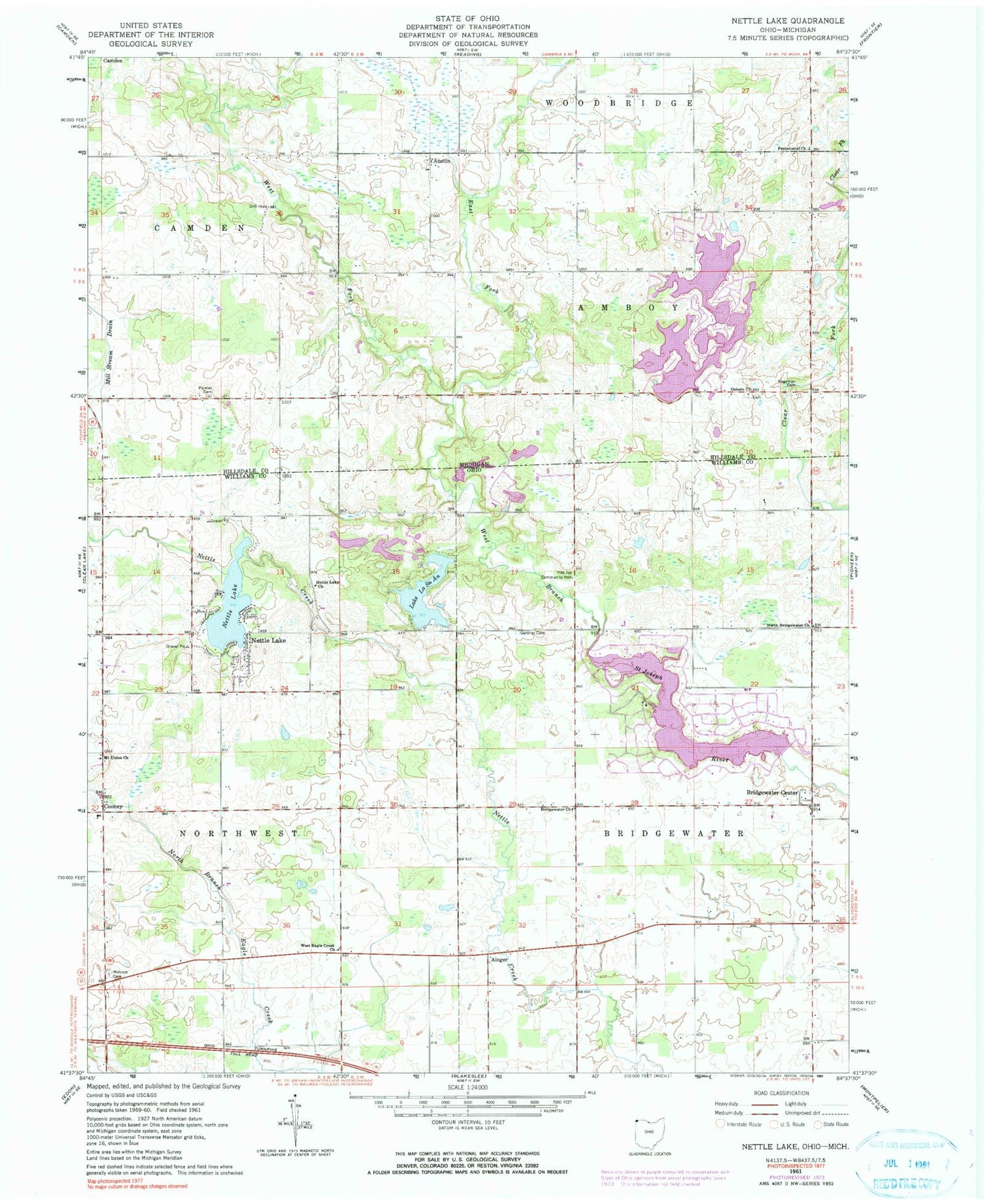
Classic USGS Nettle Lake Ohio 7.5'x7.5' Topo Map
Couldn't load pickup availability
Historical USGS topographic quad map of Nettle Lake in the states of Ohio, Michigan. Typical map scale is 1:24,000, but may vary for certain years, if available. Print size: 24" x 27"
This quadrangle is in the following counties: Hillsdale, Williams.
The map contains contour lines, roads, rivers, towns, and lakes. Printed on high-quality waterproof paper with UV fade-resistant inks, and shipped rolled.
Contains the following named places: Bridgewater Church, Gardner Cemetery, Hay Jay Community Hall, Malcom Cemetery, Mount Union Church, Nettle Lake, North Bridgewater Church, West Eagle Creek Church, Lake La Su An Wildlife Area, Ainger, Cooney, Nettle Lake, Northwest, Bridgewater Center, Nettle Lake Cemetery, Nettle Lake United Brethren Church, Lake La Su An, Lake La Su An Dam, Lake Seneca Dam, Lake Seneca, Lake A Dam, Lake A, Lake C Dam, Hays Lake Dam, Hays Lake, Kohl Lake Dam, Kohl Lake, School Number 8 (historical), School Number 2 (historical), School Number 4 (historical), School Number 10 (historical), School Number 9 (historical), School Number 8 (historical), School Number 7 (historical), School Number 6 (historical), School Number 4 (historical), Township of Bridgewater, Township of Northwest, Lake Ann, Clems Pond, Eds Pond, Hogback Pond, Jerrys Pond, Lake La Vere, Lous Pond, Spring Pond, Lake Sue, Northwest Township Fire And Rescue, Nettle Lake Census Designated Place, Lake Seneca Census Designated Place, Lake Seneca, Bridgewater Dairy, Austin, East Fork West Branch Saint Joseph River, Hagaman Cemetery, Osborn Church, Palmer Cemetery, Pentecostal Church, Lake C, White Post Office (historical), Morganville Post Office (historical), Hageman Post Office (historical), Osborn Cemetery, Robinson Family Cemetery, Cellars Cemetery, West Fork West Branch Saint Joseph River