
MyTopo
Classic USGS Nettleton Mississippi 7.5'x7.5' Topo Map
Couldn't load pickup availability
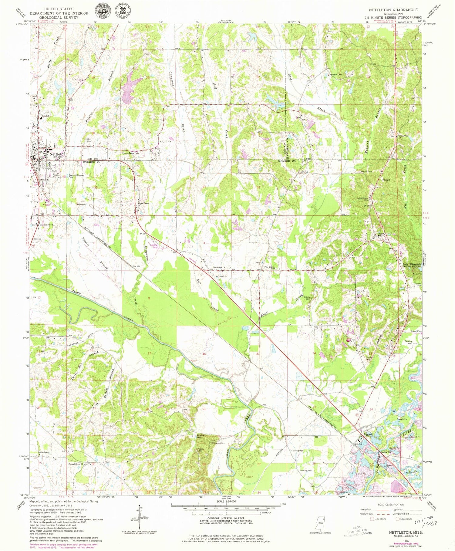
Historical USGS topographic quad map of Nettleton in the state of Mississippi. Map scale may vary for some years, but is generally around 1:24,000. Print size is approximately 24" x 27"
This quadrangle is in the following counties: Itawamba, Lee, Monroe.
The map contains contour lines, roads, rivers, towns, and lakes. Printed on high-quality waterproof paper with UV fade-resistant inks, and shipped rolled.
Contains the following named places: Aberdeen Lagoon Dam, Atkins Cemetery, B G Coggins Lake Dam, Bigbee, Bigbee Church, Bigby Fork, Burgess Lake Dam, Burketts Creek, Cason Baptist Church, Cason School, Central Grove, Central Grove Baptist Church, City of Nettleton, Colberts Mill, Conwill Cemetery, Cothers Ferry, Cowpenna Creek, Devil Den Branch, E B Rogers Lake Dam, Ed Burgess Lake Dam, Eureka, First Baptist Church, Goodwin Cemetery, Grey Cemetery, Hester Cemetery, John Young Lake Dam, Jones Chapel Baptist Church, Lake Whiteside Dam, Liberty Baptist Church, Liberty Cemetery, Little Bottom Branch, McCluney, Millhouse Ditch, Nettleton, Nettleton Cemetery, Nettleton Church of Christ, Nettleton High School, Nettleton Police Department, Nettleton Post Office, Nettleton Presbyterian Church, Nettleton United Methodist Church, Nettleton Upper Elementary School, New Prospect Missionary Baptist Church, Pine Grove Baptist Church, Pine Grove Church of Jesus Christ, Pine Grove United Methodist Church, Pisgah Cemetery, Providence Cemetery, Roberts Branch, Shoaf Creek, Sims School, South Nettleton Baptist Church, Spring Hill Baptist Church, Standifer Creek, Tabb, Tanyard Branch, Union Grove Cemetery, Union Grove Primitive Baptist Church, Union Grove United Methodist Church, Union View Church, Victory Baptist Church, Williams Cemetery, Wolf Creek, ZIP Code: 38858


