MyTopo
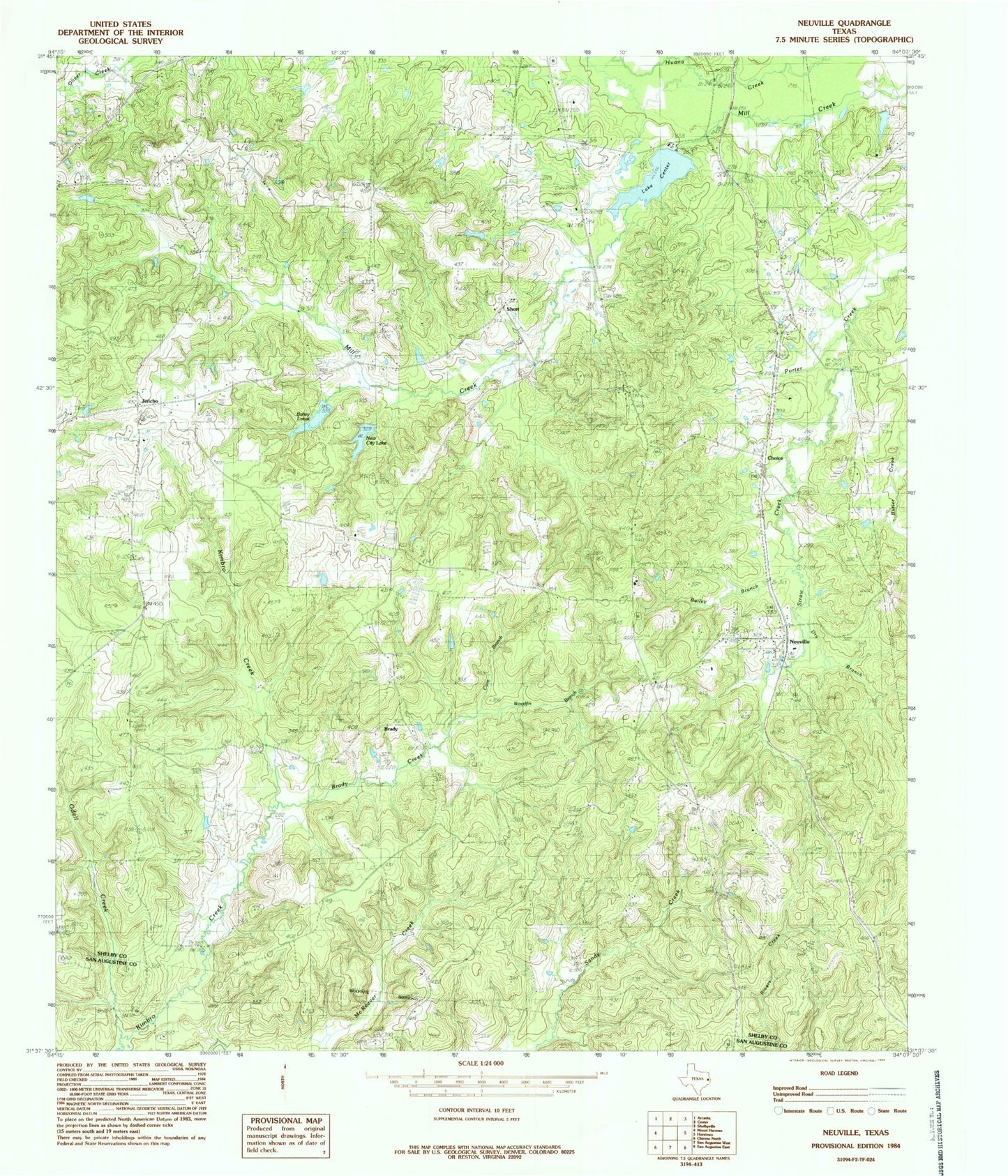
Classic USGS Neuville Texas 7.5'x7.5' Topo Map
Couldn't load pickup availability
Historical USGS topographic quad map of Neuville in the state of Texas. Map scale may vary for some years, but is generally around 1:24,000. Print size is approximately 24" x 27"
This quadrangle is in the following counties: San Augustine, Shelby.
The map contains contour lines, roads, rivers, towns, and lakes. Printed on high-quality waterproof paper with UV fade-resistant inks, and shipped rolled.
Contains the following named places: Aiken-Neuville Division, Bailey Branch, Bailey Lakes, Borders Cemetery, Brady, Brady Creek, Cave Branch, Center Filtration Plant, Choice, Dry Branch, Duff, Gallus Ranch, Hamilton Cemetery, Hughes Springs, Jericho, Kimbro Creek, Lake Center, Lake Center Dam, McCadley Cemetery, Mount Pleasant Church, Myrtlehead Church, Neuville, New City Lake, Nicholson Cemetery, Old Buckner Cemetery, Providence Missionary Church, Sand Hill Church, Sandy Springs Campground, Short, Sinclair Cemetery, Slayden Lake Number 1, Slayden Lake Number 1 Dam, Slayden Lake Number 2 Dam, Spann Church, Stonedive Creek, Straw Creek, Tabernacle Lookout, Woodfin Branch, ZIP Code: 75935