MyTopo
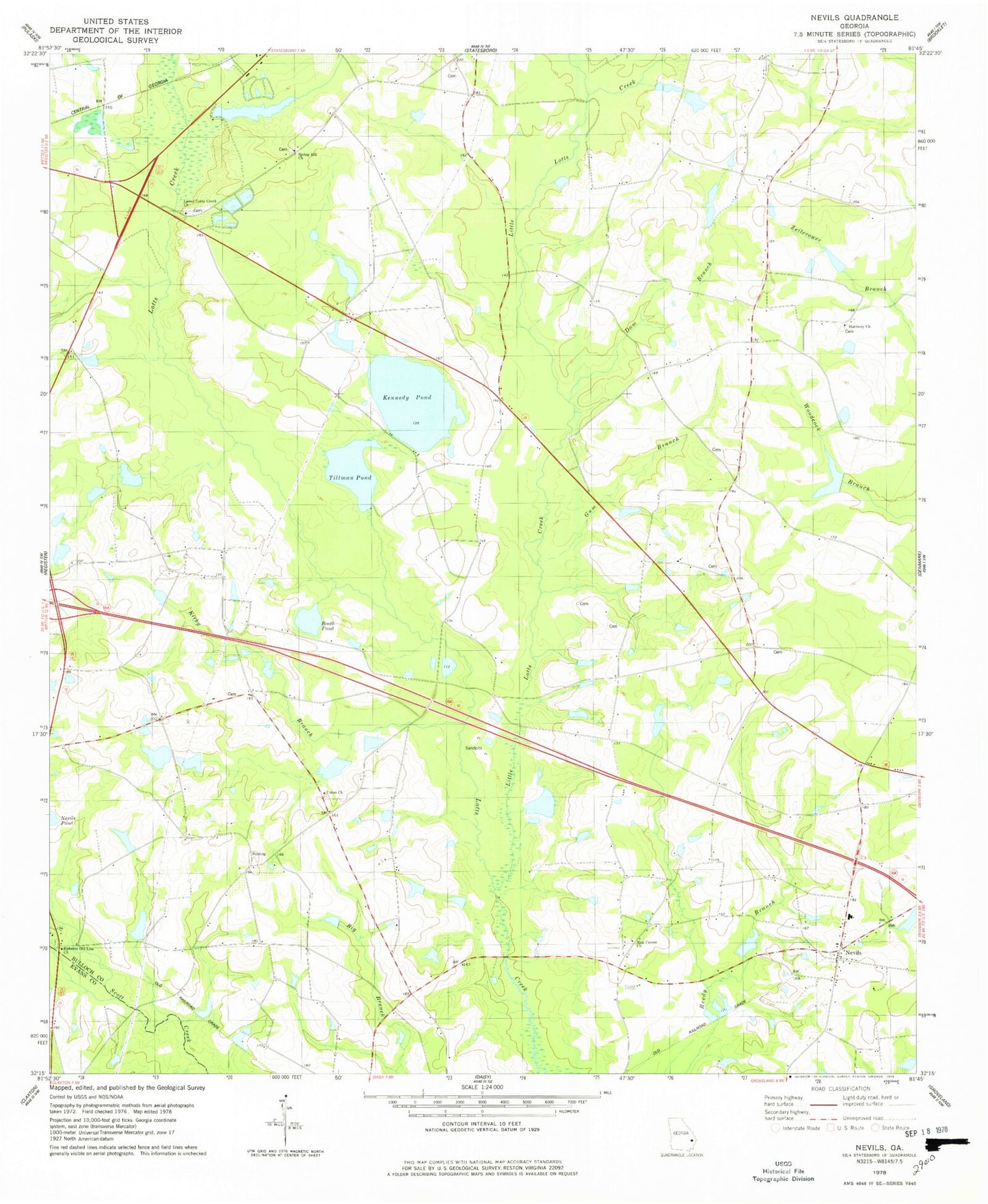
Classic USGS Nevils Georgia 7.5'x7.5' Topo Map
Couldn't load pickup availability
Historical USGS topographic quad map of Nevils in the state of Georgia. Map scale may vary for some years, but is generally around 1:24,000. Print size is approximately 24" x 27"
This quadrangle is in the following counties: Bulloch, Evans.
The map contains contour lines, roads, rivers, towns, and lakes. Printed on high-quality waterproof paper with UV fade-resistant inks, and shipped rolled.
Contains the following named places: Booth Pond, Brannen - Wilson Cemetery, Dam Branch, Delmus Rushing Lake, Delmus Rushing Lake Dam, Enal, Ephesus Church Cemetery, Ephesus Old Line Church, Ewell Pond School, Groover Pond, Gum Branch, Harmony Church, Hickman Pond, Hickman Pond Dam, Hodges Pond, Hodges Pond Dam, Kennedy Cemetery, Kennedy Pond, Kirby Branch, Little Lotts Creek, Lower Lotts Creek Church, Nevils, Nevils - Denmark Fire Department, Nevils School, Nevils United Methodist Church, New Corent Church, Newcastle School, Reedy Branch School, Riggs Lake, Riggs Lake Dam, Rimes School, Rushing Mobile Home Park, Scott Creek Bridge, Smith Pond, Smith Pond Dam, Southern Ag Aviation, Southern Links Golf Club, Spring Hill Church, Sylvester School, T K Rushing Pond, T K Rushing Pond Dam, Tillman Pond, Union Church, Union Church Cemetery, Union School, Waters Cemetery, Williams Pond, Williams Pond Dam, WOTR-FM (Statesboro)