MyTopo
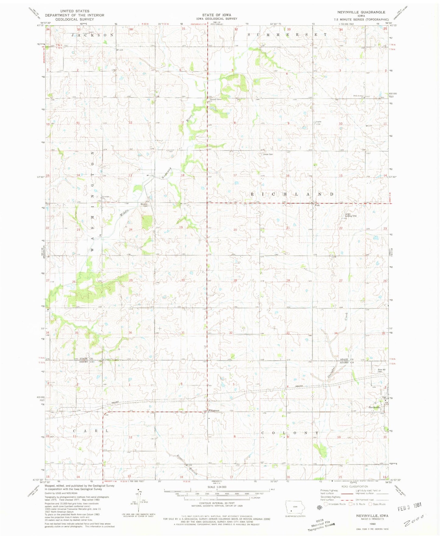
Classic USGS Nevinville Iowa 7.5'x7.5' Topo Map
Couldn't load pickup availability
Historical USGS topographic quad map of Nevinville in the state of Iowa. Map scale may vary for some years, but is generally around 1:24,000. Print size is approximately 24" x 27"
This quadrangle is in the following counties: Adair, Adams.
The map contains contour lines, roads, rivers, towns, and lakes. Printed on high-quality waterproof paper with UV fade-resistant inks, and shipped rolled.
Contains the following named places: Avondale, Avondale Cemetery, Avondale Church, Avondale Post Office, Fisk, Fisk Post Office, Gilead, Gilead Post Office, Larsen Landing Strip, Mormon Cemetery, Nevinville, Nevinville Post Office, Old Union Cemetery, Penn Avenue Cemetery, Penn Avenue Church, Pleasant Grove Cemetery, Pleasant Grove Church, Rex Sullivan Wildlife Area, Rose Hill Cemetery, Township of Richland, Williamson, Williamson Post Office