MyTopo
Classic USGS Nevis Minnesota 7.5'x7.5' Topo Map
Couldn't load pickup availability
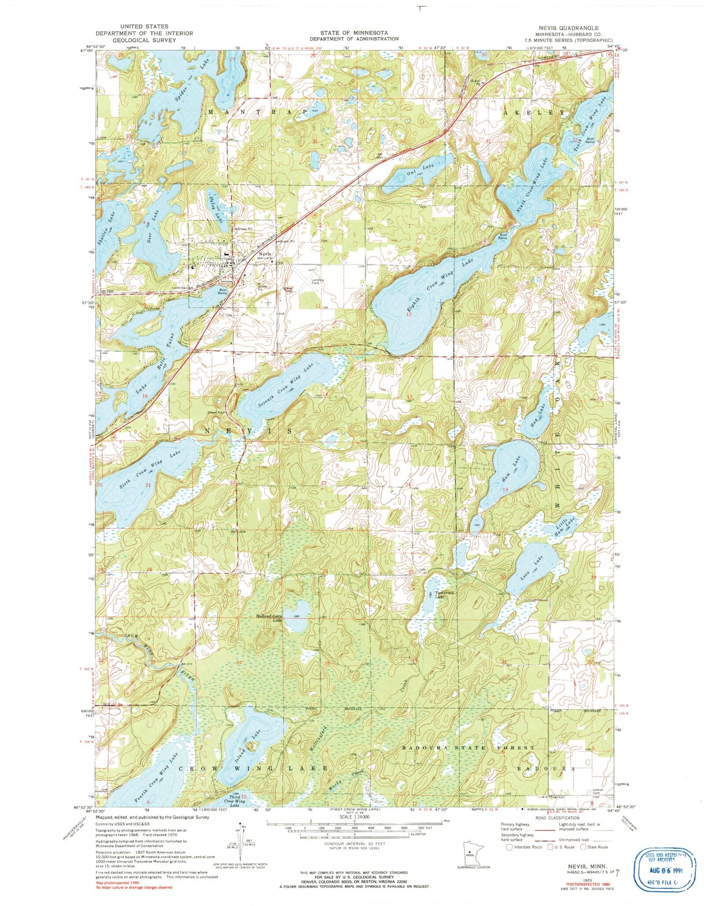
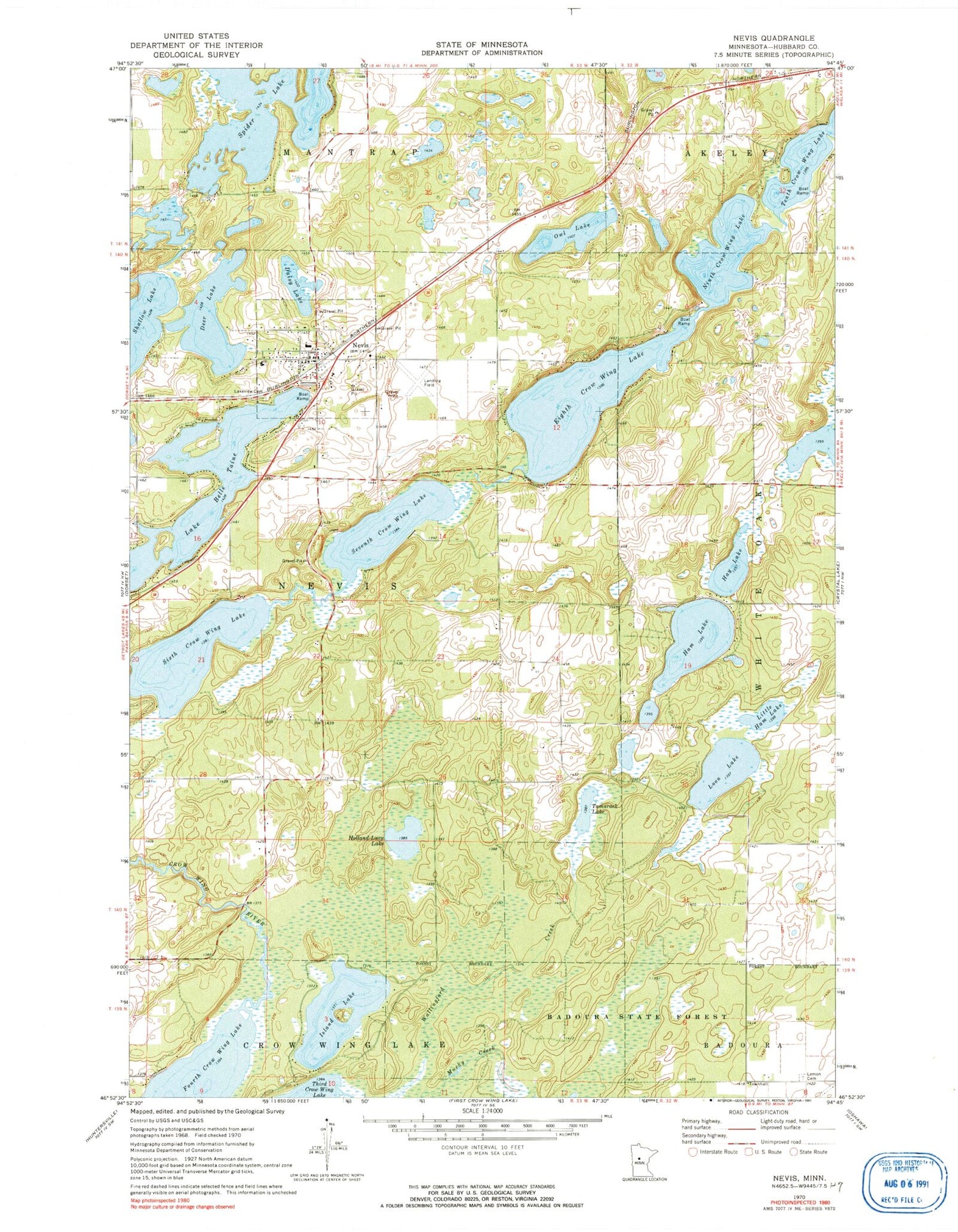
Historical USGS topographic quad map of Nevis in the state of Minnesota. Map scale may vary for some years, but is generally around 1:24,000. Print size is approximately 24" x 27"
This quadrangle is in the following counties: Hubbard.
The map contains contour lines, roads, rivers, towns, and lakes. Printed on high-quality waterproof paper with UV fade-resistant inks, and shipped rolled.
Contains the following named places: Bethany Lutheran Church, Bible Baptist Church, Church of Christ, City of Nevis, Crow Wing 8th Lake Dam, Daisy Lake, Deer Lake, Eighth Crow Wing Lake, Ham Lake, Hay Acres Airport, Hay Lake, Holland-Lucy Lake, Immaculate Conception Church, Island Lake, Lakeview Cemetery, Lemon Cemetery, Little Ham Lake, Loon Lake, Mucky Creek, Muskie Park, Nature Land Campground, Nevis, Nevis Airport, Nevis Fire Department, Nevis Police Department, Nevis Post Office, Nevis Public School, Nevis Railroad Station, Nevis Wayside Park, Ninth Crow Wing Lake, Our Lady of the Pines Catholic Church, Owl Lake, Seventh Crow Wing Lake, Sixth Crow Wing Lake, Spider Lake, Tamarack Lake, Tenth Crow Wing Lake, Township of Nevis, Wallingford Creek, Wildridge Resort and Campground, ZIP Code: 56467