
MyTopo
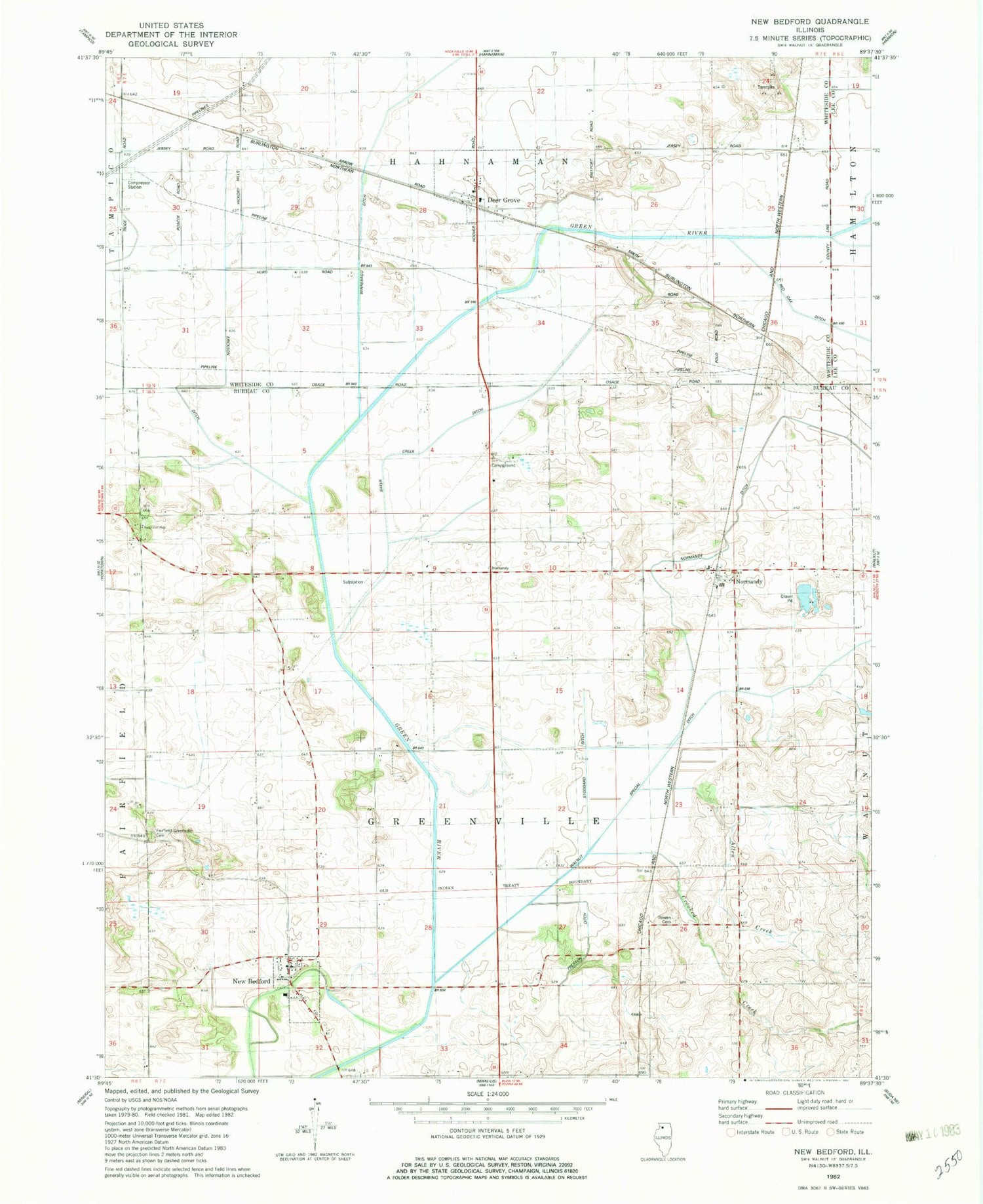
Classic USGS New Bedford Illinois 7.5'x7.5' Topo Map
Couldn't load pickup availability
Historical USGS topographic quad map of New Bedford in the state of Illinois. Map scale may vary for some years, but is generally around 1:24,000. Print size is approximately 24" x 27"
This quadrangle is in the following counties: Bureau, Lee, Whiteside.
The map contains contour lines, roads, rivers, towns, and lakes. Printed on high-quality waterproof paper with UV fade-resistant inks, and shipped rolled.
Contains the following named places: Allen Creek, Baker Creek Ditch, Bowen Cemetery, Bowen School, Church School, Crooked Creek, Deer Grove, Deer Grove Post Office, Fairfield Cemetery, Geldean Airport, Hahnaman Elementary School, Little Deer Grove, Maple Grove School, Meek School, New Bedford, New Bedford Post Office, Normandy, Normandy Ditch, Normandy Post Office, Reeves School, Sunset Ridge Emergency Medical Services, Swanson School, Township of Greenville, Village of Deer Grove, Village of New Bedford, Walnut Creek, Walnut Special Ditch, White School, Woodley 2 Airport, Woodley Aerial Spray Airport, ZIP Codes: 61243, 61346


