MyTopo
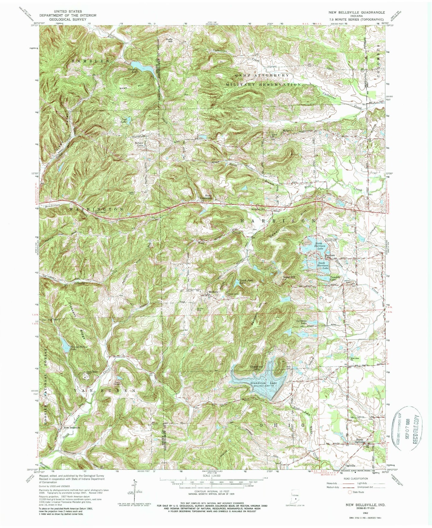
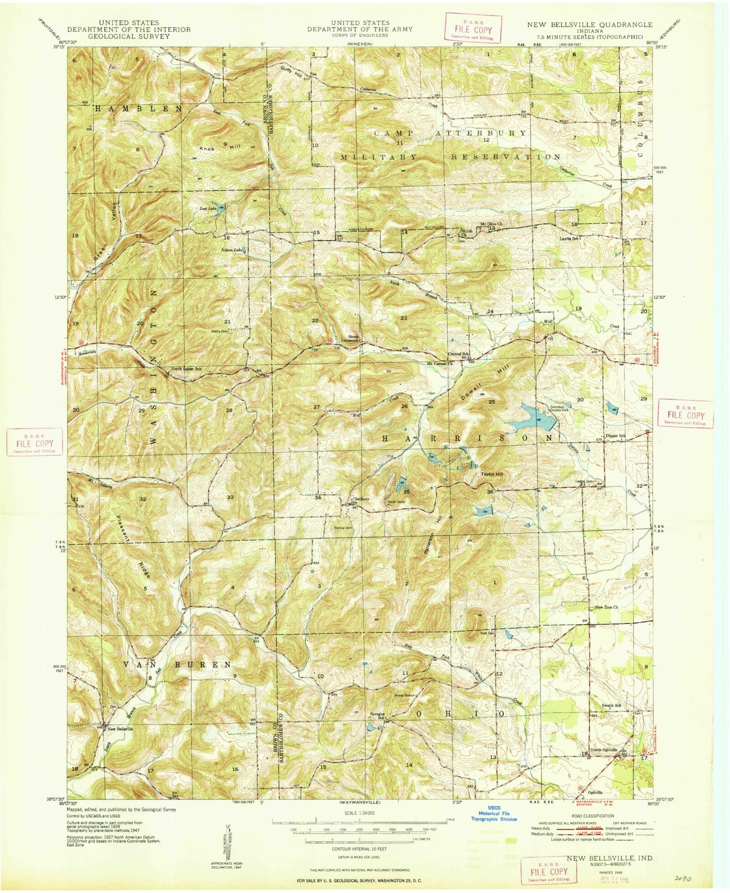
Classic USGS New Bellsville Indiana 7.5'x7.5' Topo Map
Couldn't load pickup availability
Historical USGS topographic quad map of New Bellsville in the state of Indiana. Map scale may vary for some years, but is generally around 1:24,000. Print size is approximately 24" x 27"
This quadrangle is in the following counties: Bartholomew, Brown.
The map contains contour lines, roads, rivers, towns, and lakes. Printed on high-quality waterproof paper with UV fade-resistant inks, and shipped rolled.
Contains the following named places: Bethany, Camp Christina, Camp Christina Lake, Camp Christina Lake Dam, Dobbs Cemetery, Dowell Hill, Grandview Dam, Grandview Lake, Guffy Hill, Haislup Cemetery, Happy Hollow Camp, Happy Hollow Lake, Harmony Burial Ground, Harrison Lake, Harrison Lake Country Club, Harrison North Lake Dam, Harrison South Lake Dam, Harrison Township Volunteer Fire Department, Hurricane Creek, Jean Williamson Lake, Jean Williamson Lake Dam, Knob Hill, Lake on the Green, Lawsons Lake, Lawsons Lake Dam, Lost Lake, Mount Carmel Church, Mount Olive Church, Nelson Lake, New Zion Church, North Branch Wolf Creek, North Harrison Lake, North Ogilville, North Salem Church, Ogilville, Patterson Hill, Pleasant Ridge, Roth Cemetery, Shiloh Church, South Branch Salt Creek, South Harrison Lake, Staller Lake, Staller Lake Dam, Stony Lonesome, Stratford, Tamerix Lake, Tamerix Lake Dam, Taylor Hill, Thompson Lake, Thompson Lake Dam, Tousley Lake, Township of Harrison, Youth Camp Lake, Youth Camp Lake Dam