MyTopo
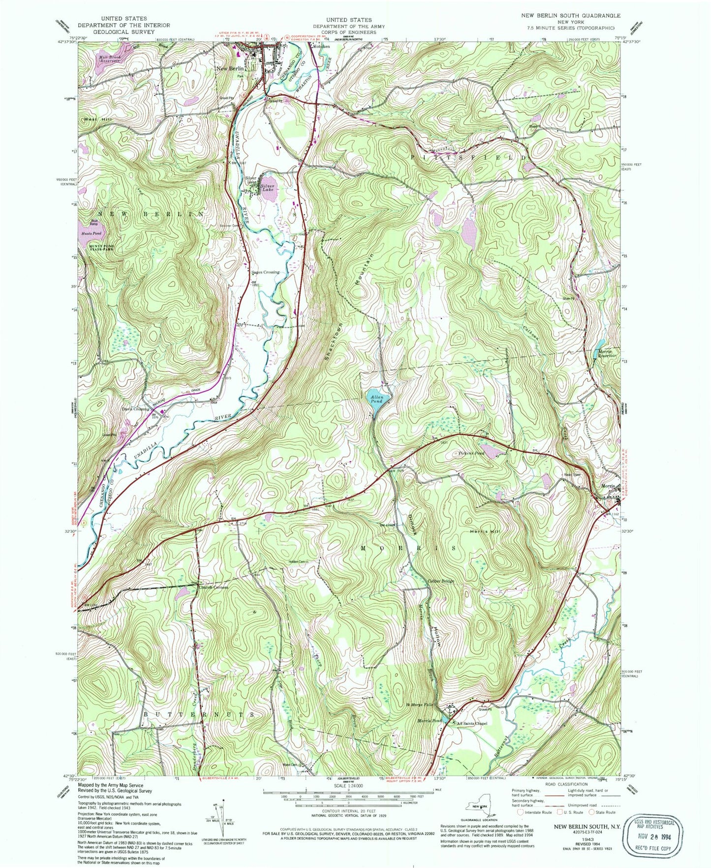
Classic USGS New Berlin South New York 7.5'x7.5' Topo Map
Couldn't load pickup availability
Historical USGS topographic quad map of New Berlin South in the state of New York. Typical map scale is 1:24,000, but may vary for certain years, if available. Print size: 24" x 27"
This quadrangle is in the following counties: Chenango, Otsego.
The map contains contour lines, roads, rivers, towns, and lakes. Printed on high-quality waterproof paper with UV fade-resistant inks, and shipped rolled.
Contains the following named places: All Saints Chapel, Allen Pond, Church Corners, Collier Bridge, Deming School (historical), Dimmick Hollow School (historical), Filer Corners, Harris Hill, Hunt Pond, Morris Brook, Morris Pond, Morris Reservoir, New Berlin, Pickens Pond, Saint Marys Falls, Scribner Cemetery, Shacktown Mountain, Silver Lake, Silver Lake, West Hill, Wharton Creek, Wheeler School (historical), Dimock Hollow, Davis Crossing, Sages Crossing, School Number 3 (historical), School Number 4 (historical), School Number 8 (historical), Town of Morris, Town of Pittsfield, Village of New Berlin, Church of the Nazarene, Dakin Opera House (historical), New Eagle Hotel (historical), New Berlin Municipal Building, New Berlin Fire Department, New Berlin Central School (historical), Saint Andrew's Cemetery, Berean Baptist Church, First Baptist Church, Saint Andrew's Episcopal Church, First United Methodist Church, New Berlin Library, Riverbend Golf Course, Unadilla Valley Central School, Waltzing Horse Farm, Johnson Farms, Mann Cemetery, Morris Family Burial Ground, Fairview Cemetery, Hunt's Pond State Park, Morris Central School, Unadilla River Bridge, New Berlin Post Office