MyTopo
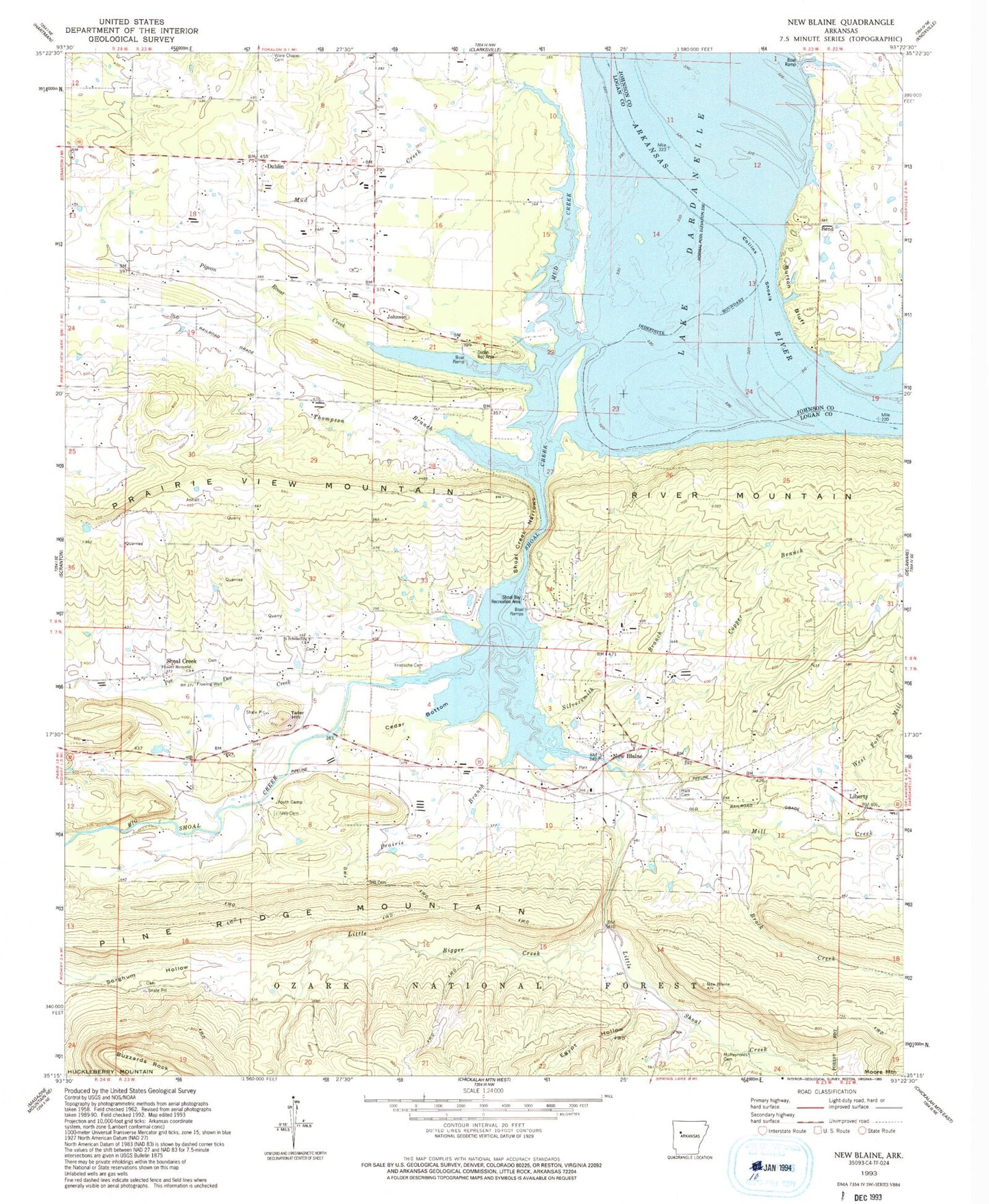
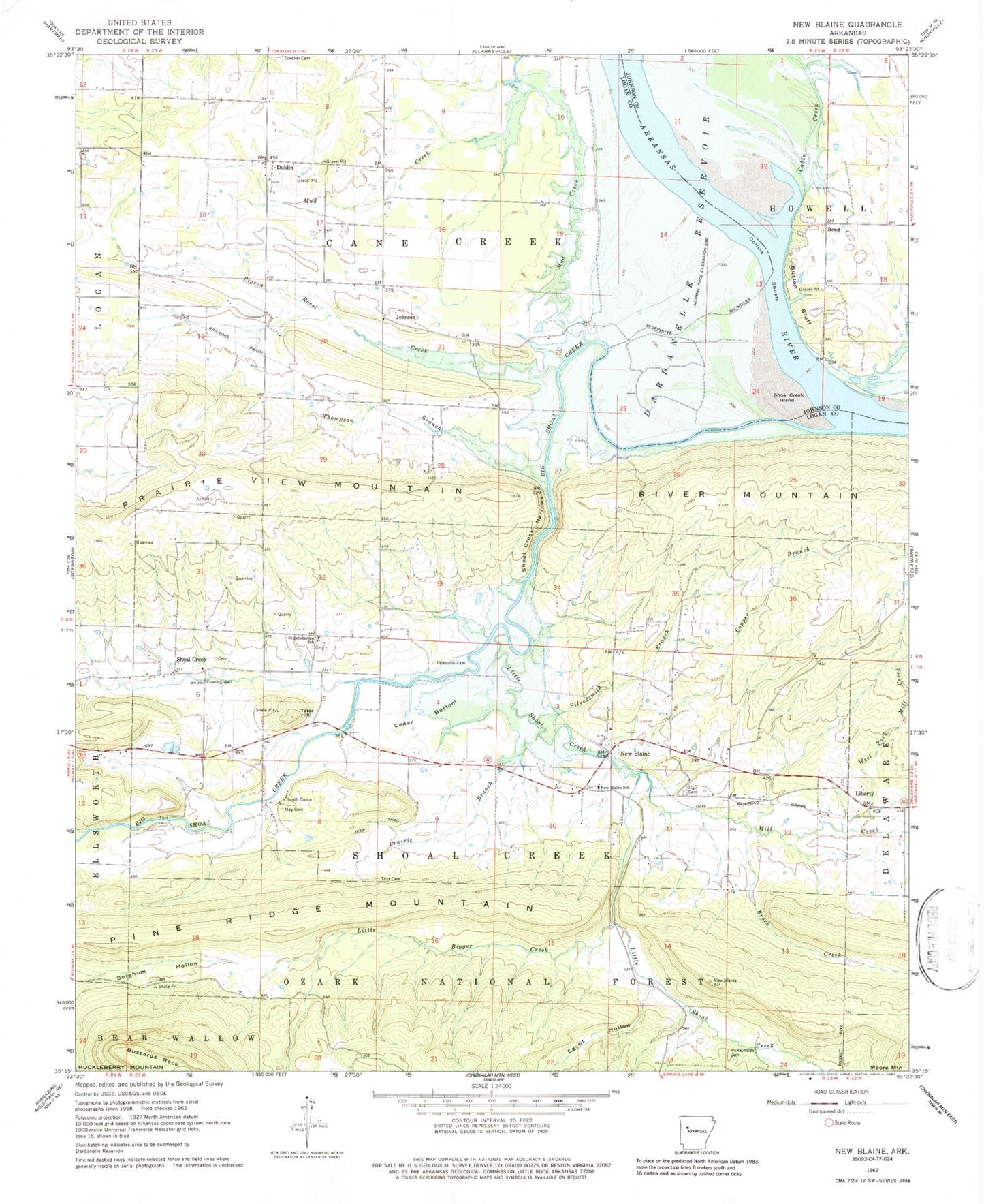
Classic USGS New Blaine Arkansas 7.5'x7.5' Topo Map
Couldn't load pickup availability
Historical USGS topographic quad map of New Blaine in the state of Arkansas. Map scale may vary for some years, but is generally around 1:24,000. Print size is approximately 24" x 27"
This quadrangle is in the following counties: Johnson, Logan.
The map contains contour lines, roads, rivers, towns, and lakes. Printed on high-quality waterproof paper with UV fade-resistant inks, and shipped rolled.
Contains the following named places: Bend, Big Shoal Creek, Brock Creek, Burton Bluff, Cabin Creek, Cedar Bottom, Church of Christ, Collins Shoals, Copper Branch, Dublin, Dublin Park, Egypt Hollow, Freewill Baptist Church, Frietsche Cemetery, Geren, Hall Cemetery, Johnson, Lake Dardanelle, Little Bigger Creek, Little Shoal Creek, May Cemetery, McReynolds Cemetery, Mill Creek, Mud Creek, New Blaine, New Blaine Census Designated Place, New Blaine Community Park, New Blaine Post Office, New Blaine Rural Fire Department Shoal Creek Station, New Blaine Rural Fire Department Station 1, New Blaine School, Pee Dee Creek, Pigeon Roost Creek, Pioneer Memorial Methodist Church, Prairie Branch, Saint Scholastica, Saint Scholastica Catholic Church, Saint Scholastica Cemetery, Saint Scholastica School, Scranton Fire Department Station 2, Shoal Bay Recreation Area, Shoal Creek, Shoal Creek Island, Shoal Creek Methodist Youth Camp, Shoal Creek Narrows, Silversmith Branch, Sommer, Tater Hill, Thompson Branch, Township of Cane Creek, Township of Howell, Township of Shoal Creek, Tritt Cemetery, West Fork Mill Creek, ZIP Codes: 72845, 72851