MyTopo
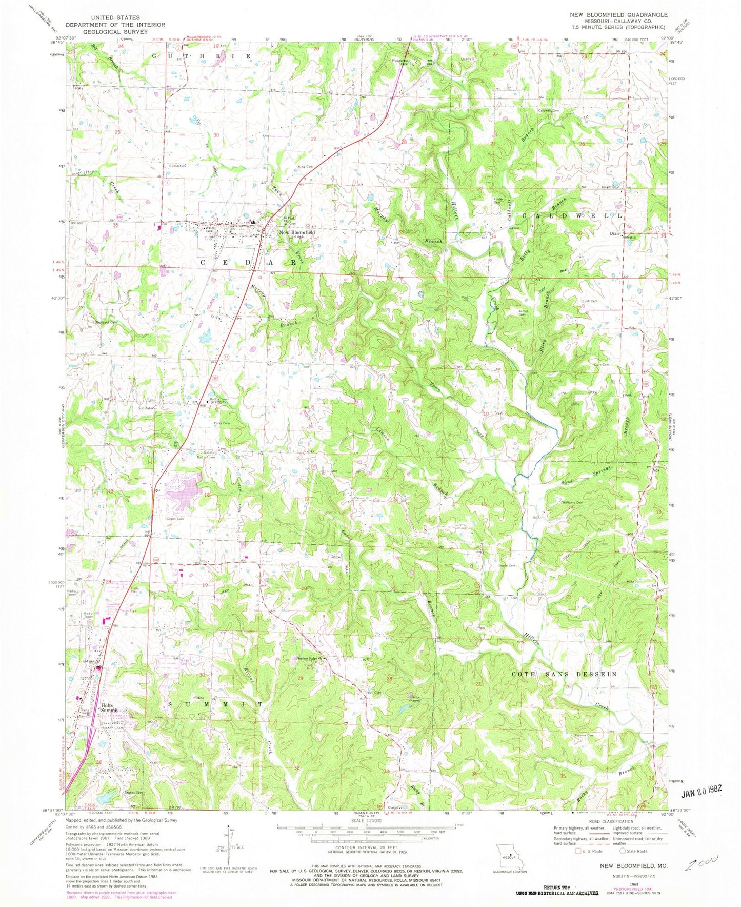
Classic USGS New Bloomfield Missouri 7.5'x7.5' Topo Map
Couldn't load pickup availability
Historical USGS topographic quad map of New Bloomfield in the state of Missouri. Map scale may vary for some years, but is generally around 1:24,000. Print size is approximately 24" x 27"
This quadrangle is in the following counties: Callaway.
The map contains contour lines, roads, rivers, towns, and lakes. Printed on high-quality waterproof paper with UV fade-resistant inks, and shipped rolled.
Contains the following named places: Boyce Cemetery, Bull Cemetery, Bush Cemetery, Caldwell Branch, Caldwell Cemetery, Callaway Hills Elementary School, Camp Keown, Cason Branch, Cason Cemetery, Cave Cemetery, City of Holts Summit, City of New Bloomfield, Dixie, Dogwood Acres Lake, Elkins, Elkins Post Office, Ellerslie, Farmer Cemetery, Fitzhugh Branch, Foster Cemetery, Handler Lake Dam, Holts Summit, Holts Summit Fire Protection District, Holts Summit Post Office, Howards Bluff, James Cemetery, Kelly Branch, King Cemetery, Knight Cemetery, KNLJ-TV (Jefferson City), KRCG-TV (Jefferson City), Lake My-Kee Dam, Lake Mykee Town, Lawson Branch, Meadow Brook Dam, Meadow Brook Lake, Murphy Branch, Murray Branch, New Bloomfield, New Bloomfield Cemetery, New Bloomfield Elementary School, New Bloomfield Fire Protection District, New Bloomfield High School, New Bloomfield Post Office, North Elementary School, Old Providence Cemetery, Perry Cemetery, Pleasant Ridge Church, Pleasant Ridge School, Prospect Cemetery, Riley Branch, Rocky Branch, Saint Paul Cemetery, Saint Paul Church, Sand Springs Branch, Stokes Cemetery, Town Creek, Township of Caldwell, Township of Cedar, Village of Lake Mykee Town, Vivian School, Williams Cemetery, ZIP Code: 65063