MyTopo
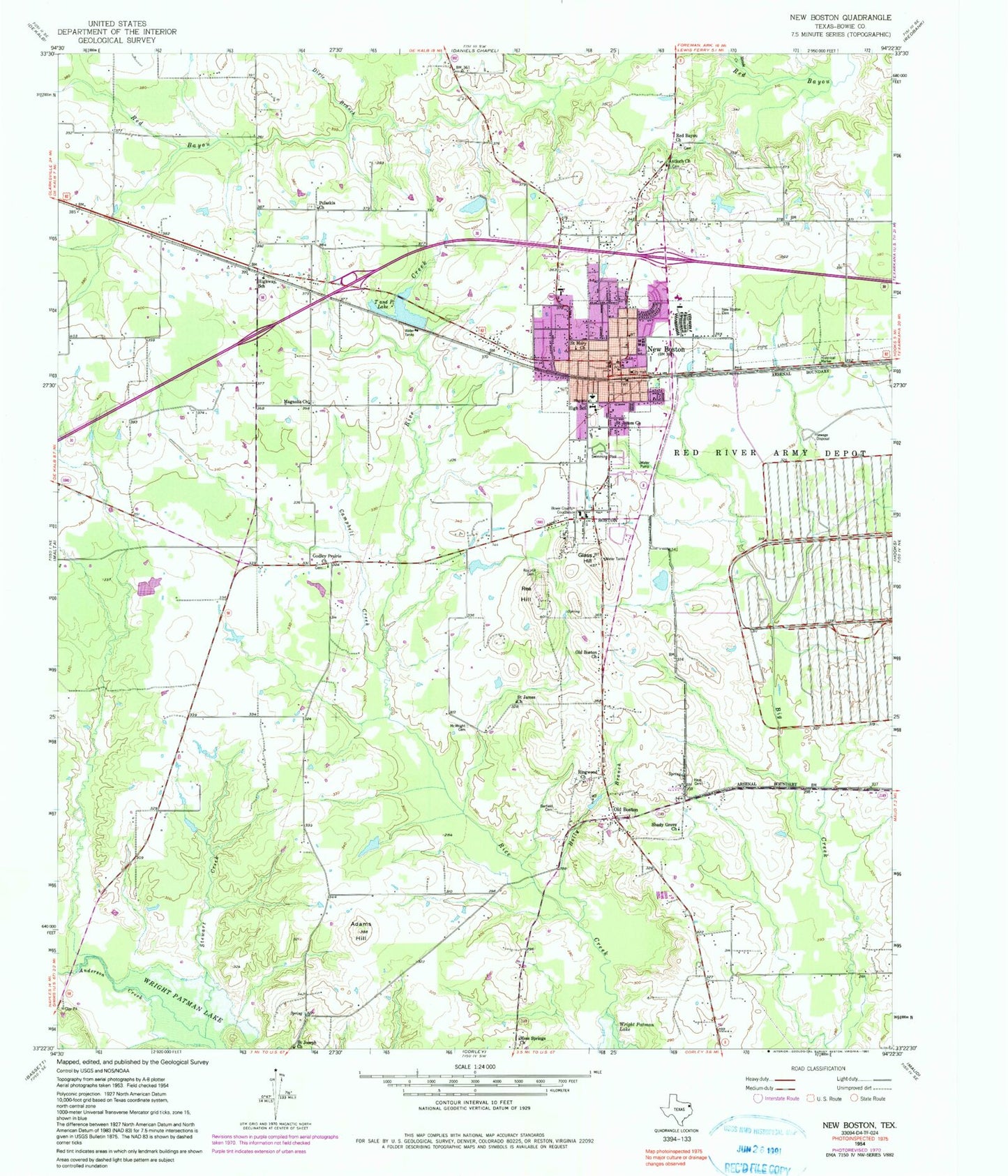
Classic USGS New Boston Texas 7.5'x7.5' Topo Map
Couldn't load pickup availability
Historical USGS topographic quad map of New Boston in the state of Texas. Map scale may vary for some years, but is generally around 1:24,000. Print size is approximately 24" x 27"
This quadrangle is in the following counties: Bowie.
The map contains contour lines, roads, rivers, towns, and lakes. Printed on high-quality waterproof paper with UV fade-resistant inks, and shipped rolled.
Contains the following named places: Adams Hill, Adams Hill Fire Tower, Antioch Church, Barfield Cemetery, Boston, Boston Chalybeate Springs, Bowie County, Bowie County Constable's Office Precinct 2, Bowie County Courthouse, Bowie County Jail, Bowie County Sheriff's Office, Campbell Creek, Chapel of Light Church, City of New Boston, Crestview Elementary School, Dixie Branch, Faith Assembly of God Church, First Assembly of God Church, Glass Hill, Godley Prairie Church, Hays Cemetery, Highway School, Holly Branch, KNBO-AM (New Boston), KTJB-FM (New Boston), Lifenet Ambulance - New Boston, Looney Airstrip, Magnolia Church, McWright Cemetery, Meade Creek, Moss Springs Church, New Boston, New Boston Cemetery, New Boston Church of Christ, New Boston City Hall, New Boston Division, New Boston Doctors Hospital, New Boston Police Department, New Boston Post Office, New Boston Volunteer Fire Department Station 1, New Boston Volunteer Fire Department Station 2, Oak Terrace Baptist Mission Church, Old Boston, Old Boston Church, Old T and P Dam, Pulaskia Church, Rea Hill, Rea Hill Cemetery, Red Bayou Church, Ringwood Church, Saint James Church, Saint Joseph Church, Saint Martins Episcopal Church, Saint Mary Church, Saint Marys Catholic Church, Scrapp Miller Park, Shady Grove Church, Stewart Creek, T and P Lake, Tapp Park, Temple Baptist Church, Texas Department of Criminal Justice Barry B Telford Unit, Texas Forest Service New Boston Office, ZIP Code: 75570


