MyTopo
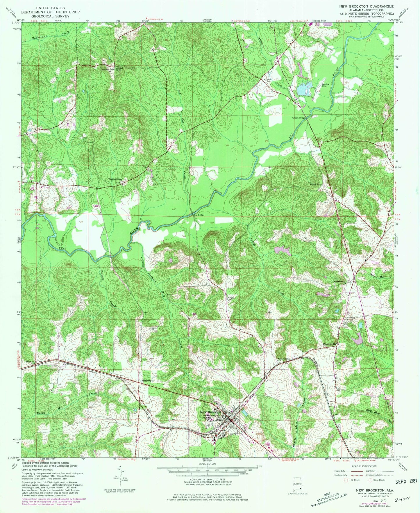
Classic USGS New Brockton Alabama 7.5'x7.5' Topo Map
Couldn't load pickup availability
Historical USGS topographic quad map of New Brockton in the state of Alabama. Map scale may vary for some years, but is generally around 1:24,000. Print size is approximately 24" x 27"
This quadrangle is in the following counties: Coffee.
The map contains contour lines, roads, rivers, towns, and lakes. Printed on high-quality waterproof paper with UV fade-resistant inks, and shipped rolled.
Contains the following named places: Arwood School, Athens Church, Camp Humming Hills, Cardwell Creek, Clintonville, Clintonville Baptist Church, Coffee County, Coffee County Sheriff's Office, Collins Chapel, Coopers Creek, Ellis Mill Creek, Folsom Bridge, Folsome Mill Creek, Greater Holy Temple Church, Harpers Mill Creek, Hollis Pond, Hollis Pond Dam, Hutchison - Russell Family Cemetery, Indigo Creek, Johnson Creek, Kingdom Hall Church, Lake Nolin Dam, Marsh Branch, McGee Cemetery, McGees Branch, Meadow Branch, Mixson, Mount Pleasant Cemetery, Mount Pleasant Primitive Baptist Church, Mount Zion Baptist Church, Mount Zion Cemetery, New Brockton, New Brockton City Cemetery, New Brockton High School, New Brockton Police Department, New Brockton Post Office, New Brockton United Methodist Church, New Brockton Volunteer Fire Department, Newhope Church, Nolin Lake, Pathway Juvenile Wilderness Camp, Pine Grove Church, Pleasant Ridge Cemetery, Pleasant Ridge Primitive Baptist Church, Popular Springs Baptist Church, Red Oak Creek, Richburg, Roe Bridge, Sawyer Lake, Sawyer Lake Dam, School House Branch, Shiloh Church, Shiloh School, Tindle Creek, Town of New Brockton, Weeks Bridge, WKMX-FM (Enterprise), Woodland Cemetery, Woodland Grove Baptist Church, ZIP Code: 36351